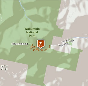
Wollumbin (Mount Warning) summit track
Wollumbin National Park
Overview
Wollumbin (Mount Warning) summit track and Aboriginal Place remains closed. Decisions about the future of the summit track will be made by the NSW National Parks and Wildlife Service in accordance with the wishes of Aboriginal custodians.
- Where
- Wollumbin National Park in North Coast
- Distance
- 8.8km return
- Time suggested
- 5 - 6hrs
- Grade
- Grade 5
- Please note
- Wollumbin is highly significant to Aboriginal people, particularly the Bundjalung nation. Visitors are asked to respect their wishes and not climb the summit track.
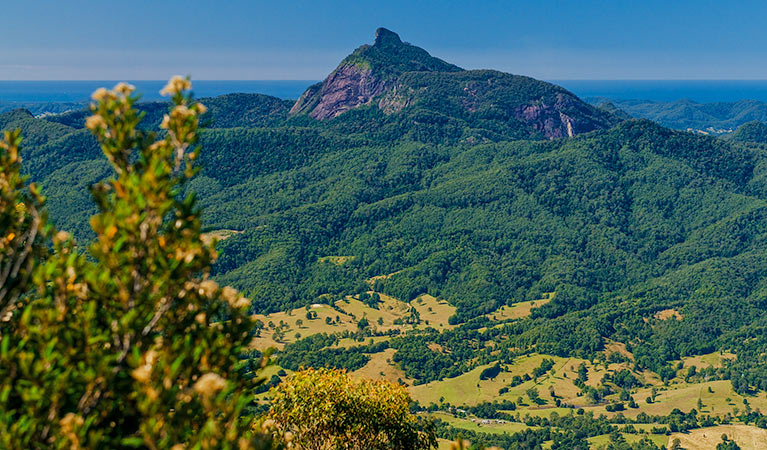
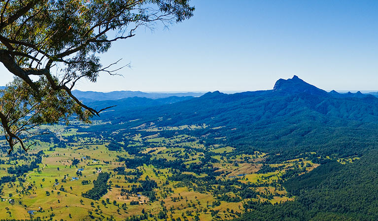
- Border Ranges National Park and Nightcap National Park provide some of the best photo opportunities of Wollumbin in all its glory.
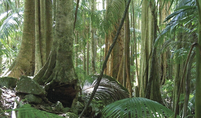
Wollumbin (Mount Warning) Summit track is located 12km south-west of Murwillumbah, in Wollumbin National Park. The summit of Wollumbin is a sacred place to the Bundjalung People, and was declared an Aboriginal Place in 2014.
View the Environment and Heritage webpage for more information about Wollumbin National Park management.
Also see
-
Lyrebird track
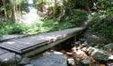
Lyrebird track is a short walk in Wollumbin National Park. It leads from Mount Warning Road across Breakfast Creek to a lookout surrounded by rainforest.
Google Street View Trekker
Using Google Street View Trekker, we've captured imagery across a range of NSW national parks and attractions. Get a bird's eye view of these incredible landscapes before setting off on your own adventure.

Park:
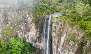
Nightcap National Park
Explore ancient World Heritage-listed rainforest in Nightcap National Park, near Lismore in north-eastern NSW. You’ll find picnic areas and stunning views from Minyon Falls lookout. Camp in nearby Rummery Park campground.
General enquiries
- National Parks Contact Centre
- 7am to 7pm daily
- 1300 072 757 (13000 PARKS) for the cost of a local call within Australia excluding mobiles
- parks.info@environment.nsw.gov.au
Operated by
- Murwillumbah office
- npws.tweedbyron@environment.nsw.gov.au
Park info
- in Wollumbin National Park in the North Coast region
Wollumbin National Park is open, but may have to close at times due to perceived risk. The gate on Mount Warning Road entrance may also be closed from 5pm in winter and 6pm in summer (during daylight savings) and will reopen at 7am the following morning.
What's nearby:
Things to do (90)
- Aboriginal culture (7)
- Adventure sports (1)
- Birdwatching and wildlife encounters (26)
- Cafes and kiosks (4)
- Canoeing/paddling (5)
- Cultural heritage (1)
- Cycling (5)
- Educational activities (2)
- Environmental appreciation/study (1)
- Fishing (5)
- Historic heritage (8)
- Horse riding (4)
- Other experiences (2)
- Picnics and barbecues (20)
- Road trips and car/bus tours (2)
- Sailing, boating and cruises (1)
- Sightseeing (37)
- Snorkelling and scuba (2)
- Surfing (10)
- Swimming (9)
- Visitor centres (2)
- Walking (43)
- Waterfalls (17)
- Wildflowers (seasonal) (4)