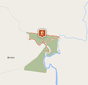
Ms Kellys walking track
Brimbin Nature Reserve
What's nearby
Nearby walking tracks
-
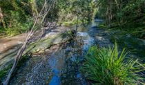
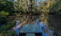
Dawson River walking track
Starting at the Brimbin picnic area near Taree, Dawson River walking track follow the mangrove-lined waterway of Brimbin Nature Reserve, and joins with a historic bullock route.
-
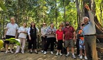
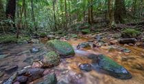
Wingham Brush boardwalk
Wingham Brush boardwalk connects several walking tracks for a wheelchair friendly experience in the rainforest. Enjoy birdwatching and see a grey-headed flying fox roosting site.
Nearby things to do


Nearby parks

Google Street View Trekker
Using Google Street View Trekker, we've captured imagery across a range of NSW national parks and attractions. Get a bird's eye view of these incredible landscapes before setting off on your own adventure.

Park info
- in Brimbin Nature Reserve in the North Coast region
Brimbin Nature Reserve is always open but may have to close at times due to flood events, poor weather or fire danger.