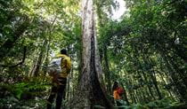
Pieries Peak walking track
Mount Royal National Park
What's nearby
Nearby walking tracks
-
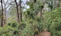
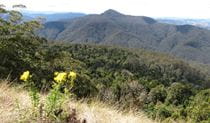
Carrow Brook walking track
Carrow Brook walking track is a remote walk into the valleys of Mount Royal National Park, near Singleton. A challenging loop hike, it’s best suited to fit, experienced bushwalkers.
Nearby things to do

Nearby camping and accommodation
-
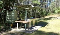
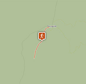
Youngville campground
Camp at Youngville campground to access the World Heritage rainforests of Mount Royal National Park over a few days. Follow walking tracks from here.
Nearby parks
-
Barrington Tops National Park
Immerse yourself in the World Heritage-listed Gondwana Rainforests of Barrington Tops National Park. Easy walks, overnight hikes, great picnic, fishing and camping spots await.
-
Mount Royal National Park
Camp, hike and picnic in World Heritage-listed Gondwana rainforest at Mount Royal National Park, close to Barrington Tops National Park.
Google Street View Trekker
Using Google Street View Trekker, we've captured imagery across a range of NSW national parks and attractions. Get a bird's eye view of these incredible landscapes before setting off on your own adventure.

Park info
- in Mount Royal National Park in the North Coast and Country NSW regions
Mount Royal National Park is always open but may have to close at times due to poor weather or fire danger.