Mount Exmouth walking track
Warrumbungle National Park
Overview
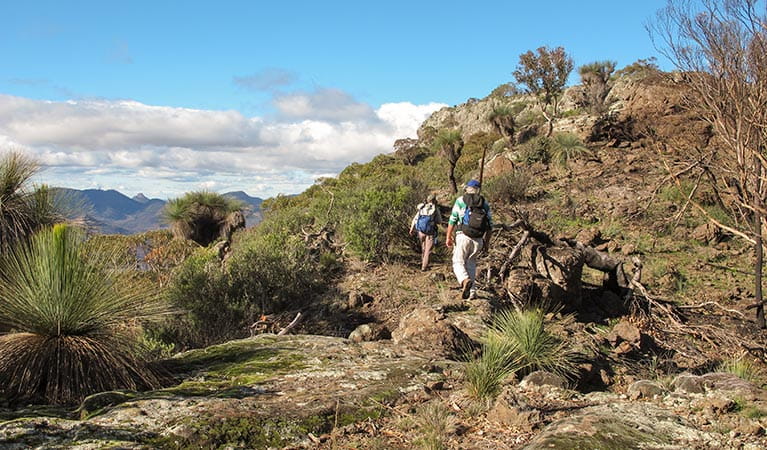
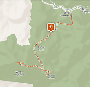
Mount Exmouth walking track in Warrumbungle National Park is a long but rewarding hike that culminates in stunning 360-degree views from the summit of Mount Exmouth.
- Where
- Warrumbungle National Park in Country NSW
- Distance
- 17km return
- Time suggested
- 5 - 7hrs
- Grade
- Grade 4
- Trip Intention Form
-
It's a good idea to let someone know where you're going. Fill in a trip intention form to send important details about your trip to your emergency contact.
- Personal Locator Beacon
-
Hire a Personal Locator Beacon (PLB) for free at Warrumbungle Visitor Centre.
- Entry fees
- Park entry fees apply
- What to
bring - Sunscreen, hat, drinking water
- Please note
- If you’re bushwalking in this park, it’s a good idea to bring a topographic map and compass, or a GPS.
- There is limited mobile reception in this park.
- Remember to take your binoculars if you want to go birdwatching.
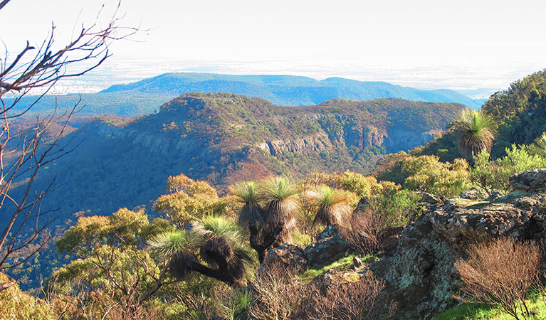
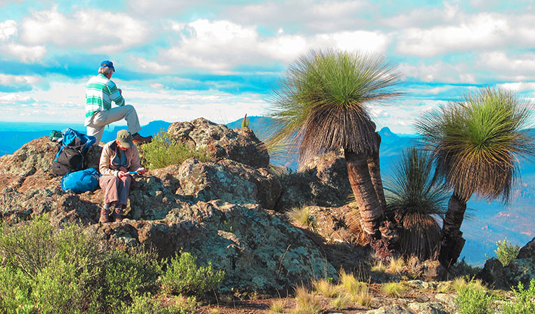
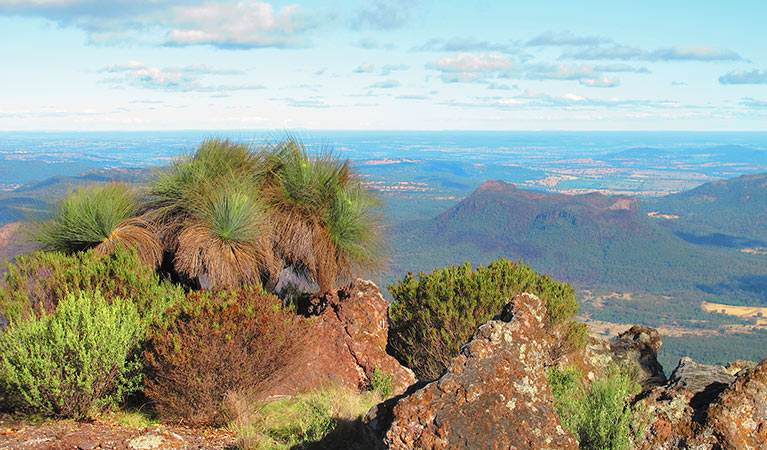
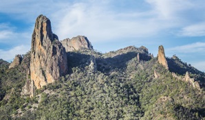
This long trek is also an extremely rewarding one: the 360-degree views from Mount Exmouth, the 1206m peak of Warrumbungle Range, are truly outstanding. Along the way to the summit, you’ll encounter beautiful scenery, a varied vegetation community, and basalt rock formations that comprise some of the few remaining pieces of the original volcanic shield. Following Mount Exmouth walking track is to walk back in time, experiencing the best that Warrumbungle National Park has to offer.
You won’t be alone, either. Kangaroos, wallabies and wallaroos are common sights along the track. If you’re lucky, you might even spot a rare koala in the trees along ‘The Boulevarde’, a stretch of scenic woodland between Camp Burbie and Danu Gap. Don’t forget your binoculars, too – turquoise parrots can be seen in small flocks around the same area.
The vegetation on the summit is sparse, and only the hardiest of plants like the mallee eucalyptus can survive here. But in spring, the wildflowers are out down below, including pink hyacinth orchids and nodding greenhood. Pack a picnic lunch and settle down to enjoy the ambience of the day.
The Mount Exmouth walking track also links with the Breadknife and Grand High Tops walk at Ogma Gap, so when it's time to head back you have the option to return via West Spirey Creek.
Take a virtual tour of Mount Exmouth walking track captured with Google Street View Trekker.
Nearby
-
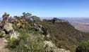
Mount Exmouth lookout
Mount Exmouth lookout is in Warrumbungle National Park along Mount Exmouth walking track. It’s a great place to enjoy stunning views of mountain peaks and the vast western plains.
-

Breadknife and Grand High Tops walk
Breadknife and Grand High Tops walk in Warrumbungle National Park, regarded as one of the best walks in NSW, offers close up views of the park’s iconic rock formations.
Google Street View Trekker
Using Google Street View Trekker, we've captured imagery across a range of NSW national parks and attractions. Get a bird's eye view of these incredible landscapes before setting off on your own adventure.

Download the NSW GeoTours app
Go on an interactive adventure in Warrumbungle National Park with the free NSW GeoTours app on your smartphone or tablet. Explore geotrails, investigate the eroded remnants of a volcano and learn the park’s explosive history.
General enquiries
- National Parks Contact Centre
- 7am to 7pm daily
- 1300 072 757 (13000 PARKS) for the cost of a local call within Australia excluding mobiles
- parks.info@environment.nsw.gov.au
Operated by
- Warrumbungle NP Visitor Information Centre
- 9am to 4pm daily. Closed Christmas Day.
- 02 6825 4364
- warrumbungle.np@environment.nsw.gov.au
- 4261 John Renshaw Parkway, Warrumbungle NSW 2828
Park info
- in Warrumbungle National Park in the Country NSW region
Warrumbungle National Park is always open but may have to close at times due to poor weather or fire danger.
-
Park entry fees:
$8 per vehicle per day.
Buy annual pass
What's nearby:
Things to do (29)
- Aboriginal culture (2)
- Adventure sports (1)
- Birdwatching and wildlife encounters (9)
- Educational activities (1)
- Historic heritage (1)
- Picnics and barbecues (2)
- Road trips and car/bus tours (2)
- Sightseeing (17)
- Swimming (1)
- Visitor centres (1)
- Walking (20)
- Wildflowers (seasonal) (10)