Wollumbin National Park
Visitor info
All the practical information you need to know about Wollumbin National Park.
Getting there and parking
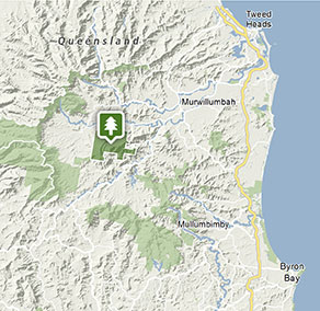
From Murwillumbah:
- Head southwest towards Uki along Riverview Street, which becomes Kyogle Road, and then Uki Road at Byangum Bridge.
- Approximately 12km from Murwillumbah, before you reach Uki, turn right into Mount Warning Road.
- Travel approximately 3.5km to carpark
Parking
The gate on Mount Warning Road entrance to the carpark at Breakfast Creek may be closed from 5pm in winter and 6pm in summer (during daylight savings) and will reopen at 7am the following morning.
By bike
Check out the Bicycle information for NSW website for more information.
By public transport
For information about public transport options, visit the NSW country transport info website.
Best times to visit
There are lots of great things waiting for you in Wollumbin National Park. Here are some of the highlights.
Autumn
Look out for macropods and young birds as they prepare to head out by themselves and find their own home range.
Spring
During this season, the forest floor comes alive with colour and activity while the canopy blooms with flowers and bears fruit above. Birds display their breeding plumage while animals taking advantage of the free bounty. The sweet fragrance of nectar fills the forest to entice insects, birds, bats and mammals.
Summer
The frequency of spectacular afternoon storms means this can be a great time for photographers.
Winter
Enjoy the clear blue skies common during this season of stable highs which dominate the Northern Rivers region in winter.
Weather, temperature and rainfall
Summer temperature
Average
19°C and 28°C
Highest recorded
43°C
Winter temperature
Average
9°C and 21.5°C
Lowest recorded
-0.3°C
Rainfall
Wettest month
February
Driest month
September
The area’s highest recorded rainfall in one day
321mm
Maps and downloads
Prohibited
Pets
Pets and domestic animals (other than certified assistance animals) are not permitted. Find out which regional parks allow dog walking and see the pets in parks policy for more information.
Smoking
NSW national parks are no smoking areas.
Contact
- in the North Coast region
Wollumbin National Park is open, but may have to close at times due to perceived risk. The gate on Mount Warning Road entrance may also be closed from 5pm in winter and 6pm in summer (during daylight savings) and will reopen at 7am the following morning.
-
-
Murwillumbah office
-
Email: npws.tweedbyron@environment.nsw.gov.au
-
Murwillumbah office
Nearby towns
Uki (10 km)
Explore the scenic wonders of the lush, World Heritage-listed rainforests of northern NSW on the meandering Rainforest Way. Uki is just one of the small villages that you'll pass through - it's certainly in one of the most scenic locations.
Murwillumbah (15 km)
Murwillumbah is rich dairy, sugar cane and banana country. It's located on the banks of the Tweed River and set in the Tweed River Valley against a backdrop of rainforest-clad hills.
Mullumbimby (55 km)
Mullumbimby sits on the Brunswick River and is overshadowed by subtropical hills.