Overview
Broughton Island walking tracks are a great way for nature lovers to explore this remote island, accessible by boat from Port Stephens. Follow this family-friendly network of walking tracks to wild beaches and stunning lookouts.
- Where
- Myall Lakes National Park in North Coast
- Accessibility
- No wheelchair access
- Distance
- 2km return
- Time suggested
- 1hr
- Grade
- Grade 3
- What to
bring - Drinking water, snacks, clothes for all weather conditions, sturdy shoes, hat, sunscreen, raincoat
- Please note
- You can only reach Broughton Island by boat.
- There is very little shade on the island. Come prepared with plenty of water, food and sun/wind protection.
- Weather and sea conditions on the island can change rapidly. Severe weather may delay your departure from the island.
- Please use the boot-washing stations. This helps stop the spread of weeds and disease that can harm the native plants and animals on the island.
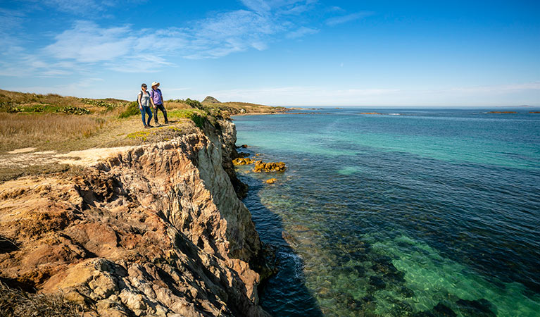
- Stay on walking tracks and follow track signs. Be careful around unstable cliff edges.
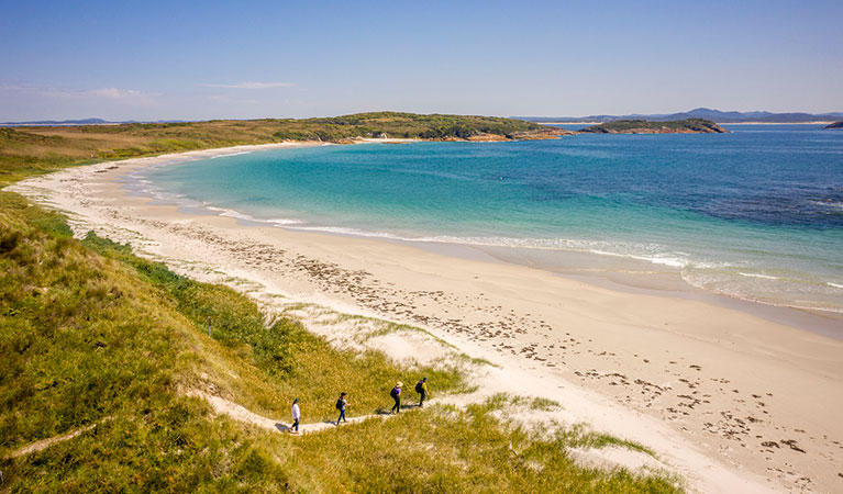
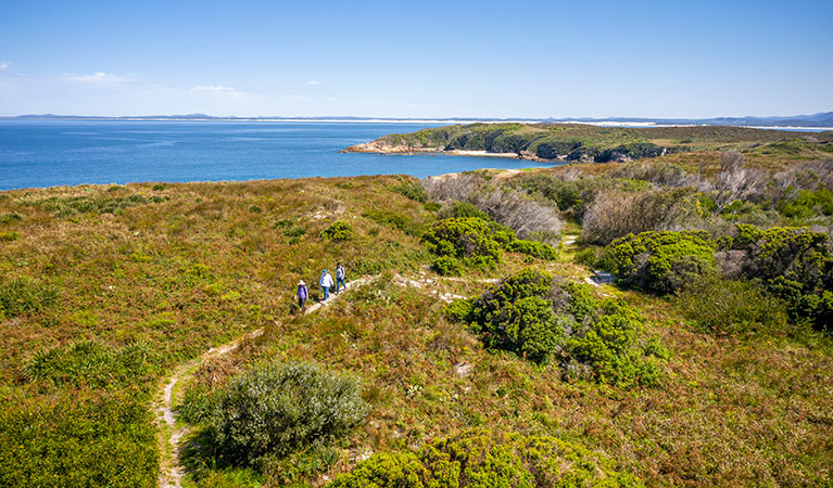
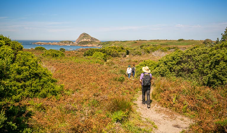
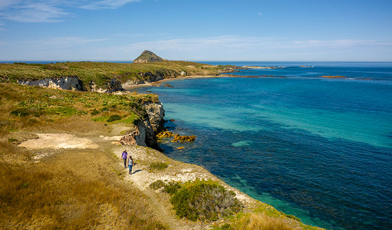
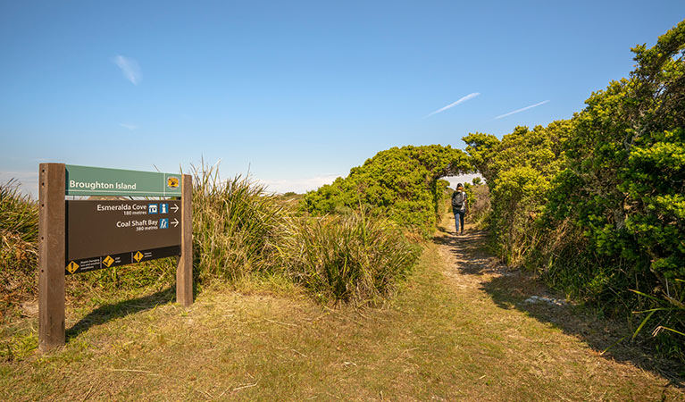
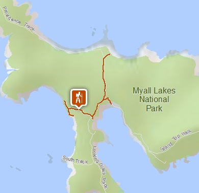
These short and easy walking tracks are easily reached from the sparkling waters of Esmerelda Cove, where most visitors land. If you’ve got a campground booking, head north-east for 250m along the track to reach your campsite.
If photography is your thing, head west from Esmerelda Cove and follow the track for 300m to Coal Shaft Bay lookout for spectacular views of pristine beaches and cliffs. Though you can still glimpse the mainland, you’ll feel a million miles away.
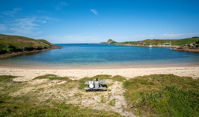
Esmerelda Cove is a delightful swimming spot, but if you’d like to enjoy a day at an even more remote beach, take a picnic lunch and walk north for 500m. In just 5 minutes you’ll be digging your toes into the glistening white sands of Providence Beach.
Remember to keep your eyes wide open for wildlife as you explore Broughton Island walking tracks. The island is paradise for birdwatchers, with its active seabird colony. Spring through autumn are great seasons to see little penguins and wedge tailed shearwaters, also known as muttonbirds. The island is also a wonderful whale watching spot during winter months, and dolphins can be seen year-round.
Nearby
-
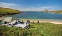
Broughton Island campground
Accessible only by boat, Broughton Island campground is the only place in NSW where you can camp among an active seabird colony. The island is part of Myall Lakes National Park.
Google Street View Trekker
Using Google Street View Trekker, we've captured imagery across a range of NSW national parks and attractions. Get a bird's eye view of these incredible landscapes before setting off on your own adventure.

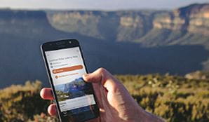
Download our app
The free NSW National Parks app lets you download maps and explore parks, things to do and places to stay—all without mobile reception.
General enquiries
- National Parks Contact Centre
- 7am to 7pm daily
- 1300 072 757 (13000 PARKS) for the cost of a local call within Australia excluding mobiles
- parks.info@environment.nsw.gov.au
Operated by
- Anna Bay office
- Monday to Friday, 8.30am to 4.30pm.
- 02 4984 8200
- npws.huntercoast@environment.nsw.gov.au
- 4154 Nelson Bay Road, Anna Bay, NSW 2315
Park info
- in Myall Lakes National Park in the North Coast region
Myall Lakes National Park is always open but may have to close at times due to poor weather or fire danger.
-
Park entry fees:
$8 per vehicle per day.
Day passes are available from a card operated pay machine at Mungo Brush campground or from the Manning Great Lakes Area Office. You can also pay for your visit via the Park’nPay app. You’ll need a Day Pass or Annual Pass when visiting the park.
Bombah Point ferry fees may also apply (cash payment only).
Buy annual pass
What's nearby:
Things to do (77)
- 4WD touring (3)
- Aboriginal culture (11)
- Adventure sports (3)
- Beach (9)
- Birdwatching and wildlife encounters (30)
- Cafes and kiosks (1)
- Canoeing/paddling (10)
- Cultural heritage (1)
- Cycling (8)
- Environmental appreciation/study (1)
- Fishing (15)
- Historic heritage (15)
- Horse riding (1)
- Picnics and barbecues (21)
- Road trips and car/bus tours (2)
- Sailing, boating and cruises (4)
- Sightseeing (21)
- Snorkelling and scuba (2)
- Surfing (9)
- Swimming (16)
- Walking (27)