Marmong picnic area
Lake Macquarie State Conservation Area
Visitor info
All the practical information you need to know about the Marmong picnic area.
Getting there and parking
Get driving directions
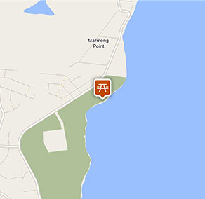
Marmong picnic area is in the Awaba Bay precinct within Lake Macquarie State Conservation Area. To get there:
- Take the Cessnock Road exit off F3 Freeway towards Awaba and Toronto
- Continue along this road as it becomes Awaba Road
- Turn left at Carey Street in Toronto to cross the water
- Turn right along Bay Road, which loops around the point, to Lake Macquarie State Conservation Area.
- Access to the walking track is via George Street, Fennell Bay.
- Take a short walk into the picnic area from the northern end of Awaba Bay Foreshore walking track
Road quality
- Sealed roads
Vehicle access
- No vehicle access
Weather restrictions
- All weather
Parking
Parking is not available at Marmong picnic area – access is via Awaba Bay Foreshore walking track.
Best times to visit
There are lots of great things waiting for you in Lake Macquarie State Conservation Area. Here are some of the highlights.
Autumn
Drop a line at Myuna Bay while the days are still warm enough to sit outside for a peaceful hour or two.
Spring
Spring is a lovely time to take Awaba Bay Foreshore walk and stop for a picnic lunch to enjoy the stunning lake views.
Summer
Why not kayak around the lake, exploring the secret bays and enjoying the warm water?.
Winter
Take a refreshing walk along Wangi circuit walking track, keeping an eye out for the tiny orchids that flower in winter.
Weather, temperature and rainfall
Summer temperature
Average
20°C and 25°C
Highest recorded
42°C
Winter temperature
Average
8°C and 19°C
Lowest recorded
1.8°C
Rainfall
Wettest month
March
Driest month
November
The area’s highest recorded rainfall in one day
283.7mm
Facilities
Drinking water is not available in this area, so it’s a good idea to bring your own.
Picnic tables
Maps and downloads
Permitted
Fishing
A current NSW recreational fishing licence is required when fishing in all waters.
Prohibited
Pets
Pets and domestic animals (other than certified assistance animals) are not permitted. Find out which regional parks allow dog walking and see the pets in parks policy for more information.
Smoking
NSW national parks are no smoking areas.
Operated by
- Newcastle office
- Monday to Friday, 8.30am to 4.30pm.
- 02 4946 4100
- npws.lowerhunter@environment.nsw.gov.au
- 1 Wetlands Place, Shortland NSW 2307
Park info
- in Lake Macquarie State Conservation Area in the Sydney and surrounds and North Coast regions
Lake Macquarie State Conservation Area is always open but may have to close at times due to extreme weather or fire danger.