Visitor info
All the practical information you need to know about Tuross Falls walking track.
Track grading
Features of this track
Distance
4km return
Time
1hr 30min - 2hrs 30min
Quality of markings
Sign posted
Experience required
Some bushwalking experience recommended
Gradient
Short steep hills
Steps
Occasional steps
Quality of path
Rough track, many obstacles
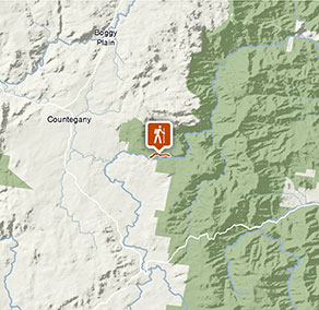
Getting there and parking
Get driving directions
Tuross Falls walking track is in the Cascades precinct of Wadbilliga National Park. To get there from Canberra:
- Head south towards Cooma on the Monaro Highway. Exit just north of Cooma, turning left onto Polo Flat Rd and then left again after crossing the train line onto the Numeralla Rd.
- Follow this for about 40 minutes, then turn right onto Badja forest Rd, which turns into a dirt road immediately after the turn off.
- From here, follow the signs to the Cascades by turning right onto Peters Rd and then right onto Tuross Falls Rd.
- Follow Tuross Falls Rd to the end, where you will find a parking area.
Road quality
Check the weather before you set out as the road to the Cascades Precinct can become boggy when it rains.
Parking
Parking is available on Main Road, a short walk from the walking track.
Best times to visit
There are lots of great things waiting for you in Wadbilliga National Park. Here are some of the highlights.
Autumn
Walk to Tuross River Falls now that the days are getting a bit cooler. Or, follow one of the many unsealed roads through Wadbilliga on a mountain bike.
Spring
Walk to Turross River Falls for a great half-day adventure. Or, take a back-country hike to Wadbilliga Trig.
Summer
Lilo and swim in the many gorgeous pools at the cascades. Camp at the Cascades and watch for greater gliders at night.
Weather, temperature and rainfall
Summer temperature
Average
8°C and 23°C
Highest recorded
38.3°C
Winter temperature
Average
-3°C and 10°C
Lowest recorded
-10.5°C
Rainfall
Wettest month
December
Driest month
August
The area’s highest recorded rainfall in one day
256mm
Facilities
- There is limited water available in this area, so it’s a good idea to bring your own.
- Firewood is not supplied and may not be collected from the park
- You are encouraged to bring gas or fuel stoves, especially in summer during the fire season.
Maps and downloads
Permitted
Fishing
Fishing from a boat, the beach, the rocks or by the river is a popular activity for many national park visitors. If you’re planning a day out fishing, check out these fishing and rock fishing safety tips.
Prohibited
Pets
Pets and domestic animals (other than certified assistance animals) are not permitted. Find out which regional parks allow dog walking and see the pets in parks policy for more information.
Smoking
NSW national parks are no smoking areas.
Park info
- in Wadbilliga National Park in the South Coast and Snowy Mountains regions
Wadbilliga National Park is always open but may have to close at times due to poor weather or fire danger.