Visitor info
All the practical information you need to know about Helmholtzia loop walking track.
Track grading
Features of this track
Distance
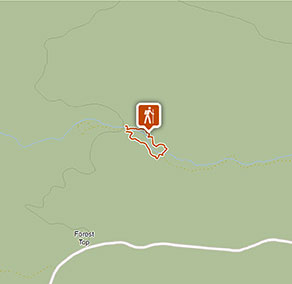
1km loop
Time
20 - 40min
Quality of markings
Clearly sign posted
Experience required
No experience required
Gradient
Gentle hills: The walk has gentle hills until you reach the steps that go down to the creek and back up the opposite bank. This section of the track is moderately steep.
Quality of path
Formed track, some obstacles: The walk is 0.5-1m-wide and hard-packed ground along its length.
Steps
Occasional steps: As the loop approaches its eastern-most point there are 3 sets of steps, ranging from between 15 to 26 steps each. The steps are irregular and some may have a higher than normal step up or down.
At the start of the northern part of the loop, there's also a set of 3 steps.
Most steps are made of timber, but there are also some irregular natural stone steps.
Other barriers
Pinch points: There are several pedestrian bridges along the walk that narrow the width of the track to 0.4m-wide. The bridges are timber, do not have handrails and some lead across Brindle Creek.
Plants, trees and boulders may also cause the track to narrow in some sections.
Accessible options
The first 100m of the southern part of the loop and the first 50m of the northern part of the loop walk may be accessible for people with reduced mobility.
Getting there and parking
Helmholtzia loop walking track is in the eastern precinct of Border Ranges National Park. To get there:
From Murwillumbah:
- Travel south-west on Kyogle Road to Lillian Rock, then turn right onto Williams Road.
- Travel along Williams Road for 2.5km, then Creegans Road for 6km, until you reach the park boundary.
- From the boundary, continue 26km along Tweed Range Scenic Drive to Brindle Creek Road intersection, then turn right.
- Travel 2km to Brindle Creek carpark
From Kyogle:
- Travel north along Summerland Way for 14km until you reach Wiangaree
- Turn right at Wiangaree into Lynches Creek Road and travel east for 12km to Forest Road
- Turn right onto Forest Road and continue 4.5km to the park boundary
- From the boundary, continue on Tweed Range Scenic Drive for 6.5km and then turn left onto Bridle Creek Road.
- Travel 2km to Brindle Creek carpark
Vehicle access
- 2WD vehicles
Weather restrictions
- 4WD required in wet weather
Parking
Parking is available on unsealed Brindle Creek Road at Brindle Creek picnic area where this walk begins.
Best times to visit
There are lots of great things waiting for you in Border Ranges National Park. Here are some of the highlights.
Autumn
A picnic at Border Loop lookout and picnic area is a must during autumn. It's also a popular spot to see the historic Border Loop railway line.
Spring
The perfect time to get away from it all on a family camping trip. Sheepstation Creek campground is a great base for exploring Border Ranges National Park.
Summer
Watching the sunrise from Pinnacle lookout offers the best views of the crater escarpment, Wollumbin-Mount Warning and the coast. You're bound to find it a breathtaking experience.
Winter
Take in the park's scenery from the comfort of your car or motor home as you drive along the Tweed Range Scenic drive. Be sure to take some breaks along the way though – you don't want to miss the views.
Weather, temperature and rainfall
Summer temperature
Average
18°C and 30°C
Highest recorded
42.9°C
Winter temperature
Average
8°C and 22°C
Lowest recorded
-0.3°C
Rainfall
Wettest month
February
Driest month
September
The area’s highest recorded rainfall in one day
321mm
Facilities
Accessible non-flush toilets and picnic tables are located at Brindle Creek picnic area, where this walk begins.
Maps and downloads
Accessibility
Disability access level - hard
Helmholtzia loop walking track is 0.5-1m wide and hard-packed ground.
The first 100m of the southern part of the loop and the first 50m of the northern part of the loop may be accessible for people with reduced mobility.
After this, there are parts of the track that people with reduced mobility may find difficult to navigate:
- There are many steps in the eastern part of the loop that can be irregular and higher than normal steps. Most are made of timber, but there are also some natural stone steps.
- There are pedestrian bridges that narrow the track to 0.4m-wide. The bridges don't have handrails and some go across Brindle Creek.
- Plants, trees and boulders may cause the track to narrow.
- There's a section of the track that's moderately steep, with steps that go down to the creek and back up the opposite bank.
Prohibited
Pets
Pets and domestic animals (other than certified assistance animals) are not permitted. Find out which regional parks allow dog walking and see the pets in parks policy for more information.
Smoking
NSW national parks are no smoking areas.
Operated by
- Kyogle office
- Monday to Friday, 8.30am to 4.30pm.
- 02 6632 0000
- npws.richmondriver@environment.nsw.gov.au
- 136 Summerland Way, Kyogle NSW 2474
Park info
- in Border Ranges National Park in the North Coast region
Border Ranges National Park is always open but may have to close at times due to poor weather or fire danger.
-
Park entry fees:
$8 per vehicle per day.
Buy annual pass