Visitor info
All the practical information you need to know about Burrabadine walking track.
Track grading
Features of this track
Distance
4km return
Time
1hr 30min - 2hrs
Quality of markings
Limited signage
Experience required
No experience required
Gradient
Very steep
Steps
Many steps
Quality of path
Rough track, many obstacles
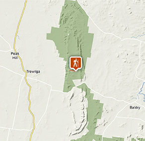
Getting there and parking
Burrabadine walking track is in the Wanda Wandong sector of Goobang National Park. To get there:
- Make your way to Peak Hill-Baldry Road, just south of Trewilga, following the signs to Goobang National Park.
- Follow this road for 15km then turn left into the park
- Follow Sawpit Gully fire trail for 5.5km (around several bends) until you reach the Burrabadine walking track carpark on the left.
Road quality
Check the weather before you set out as the road to Burrabadine walking track may be closed following heavy rain.
Parking
Limited parking is available at Burrabadine walking track's head. Alternatively, park at Greenbah campground and walk 900m south along the Sawpit Gully fire trail to the walking track.
Best times to visit
There are lots of great things waiting for you in Goobang National Park. Here are some of the highlights.
Autumn
The temperate climate makes it a good time to bushwalk on several different walking tracks or fire trails. More experienced walkers can explore the park further and head off the beaten track. Clear, crisp autumn skies mean stargazing is at its best from Wanda Wandong campground. .
Spring
Enjoy the wildflowers and flowering shrubs in full, beautiful bloom. Drive up to Caloma lookout for great views of the surrounding farming country with its mosaic of canola, cereals and pasture paddocks .
Summer
Make the most of the free gas barbecues at Wanda Wandong campground to unwind after some active park exploration.
Weather, temperature and rainfall
Summer temperature
Average
17°C and 33°C
Highest recorded
45.1°C
Winter temperature
Average
7°C and 17°C
Lowest recorded
-6.2°C
Rainfall
Wettest month
January
Driest month
September
The area’s highest recorded rainfall in one day
133.9mm
Facilities
Facilities are available at Greenbah campground.
Maps and downloads
Prohibited
Pets
Pets and domestic animals (other than certified assistance animals) are not permitted. Find out which regional parks allow dog walking and see the pets in parks policy for more information.
Smoking
NSW national parks are no smoking areas.
Operated by
- Bathurst office
- Monday to Friday, 8.30am to 4.30pm.
- 02 6332 7640
- 02 6332 7680 To contact the KARST Conservation Unit in this office.
- npws.centralwest@environment.nsw.gov.au
- Level 2, 203-209 Russell Street, Bathurst NSW 2795
Park info
- in Goobang National Park in the Country NSW region
Goobang National Park is always open but may have to close at times due to poor weather or fire danger.