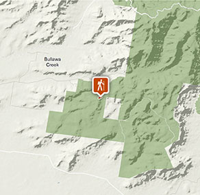
Biruu gaba lookout walking track
Deriah Aboriginal Area
Visitor info
All the practical information you need to know about Biruu gaba lookout walking track.
Track grading
Features of this track
Distance
0.7km return
Time
15 - 30min
Quality of markings
Clearly sign posted
Experience required
No experience required
Gradient
Short steep hills
Steps
Many steps
Quality of path
Formed track, some obstacles
Getting there and parking
Biruu gaba lookout walking track is in Deriah Aboriginal Area and located on Carinya Road.
To get there from Narrabri:
- Drive south-east along Old Gunnedah Road for 3km, then turn left onto Kaputar Road.
- After 9km, turn right onto Eulah Creek Road and continue for 5km until you reach the unsealed section.
- Follow the unsealed section of Eulah Creek Road for 6km, past the olive farm, before turning right onto Carinya Road.
- Follow this route up the hill to enter Deriah Aboriginal Area
- After 1km you'll see the information bay on the left
- From the information bay, travel east along Carinya Road for 2.5km, passing Wagun picnic area on your right.
Road quality
Check the weather before you set out as the road to Biruu gaba lookout walking track can become boggy when it rains.
- Mixture of sealed and unsealed roads
Vehicle access
- All roads require 4WD vehicle
Weather restrictions
- Dry weather only
Parking
Parking is available on Carinya Road, a short walk from Biruu gaba lookout walking track at the top of the hill on your right.
Bus parking is available (one small bus).
Best times to visit
There are lots of great things waiting for you in Deriah Aboriginal Area. Here are some of the highlights.
Autumn
Enjoy bushwalking or mountain biking along the area's roads and trails.
Spring
A spectacular time to enjoy the activities of the area's abundant birdlife and wildlife.
Summer
Escape the heat of the plains in the dry rainforest, where you can enjoy bushwalking and picnicking as well as a range of cultural activities.
Winter
Soak up the sun while enjoying a picnic and take advantage of the scenic views available on a clear winter day.
Weather, temperature and rainfall
Summer temperature
Average
19.4°C and 35.3°C
Highest recorded
43.3°C
Winter temperature
Average
3.4°C and 17°C
Lowest recorded
-5.6°C
Rainfall
Wettest month
January
Driest month
August
The area’s highest recorded rainfall in one day
188mm
Facilities
Drinking water is not available in this area, so it’s a good idea to bring your own.
Maps and downloads
Prohibited
Pets
Pets and domestic animals (other than certified assistance animals) are not permitted. Find out which regional parks allow dog walking and see the pets in parks policy for more information.
Smoking
NSW national parks are no smoking areas.
Operated by
- Narrabri office
- Monday to Friday, 8.30am to 4.30pm.
- 02 6792 7300
- npws.barwon@environment.nsw.gov.au
- Level 1, 100 Maitland Street, Narrabri NSW 2390. Accessible via Dewhurst Street.
Park info
- in Deriah Aboriginal Area in the Country NSW region
Deriah Aboriginal Area is always open but may have to close at times due to severe weather or extreme fire danger.