Visitor info
All the practical information you need to know about Capertee National Park.
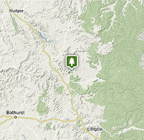
Getting there and parking
Get driving directions
From Capertee village:
- Turn east onto Glen Davis Road
- Travel 29km to the junction with Glen Alice Road and veer left
- Drive another 21km through Glen Alice, towards Rylstone, and turn left onto the unsealed Port Macquarie Road.
- Follow Port Macquarie Road to the locked gate at the park boundary (access code can be obtained from Mudgee office).
Park entry points
- Port Macquarie Road See on map
Parking
- Honeyeater Homestead See on map
- Valley lookout See on map
By bike
Check out the Bicycle information for NSW website for more information.
By public transport
Capertee National Park is not accessible by public transport however there is a train/bus service to Mudgee or Lithgow. For information about public transport options, visit the NSW country transport website.
Best times to visit
There are lots of great things waiting for you in Capertee National Park. Here are some of the highlights.
Autumn
The cooler autumn months are an excellent time for walking and mountain biking the trails and tracks within the park.
Spring
Grab your binoculars for some superb birdwatching. You might catch a rare glimpse of the endangered regent honeyeater as it builds its nest.
Summer
Enjoy a relaxing picnic on the shady banks of Capertee River, and perhaps a refreshing paddle in the shallow waters.
Winter
Enjoy a car tour of Capertee while taking in nearby Wollemi and Goulburn River National Parks.
Weather, temperature and rainfall
Summer temperature
Average
12.1°C and 25.5°C
Highest recorded
38.4°C
Winter temperature
Average
10.4°C and 0.7°C
Lowest recorded
-8°C
Rainfall
Wettest month
January
Driest month
September
The area’s highest recorded rainfall in one day
179mm
Facilities
Toilets
Showers
Picnic tables
Barbecue facilities
Electric power
Maps and downloads
Prohibited
Drones
Flying a drone for recreational purposes is prohibited in this area. Drones may affect public enjoyment, safety and privacy, interfere with park operations, or pose a threat to wildlife. See the Drones in Parks policy.
This area may be a declared Drone Exclusion Zone, or may be subject to Civil Aviation Safety Authority (CASA) rules for flying near airports, aerodromes and helicopter landing sites. See CASA's Drone Flyer Rules.
Commercial filming and photography
Commercial filming or photography is prohibited without prior consent. You must apply for permission and contact the local office.
Pets
Pets and domestic animals (other than certified assistance animals) are not permitted. Find out which regional parks allow dog walking and see the pets in parks policy for more information.
Smoking
NSW national parks are no smoking areas.
Contact
- in the Sydney and surrounds and Country NSW regions
Capertee National Park has a locked entry gate. If you're visiting during the day, get the gate code by calling Mudgee Office (weekdays) or Blue Mountains Heritage Centre (weekends).
-
-
Mudgee office
02 6370 9000
Contact hours: Monday to Friday, 9am to 4:30pm. - 27 Inglis Street, Mudgee NSW 2850
-
Email: npws.mudgee@environment.nsw.gov.au
-
Mudgee office
Nearby towns
Rylstone (34 km)
Rylstone is a pretty village with many heritage-listed stone buildings, including the magnificent post and telecommunications office, the police station, the courthouse and the shire hall. Boutiques and markets offer arts, crafts and other treasures.
Mudgee (91 km)
Set in the Cudgegong River valley in Central West NSW, Mudgee is a charming historic town and a popular destination for wine enthusiasts keen to sample its award-winning reds and whites. From its many wineries and national parks to markets, festivals and activities for the kids, Mudgee has much to offer.
Lithgow (125 km)
Hassans Walls Lookout, near Lithgow, is the highest in the Blue Mountains. Admire Mt Wilson, Mt York, Mt Tarana and Mt Blaxland as well as the pretty Hartley Valley below. To the south are the Kanimbla and Megalong valley and Mt Bindo. While there, go for a walk or ride around the lookout.