Visitor info
All the practical information you need to know about Mount Budawang trail.
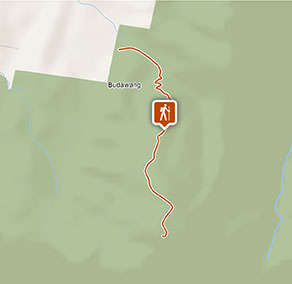
Track grading
Features of this track
Distance
8km return
Time
7 - 8hrs
Quality of markings
Clearly sign posted
Experience required
Some bushwalking experience recommended
Gradient
Very steep
Steps
Occasional steps
Quality of path
Formed track
Getting there and parking
Get driving directions
Mount Budawang trail is at the southern precinct of Budawang National Park. To get there:
From Braidwood or Mongarlowe:
- From Charleys Forest Road or Little River Road, turn onto Northangera Road through Mongarlowe, then onto Budawang Road near the fire station.
- Travel a further 1.8km, then veer right at the intersection through a gate.
- Follow the signs for another 5km to the carpark. You’ll need to go through several farm gates – make sure you leave them as you find them.
Road quality
Check the weather before you set out as the road to Mount Budawang can become boggy when it rains.
Parking
Parking is available at the start of Mount Budawang trail.
Best times to visit
There are lots of great things waiting for you in Budawang National Park. Here are some of the highlights.
Autumn
The clear autumn weather is perfect for walking to the top of Mount Budawang, which can be covered in scenic clouds.
Spring
As the weather warms up, this is a perfect time to take advantage of Long Gully campground.
Winter
Take a drive along the Western Distributor to view the steep slopes of the Budawang Range from the warmth of your car.
Weather, temperature and rainfall
Summer temperature
Average
10.5°C and 25.4°C
Highest recorded
41.1°C
Winter temperature
Average
0.4°C and 12.1°C
Lowest recorded
-9.2°C
Rainfall
Wettest month
January
Driest month
July
The area’s highest recorded rainfall in one day
199.9mm
Facilities
Drinking water isn't available in this area, so it’s important to bring your own.
Maps and downloads
Prohibited
Pets
Pets and domestic animals (other than certified assistance animals) are not permitted. Find out which regional parks allow dog walking and see the pets in parks policy for more information.
Smoking
NSW national parks are no smoking areas.
Operated by
- Ulladulla office
- Monday to Friday, 9am to 4pm.
- 02 4454 9500
- npws.shoalhaven@environment.nsw.gov.au
- Lot 9 Blackburn Industrial Estate, 6 Coller Road Ulladulla NSW 2539
Park info
- in Budawang National Park in the South Coast and Country NSW regions
Budawang National Park is always open but may have to close at times due to poor weather or fire danger.