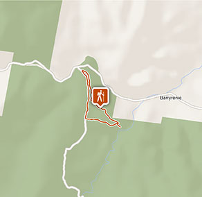
Ironbark walking track
Conimbla National Park
Visitor info
All the practical information you need to know about Ironbark walking track.
Track grading
Features of this track
Distance
4km loop
Time
1hr 30min - 2hrs
Quality of markings
Limited signage
Experience required
No experience required
Gradient
Flat
Steps
No steps
Quality of path
Rough track, many obstacles
Getting there and parking
Get driving directions
Ironbark walking track starts from Ironbark picnic area in the Conimbla Range precinct of Conimbla National Park. To get there:
From Cowra:
Travel 9km west along Mid-Western Highway. Turn right onto Barryrennie Road, following the signs to Conimbla National Park. Continue for 16km, then turn left into Ironbark picnic area.
From Gooloogong:
From the town centre, turn onto Kangarooby Road, following the signs to Conimbla National Park. Continue for 25km, then turn right into Ironbark picnic area.
From Grenfell:
Travel 46km east on Mid-Western Highway. Turn left onto Barryrennie Road, following the signs to Conimbla National Park. Continue for 16km, then turn left into Ironbark picnic area.
Road quality
The road to Ironbark walking track is an unsealed, well-travelled and highly used farm road that's in good condition. It's suitable for 2WDs in all weather.
- Unsealed roads
Vehicle access
- 2WD vehicles
Weather restrictions
- All weather
Parking
Parking is available at Ironbark picnic area.
Best times to visit
There are lots of great things waiting for you in Conimbla National Park. Here are some of the highlights.
Autumn
Take advantage of the cooler weather and go for a more adventurous walk off the beaten track.
Spring
Check out the abundance of beautiful blooming wildflowers, particularly the park's distinctive range of orchids.
Summer
A good time to enjoy the wild nightlife in Conimbla with some spotlighting along Wallaby walking track.
Weather, temperature and rainfall
Summer temperature
Average
14°C and 32°C
Highest recorded
46.6°C
Winter temperature
Average
2°C and 17°C
Lowest recorded
-8°C
Rainfall
Wettest month
January
Driest month
June
The area’s highest recorded rainfall in one day
103mm
Maps and downloads
Prohibited
Pets
Pets and domestic animals (other than certified assistance animals) are not permitted. Find out which regional parks allow dog walking and see the pets in parks policy for more information.
Smoking
NSW national parks are no smoking areas.
Operated by
- Bathurst office
- Monday to Friday, 8.30am to 4.30pm.
- 02 6332 7640
- 02 6332 7680 To contact the KARST Conservation Unit in this office.
- npws.centralwest@environment.nsw.gov.au
- Level 2, 203-209 Russell Street, Bathurst NSW 2795
Park info
- in Conimbla National Park in the Country NSW region
Conimbla National Park is always open but may have to close at times due to poor weather or fire danger.