Bellamy fire trail
Berowra Valley Regional Park
Visitor info
All the practical information you need to know about Bellamy fire trail.
Track grading
Features of this track
Distance
0.6km one-way
Time
30 - 45min
Quality of markings
Sign posted
Experience required
No experience required
Gradient
Short steep hills
Steps
Occasional steps
Quality of path
Well-formed track
Getting there and parking
Get driving directions
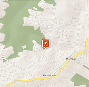
Bellamy fire trail is in the regional park precinct of Berowra Valley National Park. To get there:
- From the M2 motorway, take the Pennant Hills Road exit and head north.
- Turn left at Observatory Park to stay on Pennant Hills Road
- Turn left onto Boundary Road in Pennant Hills
- Turn right onto Bellamy Street and follow all the way to the end of the road, where the track begins.
From Thornleigh:
- You can join Bellamy fire trail from De Saxe Close, which leads off the intersection of Quarter Sessions Road and Giblett Avenue, Thornleigh.
Parking
Parking is available for the Bellamy fire trail at the end of Bellamy Street, Pennant Hills, and on De Saxe Close, Thornleigh.
Best times to visit
There are lots of great things waiting for you in Berowra Valley National Park. Here are some of the highlights.
Spring
Enjoy the spring wildflowers and take on the challenge of the Great North walk before the weather gets too warm
Summer
Swim in Berowra creek in the warmer months - remember safety precautions around waterways
Winter
Winter is generally great for bushwalking in the Sydney region but bring warm gear if you're camping - nights can be cold in the bush
Weather, temperature and rainfall
Summer temperature
Average
18°C and 28°C
Highest recorded
43.1°C
Winter temperature
Average
6°C and 18°C
Lowest recorded
-3.5°C
Rainfall
Wettest month
March
Driest month
July
The area’s highest recorded rainfall in one day
253mm
Maps and downloads
Accessibility
Disability access level - medium
- The walking track follows a concrete path through bushland, between Bellamy Street, Pennant Hills and De Saxe Close, Thornleigh.
- The path is suitable for wheelchairs, prams, and visitors with limited mobility, for the first 300m. From here, there's a short steep hill after the bridge crossing Zig Zag Creek, which requires assistance. There's a handrail on 1 side of the hill.
- Assistance may be required to pass through the bollards at either end of this walking track.
- There's a picnic table near the Bellamy Street end of the walk and low, log seating in the amphitheatre, around half way.
Medium access presents some minor difficulties, such as a grassy surface. You may require a little assistance to get around in some areas.
Permitted
Pets
You can walk your dog on-lead at this location. See other regional parks in NSW that have dog walking areas.
Dog walking is permitted on Bellamy fire trail as it traverses the adjacent park, Berowra Valley Regional Park. Dogs need to be kept on a leash at all times, and please remember to pick up after them.
Dog walking is not permitted on Benowie walking track or Jungo walk.
Prohibited
Smoking
NSW national parks are no smoking areas.
Operated by
- Bobbin Head Visitor Centre
- 10am to 4pm daily. 9am to 4pm during summer school holidays, closed 12pm-12:30pm. Closed Christmas Day.
- 02 9472 8949
- bobbin.head@environment.nsw.gov.au
- 688 Ku-ring-gai Chase Road, Mount Colah, NSW 2079
Park info
- in Berowra Valley Regional Park in the Sydney and surrounds region