Tuross Falls walking track
Wadbilliga National Park
Overview
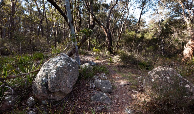
Turross Falls walking track is a medium difficulty 4km bushwalk at Wadbilliga National Park featuring scenic views, waterfalls, picnicking opportunities and birdwatching.
- Distance
- 4km return
- Time suggested
- 1hr 30min - 2hrs 30min
- Grade
- Grade 4
- What to
bring - Sunscreen, hat, drinking water
- Please note
- There is no mobile reception at the Cascades precinct and very limited mobile reception in this park
- The weather in this area can be extreme and unpredictable, so please ensure you’re well-prepared for your visit.
- Remember to take your binoculars if you want to bird watch
- For more information please contact the Bombala office on (02) 6458 5900 between 9am and 12.30pm Monday to Friday.
If you’ve got a half-day to while away in Wadbilliga National Park, making the journey along the Tuross Falls walking track is highly recommended. This medium-difficulty, 4km return bushwalking track will reward your efforts with amazing views and wildlife.
At the viewing platform at the end of the walk, you can enjoy incredible panoramic views out over the park where the Tuross Falls tumbles dramatically down rocky outcrops into the gorge.
The area is also famous for its greater glider population. If you’re lucky, you might also spy the spotted-tail quoll in this area. Birdwatchers should be sure to bring their binoculars, as there is a huge diversity of birdlife here, with over 122 native species being sighted in the area.
Map
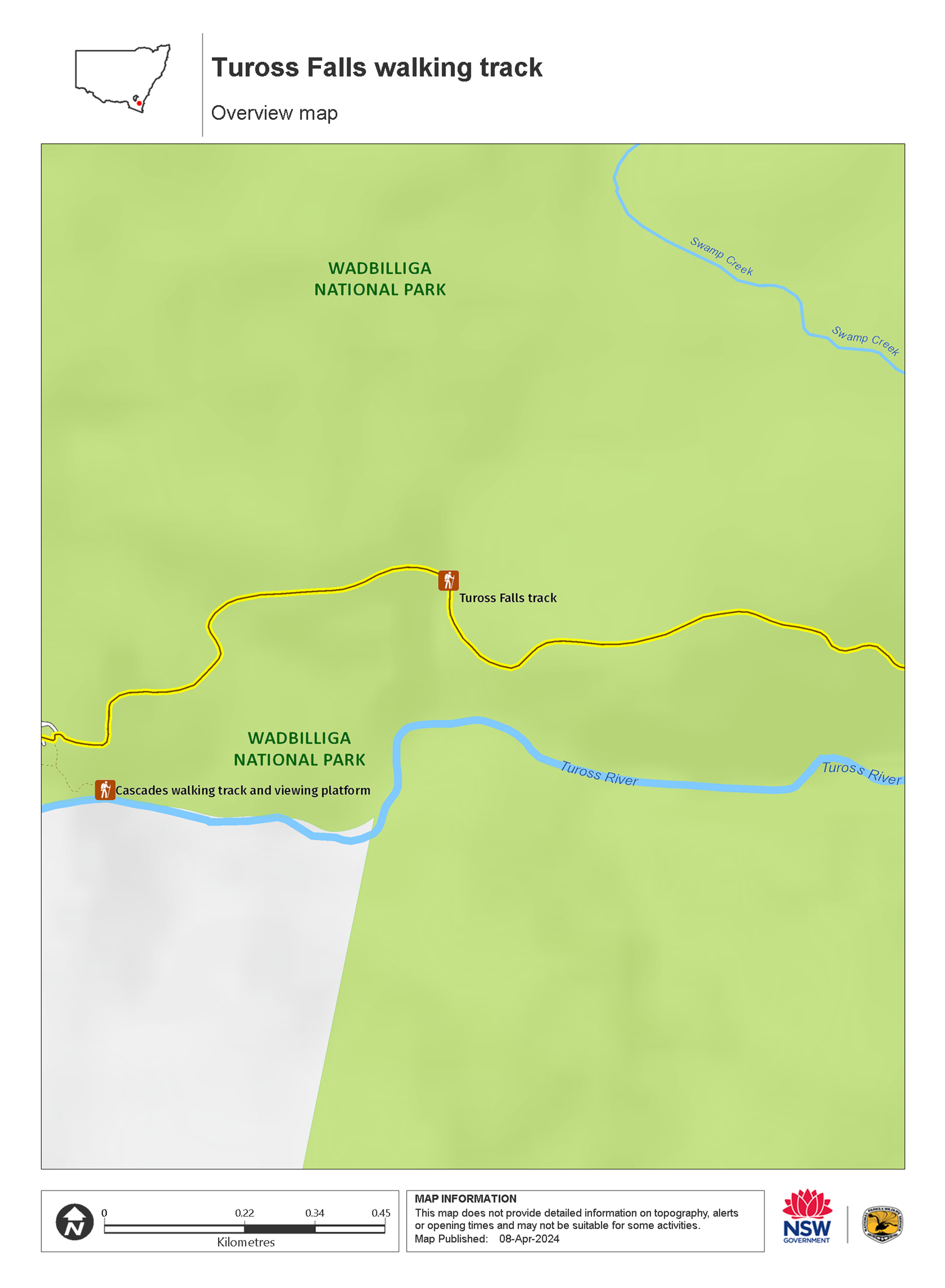
Map legend

Local alerts
For the latest updates on fires, closures and other alerts in this area, see https://www.nationalparks.nsw.gov.au/things-to-do/walking-tracks/tuross-falls-walking-track/local-alerts
General enquiries
- National Parks Contact Centre
- 7am to 7pm daily
- 1300 072 757 (13000 PARKS) for the cost of a local call within Australia excluding mobiles
- parks.info@environment.nsw.gov.au
Park info
- in Wadbilliga National Park in the South Coast and Snowy Mountains regions
Wadbilliga National Park is always open but may have to close at times due to poor weather or fire danger.
Visitor info
All the practical information you need to know about Tuross Falls walking track.
Maps and downloads
Learn more
Tuross Falls walking track is in Wadbilliga National Park. Here are just some of the reasons why this park is special:
A botanist's wonderland

Wadbilliga has many impressive examples of open forest, woodland, heath, swamp, bogs and numerous pockets of rainforest. There are some rare species of eucalypt and acacia that do not occur anywhere else. In the Wadbilliga Valley, yellow box and forest red gum can be seen, while on the ridge tops tower large stands of silvertop ash with snow gums at high altitudes. The Wadbilliga Plateau also has dwarf she-oaks and rare stunted mallee eucalypts.
- Cascades walking track and viewing platform Cascades walking track takes you to a viewing platform with scenic views of the spectacular Tuross River which cascades into a pool.
A glimpse of gold mining history

The surrounding area has a variety of artefacts, structures and features that hark back to gold and silver mining eras, as well as the early forestry history of the local area. Today, visitors can still view various mining remains that are evidence of once arduous searches for gold and other precious materials.
A natural animal sanctuary

Due to the rugged and isolated nature of the park, animal populations here have remained relatively undisturbed. Many of the park's animals are large marsupials such as swamp wallabies, eastern grey kangaroos and wombats. There are also possums, platypuses and echidnas and one of the biggest greater glider populations in all of Australia. The birdlife is varied too, with over 120 native species. Lyrebirds are common as are many colourful and tuneful bush birds.
- Cascades walking track and viewing platform Cascades walking track takes you to a viewing platform with scenic views of the spectacular Tuross River which cascades into a pool.
- Tuross Falls walking track Turross Falls walking track is a medium difficulty 4km bushwalk at Wadbilliga National Park featuring scenic views, waterfalls, picnicking opportunities and birdwatching.
Aboriginal cultural heritage

The Yuin people consider Wadbilliga National Park a sacred place and many sites in the park are strongly associated with Dreamtime stories. The dissected, rugged escarpment contains a network of bridle tracks that follow both high country and river courses, which Aboriginal people originally used. The bridle tracks are also the most tangible historical link with the first Europeans in the area and were used for transporting produce and moving stock from one location to another. The park is abundant in traditional foods and medicines.