Hastings Forest Way touring route
North Coast, Country NSW
Overview
See Gondwana rainforest, go camping, birdwatching and enjoy amazing scenery on a scenic drive through Hastings Forest Way touring route near Port Macquarie and Wauchope.
- Distance
- 122km
- Time suggested
- 8hrs
- Grade
- Medium
- What to
bring - Hat, sunscreen, drinking water
- Please note
- Hastings Forest Way is routinely used by logging trucks. Drive to the conditions and move well out of the way to allow trucks to safely pass.
- The weather in this area can be extreme and unpredictable, so please ensure you’re well-prepared for your visit.
- There is limited mobile reception in this park
- Remember to take your binoculars if you want to bird watch
Get away from everything and discover remote bushland on Hastings Forest Way touring route. This scenic drive is a fantastic way to explore the wilderness and falls country of Werrikimbe National Park. Make it a day trip or camp overnight at Brushy Mountain or Plateau Beech campground.
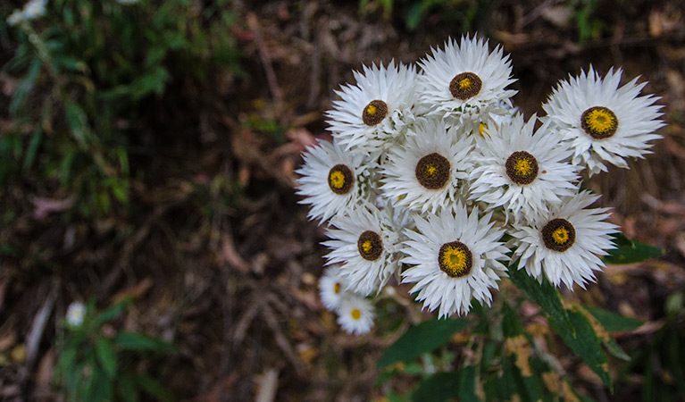
The 122km return touring route from Wauchope to Brushy Mountain climbs from 100m above sea level to 1,100m near Spokes Mountain. The journey takes you through the woodlands and heath, dotted with colourful wildflowers in spring and into ancient Gondwana rainforest.
For rewarding views, make a side-trip to Number 1 Tower picnic area or take your 4WD along the isolated Racecourse trail up the escarpment to Mooraback campground and continue on to Walcha.
Stop to enjoy a peaceful picnic and take advantage of the great birdwatching. You’ll see a range of forest birds such as eastern yellow robins, scarlet robins and rufous fantails.
Map
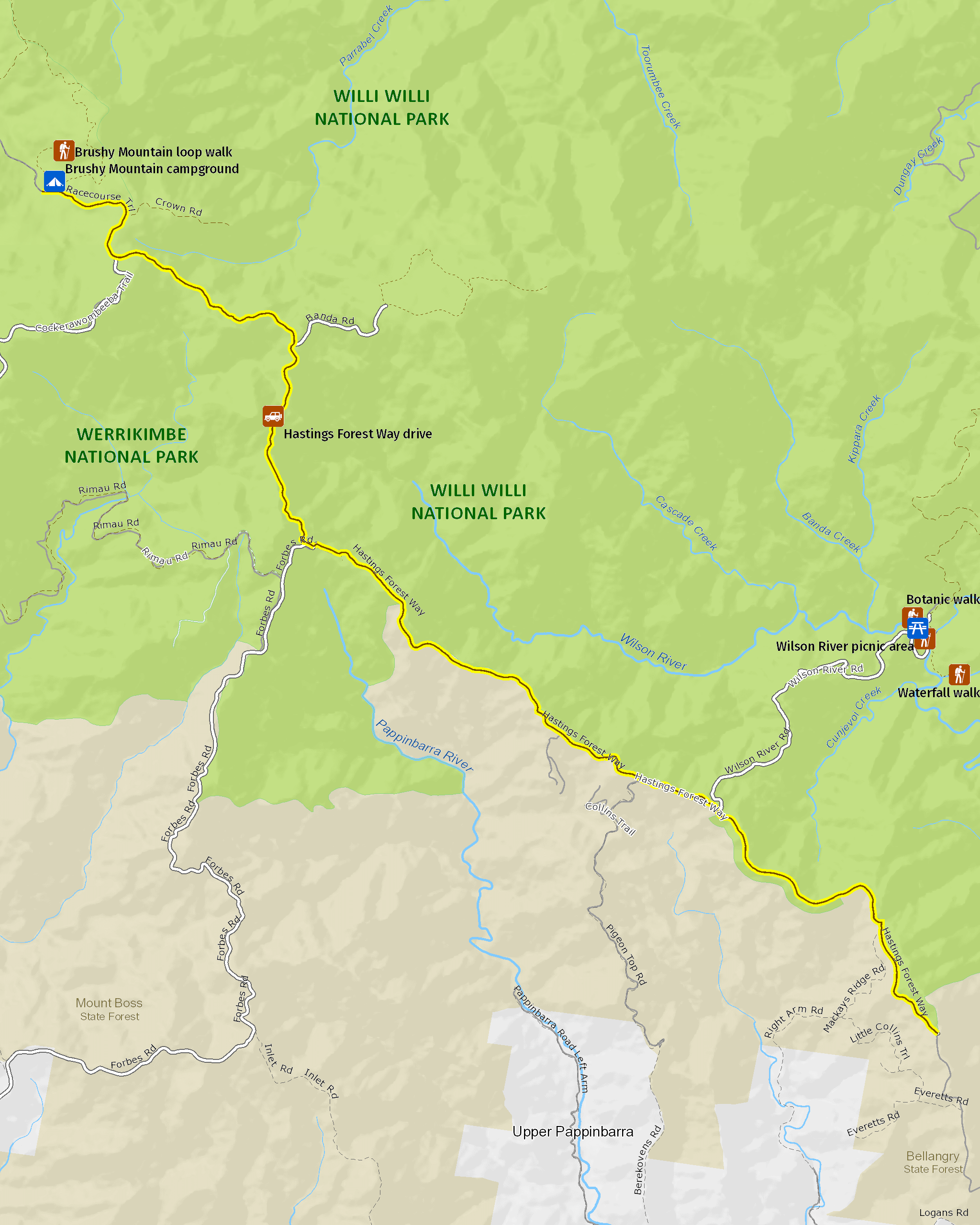
Map legend

Local alerts
For the latest updates on fires, closures and other alerts in this area, see https://www.nationalparks.nsw.gov.au/things-to-do/4wd-touring-routes/hastings-forest-way-touring-route/local-alerts
Park info
- in Willi Willi National Park in the North Coast and Country NSW regions
Willi Willi National Park is always open but may have to close at times due to poor weather or fire danger.
- in Werrikimbe National Park in the North Coast and Country NSW regions
Werrikimbe National Park is always open but may have to close at times due to poor weather or fire danger.
Visitor info
All the practical information you need to know about Hastings Forest Way touring route.
Maps and downloads
Learn more
Hastings Forest Way touring route is in Willi Willi National Park. Here are just some of the reasons why this park is special:
An ancient story

Today’s lush rainforests are direct relations of the ancient forests of Gondwana within the Antarctic Circle. Around 80 million years ago, the ancestral continent broke up and Australia started moving north, which eventually reduced most of the rainforests to a narrow strip along south-eastern Australia. As well as World Heritage-listed rainforests, the park protects a diversity of vegetation, including old growth eucalypt forests and open heath. This diverse vegetation provides food and shelter for a medley of creatures; small ground mammals and bats, the endangered Hastings River mouse, the yellow-bellied glider. Australia’s largest marsupial carnivore, the spotted-tailed quoll, also calls Willi Willi home.
- Botanic walk A short stroll not far from Wauchope, Botanic walk heads through World Heritage rainforest and is great for birdwatching and relaxing with the family over a picnic.
Ground beneath our feet

The geology of Willi Willi National Park is for the most part mudstone, sandstone and conglomerate, making the terrain exceptionally steep and rugged. These rocks are more resistant to erosion than the sedimentary beds, making them the cause of such rippled landscapes and the spectacular angles of the park.
- Hastings Forest Way touring route See Gondwana rainforest, go camping, birdwatching and enjoy amazing scenery on a scenic drive through Hastings Forest Way touring route near Port Macquarie and Wauchope.
- Waterfall walk This medium-difficulty trail, not too far from Kempsey, walks you through flourishing World Heritage-listed rainforest of Willi Willi National Park. You can also picnic by waterfalls and swim in a natural pool.
- Wilson River picnic area Wilson River picnic area near Wauchope is the ideal place to begin your driving or walking adventures. Bring a picnic, explore rainforests on a walking track and swim near the waterfall.
The land provides balance

The name Willi Willi National Park is derived from the local Dunghutti Aboriginal word 'willai' meaning possum. The repetition of the word indicates a plural form translating roughly as “many possums”. Dunghutti Aboriginal Nguloongooras (wise elders) would perform secret ‘increase rituals’ on sacred mountain tops such as Kemps Pinnacle, near the western boundary of the park, to extend their food supply. Placing limits on certain species during seasonal variations allowed for a natural increase in food resources. It was the wish of their great deity, Woormprahl, for them to create this balance with nature.