Murramarang Aboriginal Area walking track
Murramarang Aboriginal Area
Overview
Murramarang Aboriginal Area walking track is a 2.2km loop track that passes middens and other sites of great Aboriginal cultural and historic significance.
- Where
- Murramarang Aboriginal Area in South Coast
- Distance
- 2.2km loop
- Time suggested
- 1hr - 1hr 30min
- Grade
- Grade 3
- What to
bring - Hat, sunscreen
- Please note
- Please leave Aboriginal artefacts undisturbed – you will be helping to preserve them.
- This section of the coast is part of Batemans Marine Park.
- Remember to take your binoculars if you want to bird watch or whale watch.
Give yourself a couple of hours to immerse yourself in the surroundings on the 2.2km Murramarang Aboriginal Area walking track along the coastline. Interpretive signs offer insight into some of the most culturally significant Aboriginal sites along the track. The beginning of the walk is along a sand track from the carpark, and the undeveloped location is very evocative, making it easier to imagine how the landscape would have looked thousands of years ago when large numbers of Aboriginal people lived here.
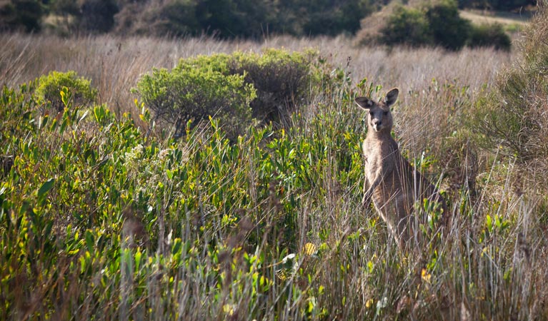
As well as the cultural significance, the walk offers incredible coastal views, including clear views to Brush Island . You might see kangaroos grazing on the grassland or sea eagles soaring overhead as you’re ambling along. Don’t forget your swimmers either – when the weather is warm, you’ll definitely want to go for a splash in the waves.
Map

Map legend

Local alerts
For the latest updates on fires, closures and other alerts in this area, see https://www.nationalparks.nsw.gov.au/things-to-do/walking-tracks/murramarang-aboriginal-area-walking-track/local-alerts
General enquiries
- National Parks Contact Centre
- 7am to 7pm daily
- 1300 072 757 (13000 PARKS) for the cost of a local call within Australia excluding mobiles
- parks.info@environment.nsw.gov.au
Park info
- in Murramarang Aboriginal Area in the South Coast region
Murramarang Aboriginal Area is always open but may have to close at times due to poor weather or fire danger.
Visitor info
All the practical information you need to know about Murramarang Aboriginal Area walking track.
Maps and downloads
Learn more
Murramarang Aboriginal Area walking track is in Murramarang Aboriginal Area. Here are just some of the reasons why this park is special:
First sightings

When Captain Cook first spotted what he would later call Pigeon House Mountain from the sea, he sailed towards the coast to see if he could find a safe place to anchor. On 22 April 1770, he made his first sighting of Aboriginal people - some in bark canoes, others on land - here at Murramarang. Incidentally, the Aboriginal name for Pigeon House is 'Didthul', which is connected to the ocean through Dreaming stories. The first white settlers came to the area to graze cattle and cut timber in the late 1820s.
In a flap

Because of the preservation of nature here and its proximity to the coast, Murramarang is a great place to go bird watching. There are many species of threatened seabirds - including the sooty oystercatcher and hooded plover - living on the beaches. Swan Lagoon is an important habitat for waterbirds, including the black swan, little pied cormorant and white-faced heron. Sea eagles and osprey can often be seen swooping over the water.
- Murramarang Aboriginal Area walking track Murramarang Aboriginal Area walking track is a 2.2km loop track that passes middens and other sites of great Aboriginal cultural and historic significance.
Vast Aboriginal history

There are very few sites on the NSW South Coast with this much heritage. Material found at Murramarang has been dated back to an astounding 12,000 years. The headland, with its rock platforms, fishing, and nesting sea birds, was an important meeting point for Aboriginal people. Large fires where people cooked their food would have been visible for miles, and some archaeological finds suggest people in this area ate whales and dolphins. These days, the area is still used by local Aboriginal people for fishing, recreational and educational activities. Signs along the walking track identify some of the most important features of the area.
- Murramarang Aboriginal Area walking track Murramarang Aboriginal Area walking track is a 2.2km loop track that passes middens and other sites of great Aboriginal cultural and historic significance.