Border walk
Bald Rock National Park
Overview
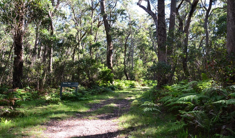
The Border walk takes you from the Bald Rock picnic area to the NSW/Queensland border. Heading north, you’ll be rewarded with views from the lookout over Bald Rock.
- Where
- Bald Rock National Park in Country NSW
- Distance
- 13km loop
- Time suggested
- 5 - 6hrs
- Grade
- Grade 3
- Trip Intention Form
-
It's a good idea to let someone know where you're going. Fill in a trip intention form to send important details about your trip to your emergency contact.
- Personal Locator Beacon
-
Hire a Personal Locator Beacon (PLB) for free at the Tenterfield office.
- Entry fees
- Park entry fees apply
- What to
bring - Drinking water, hat, sunscreen
- Please note
- Remember to take your binoculars if you want to birdwatch
- The weather in this area can be extreme and unpredictable, please ensure you are well prepared for your visit.
- There is limited reception in this park
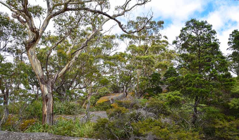
Beginning at the northern end of the Bald Rock picnic area, Border walk passes through creeks and swamp, rising above attractive woodlands.
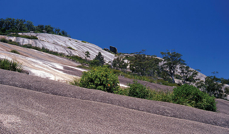
When you reach the northern extent of the walk, take time to rest at the viewing site that offers a fine profile of Bald Rock.
If you walk quietly at dawn or dusk you may see grey kangaroos, red-necked wallabies and swamp wallabies. If you're in the campground at night, and with a good torch, you might also see possums and gliders. In spring, boronia, banksia, grevillea and a profusion of other wildflowers brighten the woodlands of this granite country. The best time of year to visit would have to be late July, with golden wattle trees blooming.
Map
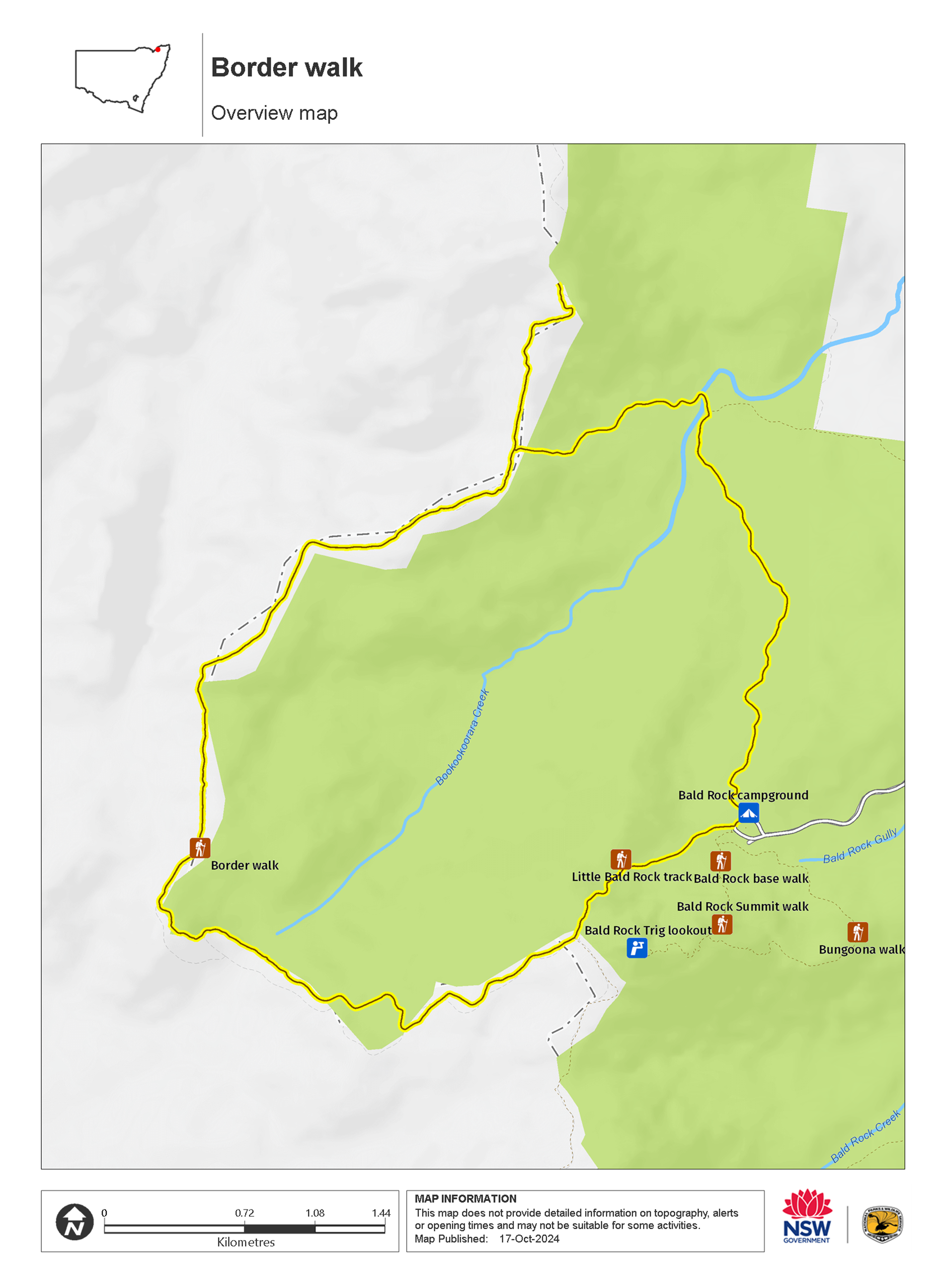
Map legend

Local alerts
For the latest updates on fires, closures and other alerts in this area, see https://www.nationalparks.nsw.gov.au/things-to-do/walking-tracks/border-walk/local-alerts
General enquiries
- National Parks Contact Centre
- 7am to 7pm daily
- 1300 072 757 (13000 PARKS) for the cost of a local call within Australia excluding mobiles
- parks.info@environment.nsw.gov.au
Park info
- in Bald Rock National Park in the Country NSW region
Bald Rock National Park is always open but may have to close at times due to poor weather or fire danger.
-
Park entry fees:
$8 per vehicle per day. The park uses a self-registration fee collection system. Please bring the correct change.
Buy annual pass.
Visitor info
All the practical information you need to know about Border walk.
Maps and downloads
Learn more
Border walk is in Bald Rock National Park. Here are just some of the reasons why this park is special:
A peaceful trade
Bald Rock also served as neutral ground for three of the Aboriginal nations of the area: the Jukambal, Bundgalung and Kamilleroi. An important trade route for these three nations, meetings and trade occurred without each nation having to journey through the other territories, as Bald Rock was considered a boundary positioned fairly between each Country.
A picture to remember

From the summit, the best views are seen across winter and autumn, when the air is freshest and the light crisp. The colours are most dramatic at dusk, as the rock face hues change beneath your feet from orange to yellow. Be sure to take your camera, a flask of coffee, and wait till the sun sets to capture a photograph worthy of your living room wall.
- Bald Rock base walk Get an up-close view of Australia’s largest exposed granite dome on Bald Rock base walk. This short, accessible walking track is an easy way to explore Bald Rock National Park, near Tenterfield.
Conquer the granite titan
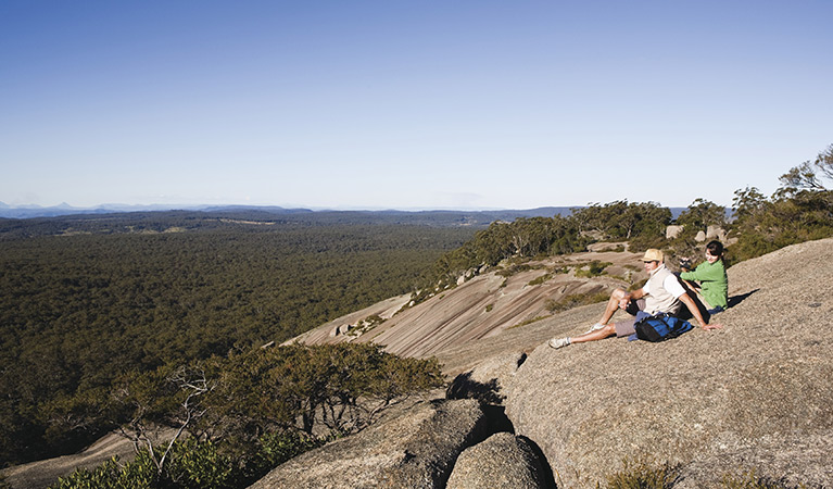
Bald Rock's dome is 500 metres wide and 750 metres in length, and at close to 1300 metres above sea level, it feels like a remote 'top of the world' experience from the summit. Collections of granite archways, scattered boulders, ravines roping their way through the terrain and a pile of enormous smooth granite stones balancing strangely across each other, all await your exploration. The boulders, looming in and out of view as you make your ascent towards the crown, bear the majestic title of 'Granite Titans', and it's easy to see why. Bald Rock's water-streaked dome is the largest granite formation of its kind anywhere in Australia.
- Bald Rock base walk Get an up-close view of Australia’s largest exposed granite dome on Bald Rock base walk. This short, accessible walking track is an easy way to explore Bald Rock National Park, near Tenterfield.
- Bald Rock Summit walk Bald Rock Summit walk is a challenging climb up the largest granite rock in Australia, with scenic views out across Bald Rock National Park, near Tenterfield.
- Border walk The Border walk takes you from the Bald Rock picnic area to the NSW/Queensland border. Heading north, you’ll be rewarded with views from the lookout over Bald Rock.
- Bungoona walk Bungoona walk is a moderately challenging hike to the top of Australia’s largest granite dome. From the summit, take in sweeping views of the mighty Bald Rock National Park, near Tenterfield.
Nature lovers
Following a good rain, the smells and colours of the bush really come alive; golden wattle trees bloom late in July as do wildflowers across spring, and the vibrant colours of the rock lilies, boronia and banksia are a sight to behold. Look out for the rare spotted tailed quoll, as well as possums, grey kangaroos and swamp wallabies on your tour through the park. There are several common species of snakes and lizards which you'll often see around the park's walking tracks in spring and summer.
- Border walk The Border walk takes you from the Bald Rock picnic area to the NSW/Queensland border. Heading north, you’ll be rewarded with views from the lookout over Bald Rock.