Tapin Tops National Park
Overview
A few hours drive north of Sydney, Tapin Tops National Park lies on a spectacular section of the Great Eastern Escarpment, high up in the mountains just northwest of Wingham.
Read more about Tapin Tops National Park
Scenic lookouts such as Rowleys Rock lookout provide astounding panoramic views out across Taree and the ocean beyond. Wander through the park’s subtropical rainforest and old growth eucalypt trees with its richly diverse plant and animal habitat, which dingoes and other interesting native species call home.
Mountain Brush circuit offers an easy, yet rewarding, stroll through the rainforest. Potoroo Falls walk is a fun, easy walk that involves a bit of rock jumping along a creek down to the falls and their swimming waterhole. If you’re in the mood for something a little more strenuous, hike up to the top of Rowleys Rock for incredible mountain views.
Dingo Tops campground is the perfect place to base yourself if you're exploring the park for more than a day-trip.
Local alerts
For the latest updates on fires, closures and other alerts in this area, see https://www.nationalparks.nsw.gov.au/visit-a-park/parks/tapin-tops-national-park/local-alerts
Contact
- in the North Coast region
Tapin Tops National Park is always open but may have to close at times due to poor weather or fire danger.
-
-
Taree office
02 6552 4097
Contact hours: Monday to Friday, 9am to 4.30pm. - 78 Hargreaves Drive, Taree NSW 2430
-
Email: npws.manninggreatlakes@environment.nsw.gov.au
-
Taree office
Visitor info
All the practical information you need to know about Tapin Tops National Park.
Map
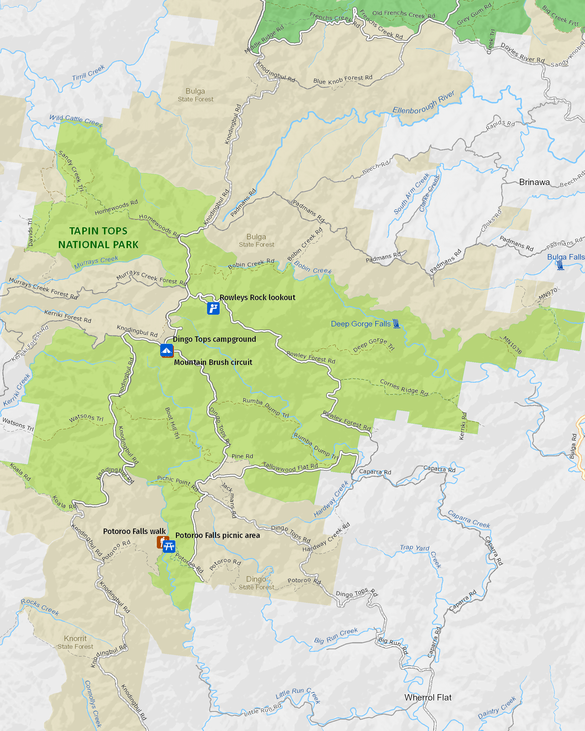
Map legend

Maps and downloads
Nearby towns
Wingham (35 km)
A short stroll from the centre of Wingham is Wingham Brush Nature Reserve. Here you'll see a major colony of grey-headed flying foxes hanging head-down in the canopies of 1000-year-old Moreton Bay and strangler figs.
Taree (47 km)
Taree is a major mid North Coast city, ringed by superb beaches. It's situated on the Manning River and set against rolling hills.
Gloucester (98 km)
Famous for gold deposits and the bushranger Captain Thunderbolt, Gloucester is located in the north Hunter region, east of Barrington Tops. The nearby state forests and national parks are ideal for walking, camping and outdoor adventure sports.
Learn more
Tapin Tops National Park is a special place. Here are just some of the reasons why:
So many amazing animals

Birdwatchers will want to keep their eyes out for the black and gold regent bowerbird, the green catbird, and the topknot pigeons resting in the treetops. Three threatened species of owls have been recorded here (sooty, powerful and masked owls), although if you spot these rare creatures you are lucky indeed, as they are hardly ever seen. During the day, listen out for the superb lyrebird’s call. Other incredible animals you might be lucky enough to encounter here include the parma wallaby, the spotted-tailed quoll, or brush turkeys scratching on the forest floor. Koalas are present feeding at night, moving between trees in search of the succulent leaves from the eucalypt. They then spend most of the day sleeping in the extensive canopy.
- Mountain Brush circuit This easy walk through the rainforest is a treat for birdwatchers and botanists alike with its lively array of interesting plants, birds and wildlife
A long, rich, Aboriginal culture

Tapin Tops National Park is part of the traditional lands of the Biripi People and this incredible landscape has helped them form their identity and spirituality. The name, ‘Tapin’, means ‘dingo’ in their language, as the park provides habitat to native wild dingos.
A botanist’s dream

An impressive 20 different forest types have been mapped within the park, providing a fantastic variety of unique plants. The temperate, subtropical rainforest is dominated by corkwood, crabapple, sassafras and booyong with majestic yellow carabeen at higher altitudes. There’s also myrtle-dominated rainforest and viney scrub. This diverse flora habitat has several threatened plants species, such as the endangered climbing vine and a rare, vulnerable orchid. A variety of different eucalypts can be seen in Tapin Tops, including brushbox, tallowwood, blue gum, bloodwood, silvertop stringybark and grey gum.
- Mountain Brush circuit This easy walk through the rainforest is a treat for birdwatchers and botanists alike with its lively array of interesting plants, birds and wildlife
- Potoroo Falls walk Take a walk along Potoroo Falls walk which leads from the picnic area through rainforest to the beautiful Potoroo Falls, with its tranquil swimming hole.
- Rowleys Rock lookout From Rowleys Rock lookout in Tapin Tops National Park, you can stand over 1000m above sea level and enjoy astonishing scenic views out over the park, Taree and beyond.
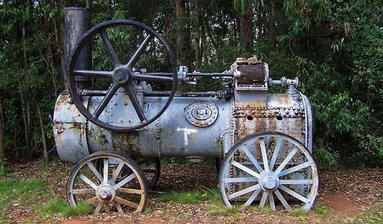
Part of our forestry past

Prior to becoming a national park, this area was part of Bulga and Dingo state forests, which were logged over the last 80 years. In the campground, you can see fascinating relics of road building and forestry operations that date back to pioneering days.
Education resources (1)
What we're doing
Tapin Tops National Park has management strategies in place to protect and conserve the values of this park. View the detailed park and fire management documents.