National Pass
Katoomba area in Blue Mountains National Park
Affected by closures, check current alerts
Overview
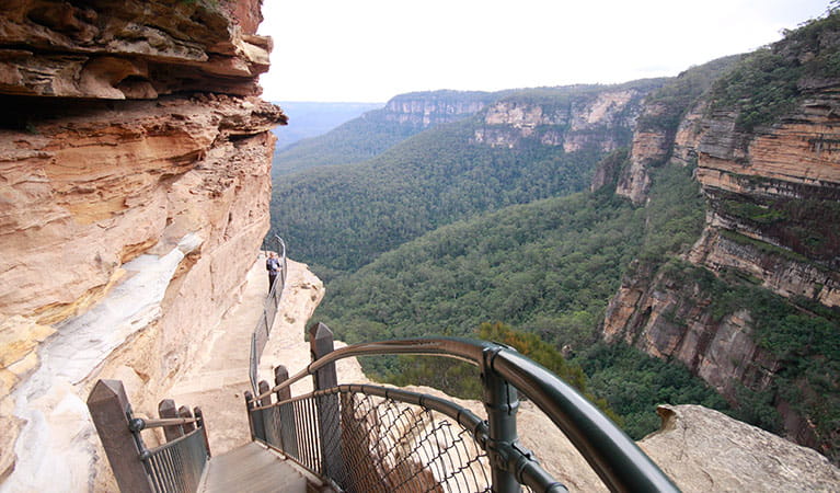

National Pass is closed between Valley of the Waters and Slacks Stairs due to rockfall. From Wentworth Falls picnic area, you can walk the upper section of this loop walk, atop the escarpment, for epic lookouts with sweeping views of the waterfalls and Jamison Valley.
- Distance
- 4.5km loop
- Time suggested
- 2hrs 30min - 3hrs 30min
- Grade
- Grade 4
- What to
bring - Drinking water, hat, sunscreen
- Please note
- Check the weather before you set out as some sections of the track can become impassable after rain.
- Please take care and stay on the track as there are hidden cliff edges in this area of the park. Children should be supervised.
- This track has sections of steep stairs.
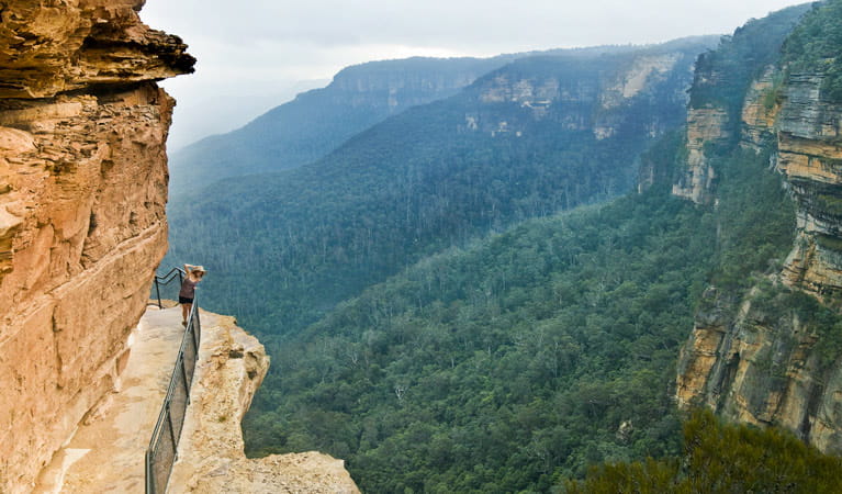
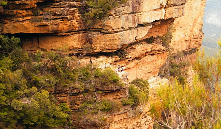
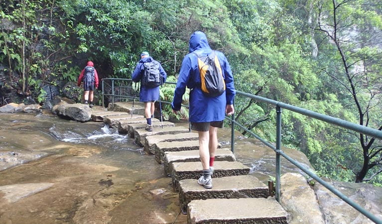
Built into the side of the cliff, National Pass is a spectacular walking track offering unrivalled views of the many natural wonders of the World Heritage-listed Blue Mountains National Park.
Your journey begins at Wentworth Falls picnic area, where you can stroll over to Jamison lookout and take in magnificent views of the valley below. Follow the steps towards Fletchers lookout and down to the top of Wentworth Falls waterfall. There are also easy detours to Weeping Rock or Rocket Point lookout.
Beyond the stepping stones you'll meet the historic Grand Stairway, built by hand in the early 1900’s. As you descend to the base of the waterfall, spare a thought for the men who built it using picks and shovels, with a bit of dynamite for good measure, more than 100 years ago. You'll need to turn back when you reach Slacks Stairs.
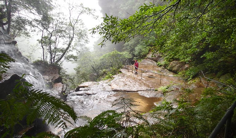
Visitors can access the Valley of the Waters, including Empress, Silvia and Lodore Falls from Conservation Hut. The 1km Shortcut track connects Wentworth Falls picnic area with Conservation Hut. Enjoy a snack or cuppa at the hut or bring a picnic and take advantage of the facilities at the picnic area.
Take a virtual tour of National Pass captured with Google Street View Trekker.
Google Street View Trekker
Using Google Street View Trekker, we've captured imagery across a range of NSW national parks and attractions. Get a bird's eye view of these incredible landscapes before setting off on your own adventure.

Conservation program:
Bush Trackers
Bush Trackers was created to encourage children to engage with the environment in and around the Greater Blue Mountains World Heritage area. This program highlights the natural and cultural splendour of the greater Blue Mountains through education initiatives and bushwalks.
General enquiries
- National Parks Contact Centre
- 7am to 7pm daily
- 1300 072 757 (13000 PARKS) for the cost of a local call within Australia excluding mobiles
- parks.info@environment.nsw.gov.au
Operated by
- Blue Mountains Heritage Centre and Blackheath office
- 9am to 4pm daily. Closed Christmas Day.
- 02 4787 8877
- bluemountains.heritagecentre@environment.nsw.gov.au
- 270 Govetts Leap Road, Blackheath NSW 2785
Park info
- in the Katoomba area of Blue Mountains National Park in the Sydney and surrounds region
Katoomba area is always open but some locations may close at times due to maintenance, poor weather or fire danger.
What's nearby:
Things to do (122)
- 4WD touring (3)
- Aboriginal culture (7)
- Adventure sports (12)
- Birdwatching and wildlife encounters (10)
- Cafes and kiosks (2)
- Cycling (9)
- Environmental appreciation/study (4)
- Historic heritage (9)
- Other experiences (7)
- Photography (3)
- Picnics and barbecues (9)
- Road trips and car/bus tours (3)
- Sightseeing (61)
- Swimming (2)
- Visitor centres (1)
- Walking (66)
- Waterfalls (41)
- Wildflowers (seasonal) (4)