Overview
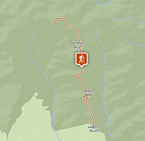
The challenging Corker trail is a hard mountain walking track with scenic views, from Lagoon Pinch to Careys Peak, in Barrington Tops National Park near Dungog.
- Distance
- 20km return
- Time suggested
- 1 - 2 days
- Grade
- Grade 4
- Trip Intention Form
-
It's a good idea to let someone know where you're going. Fill in a trip intention form to send important details about your trip to your emergency contact.
- What to
bring - Drinking water, hat, sunscreen, topographic map, compass, gps
- Please note
- This challenging walk should only be undertaken by experienced bushwalkers with the ability to navigate rugged mountain terrain
- This trail is for walkers only. Bikes are not permitted for the safety of riders and walkers.
- Water is scarce on the dry ridges, so ensure you carry plenty of water.
- Picnic facilities are located at Lagoon Pinch picnic area in the south
- Toilets and camping facilities are located at Wombat Creek campground on Barrington Plateau
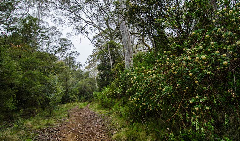
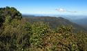
It’s not called Corker trail for nothing. This is a high altitude, high-octane adventure walk for fit and experienced bushwalkers in the rugged mountain country of Barrington Tops National Park. This challenging track follows the ridgeline from Lagoon Pinch picnic area to Careys Peak on the Barrington Plateau. It won’t just be the scenery that will take your breath away.
Be aware that this trail is for walking only. If you prefer to cycle, head to nearby Link trail or Careys Peak walking track.
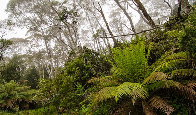
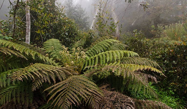
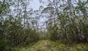
Winding through a variety of vegetation, from tall open woodlands to lush rainforest and cool temperate stands of Antarctic beech, your vigorous effort will be rewarded with brilliant views near Corker Mountain. After that, the expansive snow gum woodlands, grassy plains, and swamps of the Barrington Tops plateau will roll out before you.
Why not pitch the tent at Wombat Creek campground, before taking in the inspiring views at Careys Peak lookout? Spend a night under the stars before heading back, or explore the plateau via a network of linked walks.
Nearby
-
Link Trail - Gloucester Tops to Careys Peak
Link trail – Gloucester Tops to Careys Peak offers a moderate walk or mountain bike trail and scenic views from Gloucester Tops to Barrington plateau, in Barrington Tops National Park.
-
Careys Peak walking track
Easy Careys Peak walking track offers picnicking, scenic views, birdwatching, and historic heritage in the sub-alpine region of Barrington National Park, near Scone.
Subscribe to Naturescapes
Subscribe to our Naturescapes e-newsletter which is packed with the latest information, experiences and events in NSW national parks. Your next park adventure starts here.
General enquiries
- National Parks Contact Centre
- 7am to 7pm daily
- 1300 072 757 (13000 PARKS) for the cost of a local call within Australia excluding mobiles
- parks.info@environment.nsw.gov.au
Operated by
- Gloucester office
- Monday to Friday, 8.30am to 4.30pm.
- 02 6538 5300
- npws.barringtontops@environment.nsw.gov.au
- 59 Church Street, Gloucester NSW 2422
Park info
- in Barrington Tops National Park in the North Coast and Country NSW regions
Barrington Tops National Park is always open but may have to close at times due to poor weather or fire danger.