Murramarang Aboriginal Area
Overview
Located on the NSW South Coast, enriched with historic heritage, Murramarang Aboriginal Area has one of the largest and most important Aboriginal sites on the NSW coast.
Read more about Murramarang Aboriginal Area
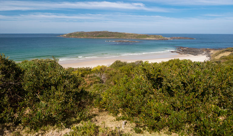
Can you imagine what life was like 12,000 years ago? At Murramarang Aboriginal Area, it’s much easier than you’d think. This reserve protects the largest midden on the South Coast, and a lagoon to the north of the headland that, according to Dreamtime beliefs, is home to a serpent involved in the creation of the land. The midden covers several hectares and contains millions of stone artefacts as well as dense deposits of mammal, fish and bird bones and shells. Based on some of the rare finds – bone points and shell fishhooks – archaeologists believe the people of Murramarang had a sophisticated bone industry and fishing economy.
With its picturesque coastal setting, Murramarang Aboriginal Area is also popular for snorkelling, swimming, surfing, beach and rock fishing, and rock-pooling. A signed walk, with panoramic views, guides visitors through the site.
Local alerts
For the latest updates on fires, closures and other alerts in this area, see https://www.nationalparks.nsw.gov.au/visit-a-park/parks/murramarang-aboriginal-area/local-alerts
Contact
- in the South Coast region
Murramarang Aboriginal Area is always open but may have to close at times due to poor weather or fire danger.
-
-
Ulladulla office
02 4454 9500
Contact hours: Monday to Friday, 9am to 4pm. - Lot 9 Blackburn Industrial Estate, 6 Coller Road Ulladulla NSW 2539
-
Email: npws.shoalhaven@environment.nsw.gov.au
-
Ulladulla office
Visitor info
All the practical information you need to know about Murramarang Aboriginal Area.
Map
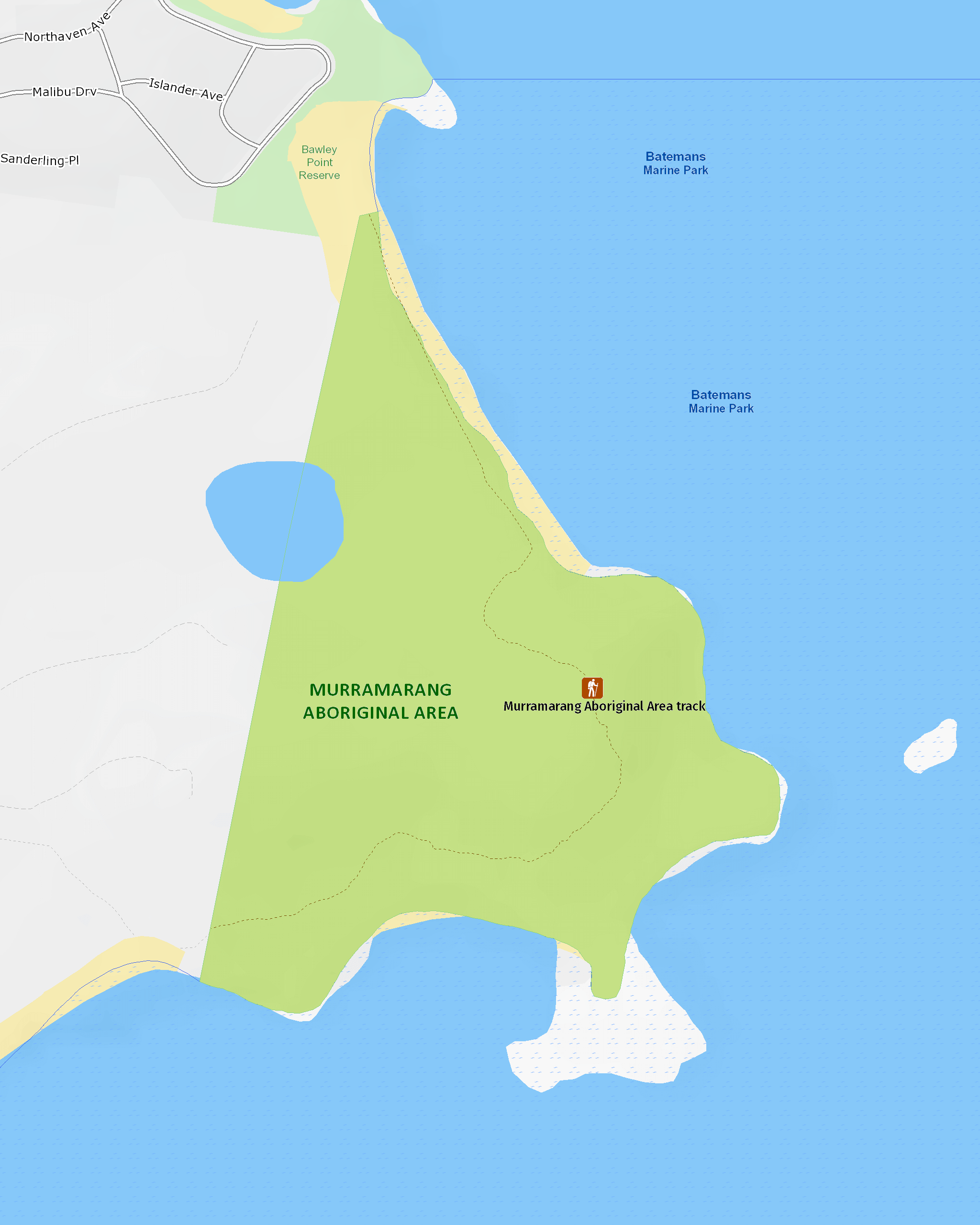
Map legend

Maps and downloads
Nearby towns
Bawley Point (1 km)
Some of the beaches around Bawley Point are popular with surfers looking for the best waves along the coast. But there are plenty of other beaches where you can swim, picnic or simply watch kangaroos enjoying the surf.
Ulladulla (28 km)
Ulladulla is close to several wonderful national parks. Morton National Park, to the west, is home to Pigeon House Mountain, a local landmark which is a popular climb. Murramarang National Park, between Ulladulla and Batemans Bay, has beautiful coastal walks, beaches and camping sites.
Batemans Bay (40 km)
Batemans Bay is a bustling coastal town with majestic seascapes. It's located on the estuary of the Clyde River.
Learn more
Murramarang Aboriginal Area is a special place. Here are just some of the reasons why:
Vast Aboriginal history

There are very few sites on the NSW South Coast with this much heritage. Material found at Murramarang has been dated back to an astounding 12,000 years. The headland, with its rock platforms, fishing, and nesting sea birds, was an important meeting point for Aboriginal people. Large fires where people cooked their food would have been visible for miles, and some archaeological finds suggest people in this area ate whales and dolphins. These days, the area is still used by local Aboriginal people for fishing, recreational and educational activities. Signs along the walking track identify some of the most important features of the area.
- Murramarang Aboriginal Area walking track Murramarang Aboriginal Area walking track is a 2.2km loop track that passes middens and other sites of great Aboriginal cultural and historic significance.
In a flap

Because of the preservation of nature here and its proximity to the coast, Murramarang is a great place to go bird watching. There are many species of threatened seabirds - including the sooty oystercatcher and hooded plover - living on the beaches. Swan Lagoon is an important habitat for waterbirds, including the black swan, little pied cormorant and white-faced heron. Sea eagles and osprey can often be seen swooping over the water.
- Murramarang Aboriginal Area walking track Murramarang Aboriginal Area walking track is a 2.2km loop track that passes middens and other sites of great Aboriginal cultural and historic significance.
First sightings

When Captain Cook first spotted what he would later call Pigeon House Mountain from the sea, he sailed towards the coast to see if he could find a safe place to anchor. On 22 April 1770, he made his first sighting of Aboriginal people - some in bark canoes, others on land - here at Murramarang. Incidentally, the Aboriginal name for Pigeon House is 'Didthul', which is connected to the ocean through Dreaming stories. The first white settlers came to the area to graze cattle and cut timber in the late 1820s.
Education resources (1)
What we're doing
Murramarang Aboriginal Area has management strategies in place to protect and conserve the values of this park. View the detailed park and fire management documents.
Preserving biodiversity
Murramarang Aboriginal Area promotes programs to monitor, help recover and secure populations of threatened shorebirds. The area targets pest impacts, limits disturbance from recreational users and undertakes frequent species monitoring. NPWS is committed to plant and animal conservation, and protects threatened, vulnerable and endangered species within all NSW national parks.