Lake Macquarie State Conservation Area
Overview
The bush backyard of Newcastle and the Central Coast is a hiker’s and boatie’s paradise – bushwalking, canoeing, kayaking, and other water sports await.
Read more about Lake Macquarie State Conservation Area
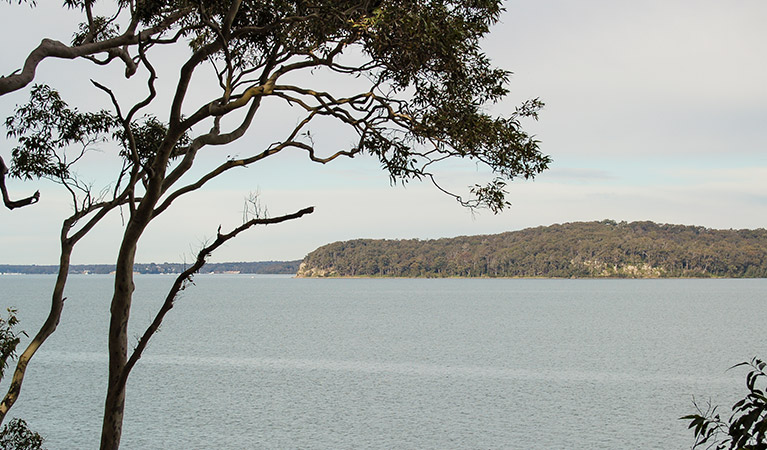
Come and enjoy the blissful lake lifestyle at Lake Macquarie. Twice the size of Sydney Harbour, it’s the biggest permanent saltwater lake in the Southern Hemisphere and provides stunning views, countless opportunities for boating, fishing and water sports, and is a haven for birdwatchers and nature-lovers.
Whether you like to bushwalk with only the lapping of water on the shore for company, enjoy long relaxed family picnics, or prefer to kayak with a line off the side to catch dinner, this park is very accessible – it’s nestled between Newcastle and the Central Coast. You can explore the coves and headlands in any season, and the water is lovely in summer if you need to cool off after a long walk.
Local alerts
For the latest updates on fires, closures and other alerts in this area, see https://www.nationalparks.nsw.gov.au/visit-a-park/parks/lake-macquarie-state-conservation-area/local-alerts
Contact
- in the Sydney and surrounds and North Coast regions
Lake Macquarie State Conservation Area is always open but may have to close at times due to extreme weather or fire danger.
-
-
Lake Munmorah office
02 4972 9000
Contact hours: Monday to Friday, 8.30am to 4pm. - 1 Blue Wren Drive, Wybung NSW 2259
-
Email: npws.centralcoast@environment.nsw.gov.au
-
Lake Munmorah office
Visitor info
All the practical information you need to know about Lake Macquarie State Conservation Area.
Map

Map legend

Maps and downloads
Nearby towns
Swansea (17 km)
Swansea is an energetic Lake Macquarie town with wonderful boating. It's situated on an isthmus between the lake and the sea.
Newcastle (23 km)
Newcastle is a harbour city surrounded by amazing surf beaches that are linked by a great coastal walk, the Bathers Way. The walk from Nobbys Beach to Merewether Beach takes about three hours and is a great way to explore the city.
Gosford (45 km)
Gosford is a great destination for a family day trip or holiday. It's situated on Brisbane Water National Park and surrounded by state forests, lakes and beaches.
Learn more
Lake Macquarie State Conservation Area is a special place. Here are just some of the reasons why:
Wonderful wildlife, diverse habitats

The animals love it here too, making their home among the diverse habitats. Green sea turtles, dolphins, sugar and squirrel gliders, and kangaroos all call the park their home. If you look up, you'll find sea eagles, kookaburras, lorikeets, and the threatened pied oystercatcher in the trees and sky above the lake. On bushwalks, look out for lovely orchids, spectacular wattles, and coastal banksia.
- Alexanders picnic area This very peaceful picnic area with scenic views, at the southern end of Awaba Bay Foreshore walk is the perfect spot to rest after a bushwalk along beautiful Lake Macquarie - indulge in birdwatching, picnicking, and relaxing among the diverse habitats.
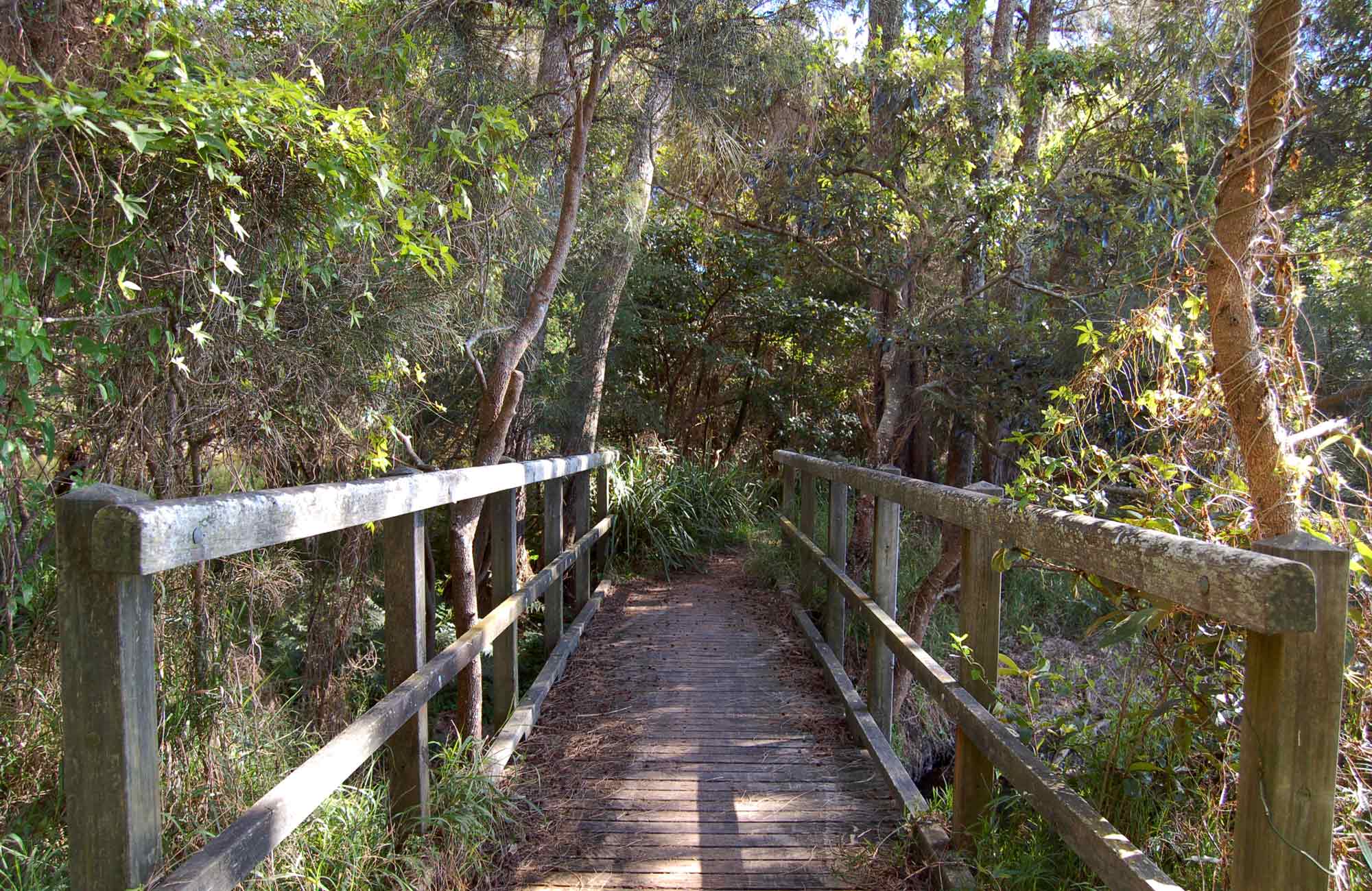
- Awaba Bay Foreshore walk Take a stroll along the shores of Lake Macquarie on Awaba Bay Foreshore walk, enjoying the spectacular scenic lake views while birdwatching and keeping an eye out for dolphins and green sea turtles.
Holidaying history
The special atmosphere of Lake Macquarie has long drawn holidaymakers. A ferry service between Wangi Wangi Point and Toronto led to a growth in tourism in the 1910s and 1920s, and a number of swimming enclosures and guesthouses catered for the area's many visitors. Miners came to Wangi Wangi Point from the Cessnock coalfields, and it became a tent city during December and January when the mines closed for Christmas. You can still stay at Wangi Wangi Point in the Tourist Park.
An important place

The plentiful nature and beauty of this area have made it a special place for thousands of years. The Awabakal Aboriginal people were the original inhabitants, enjoying plant foods such as cabbage palm and lillypilly, and shellfish like pipis, cockles, mussels, whelks, and oysters collected from rock platforms, the lake's foreshore, and beaches. Local people caught fish with lines or spears, or trapped them in weirs built at the entrance of tidal channels. The beautiful Pulbah Island is considered sacred by the Awabakal People.
Activities galore

Whatever pace you like to take life at, there's stacks to do on Lake Macquarie. Kayak the serene waters, meander along Awaba Bay Foreshore walk or try Wangi circuit walking track for a gorgeous helping of nature. Picnic at Alexanders, throw a line over your boat, or take things a little bit faster with some waterskiing.
- Alexanders picnic area This very peaceful picnic area with scenic views, at the southern end of Awaba Bay Foreshore walk is the perfect spot to rest after a bushwalk along beautiful Lake Macquarie - indulge in birdwatching, picnicking, and relaxing among the diverse habitats.
- Marmong picnic area Marmong picnic area is an idyllic place to picnic by the lake, with opportunities for walking, swimming, boating, paddlnig, fishing and birdwatching within Lake Macquarie State Conservation Area.
- Wangi circuit walking track Take a peaceful bushwalk through towering forests to the shores of Lake Macquarie on Wangi circuit walking track, with wonderful scenic views of Pulbah Island, birdwatching and picnicking opportunities, and even sea turtles to see.
Education resources (1)
What we're doing
Lake Macquarie State Conservation Area has management strategies in place to protect and conserve the values of this park. View the detailed park and fire management documents.