Budawang National Park
Overview
Budawang National Park is declared a wilderness area, with hiking, river camping, swimming and scenic views for advanced, well-equipped travellers.
Read more about Budawang National Park
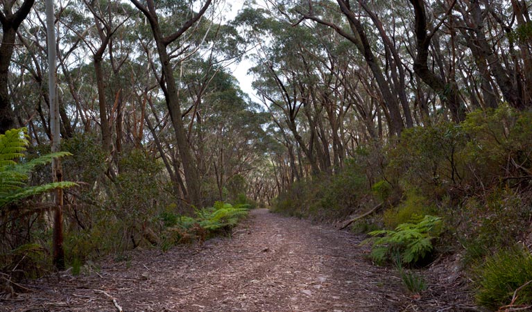
Budawang National Park is wilderness. Rugged and isolated, it's full of steep mountainsides and tall moist forests. There are glossy black-cockatoos in tall eucalypt forests, shallow rivers, and wallabies in patches of grassland.
The park derives its name from one of its dominant features, Mount Budawang – whose name is a variation of the Aboriginal word ‘Buddawong’. The prominence of its peak meant it was used to light signal fires and to observe the movement of people between the highlands and the coast.
Today, this park is perfect for adventurers and experienced trekkers who will love the walking through remote areas and river camping opportunities. If you’re looking for a place to truly get away from the civilised world, Budawang offers a ready haven. Hiking in the park is suitable for fit and experienced bushwalkers equipped with sufficient water and survival gear. There are formal and informal walking tracks, meaning this is a perfect place to set off into the bush with a map and GPS.
Come for a day walk, or prepare the backpack for a full weekend getaway. Expect spectacular scenery and plenty of solitude.
Local alerts
For the latest updates on fires, closures and other alerts in this area, see https://www.nationalparks.nsw.gov.au/visit-a-park/parks/budawang-national-park/local-alerts
Contact
- in the South Coast and Country NSW regions
Budawang National Park is always open but may have to close at times due to poor weather or fire danger.
-
-
Ulladulla office
02 4454 9500
Contact hours: Monday to Friday, 9am to 4pm. - Lot 9 Blackburn Industrial Estate, 6 Coller Road Ulladulla NSW 2539
-
Email: npws.shoalhaven@environment.nsw.gov.au
-
Ulladulla office
Visitor info
All the practical information you need to know about Budawang National Park.
Map
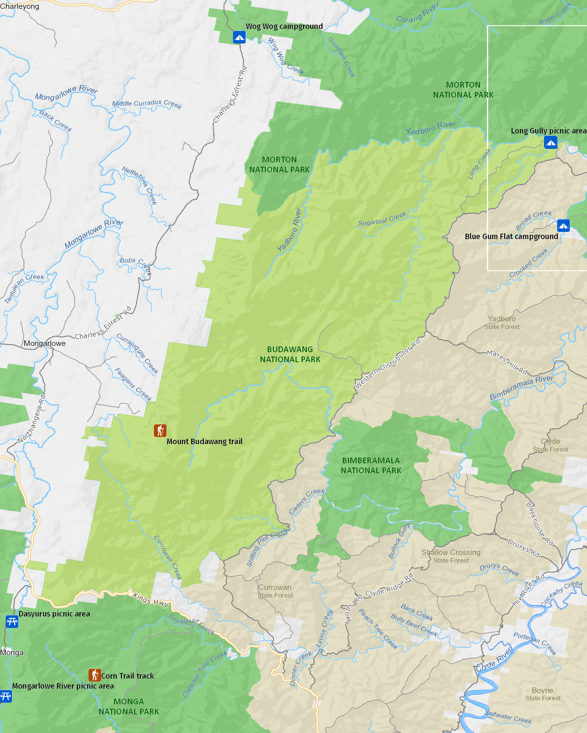
Map
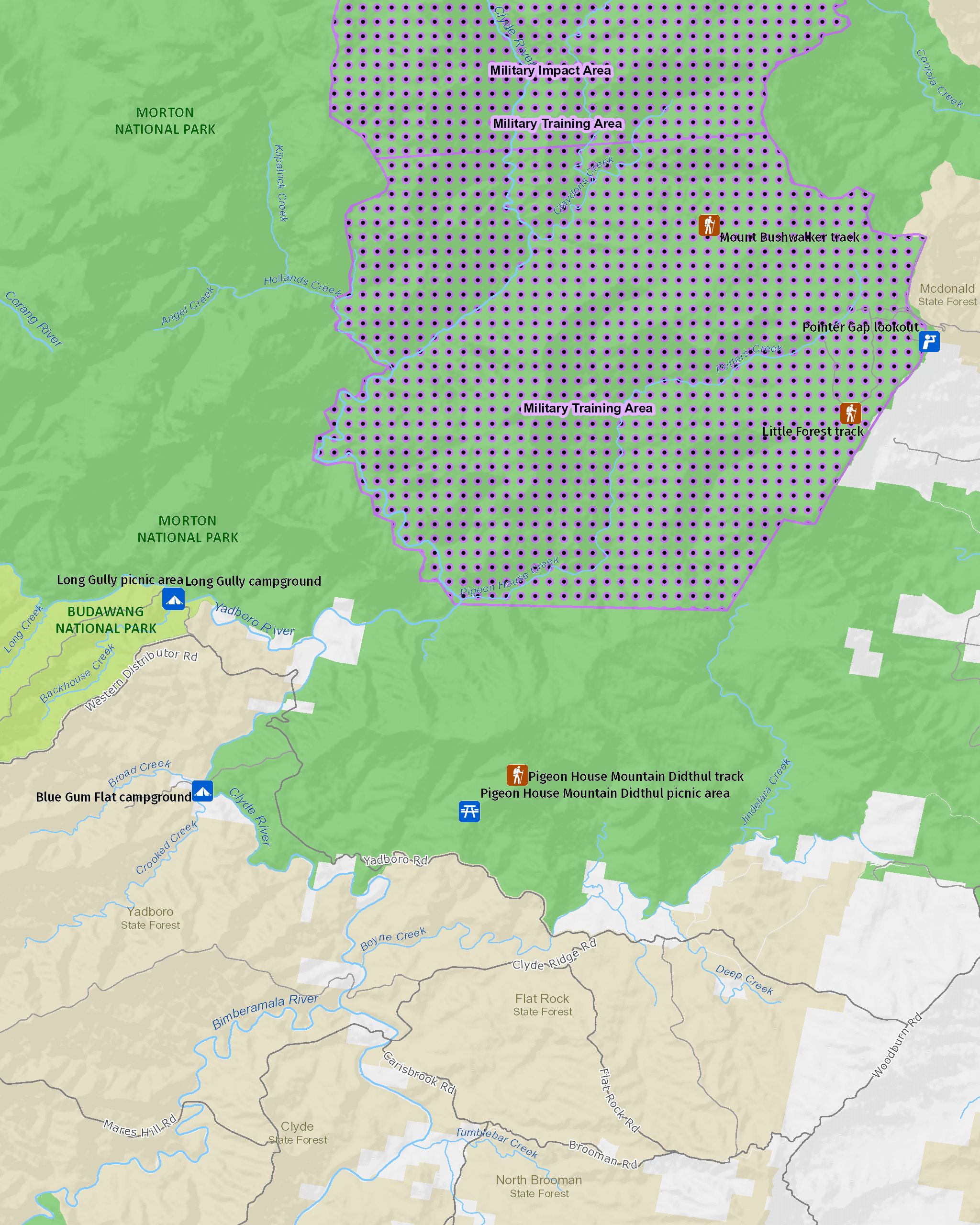
Map legend

Maps and downloads
Nearby towns
Braidwood (25 km)
Braidwood was the first town to be listed on the NSW State Heritage register. Today, you can tour the town on a self-guided heritage walk and see dozens of impressive historic buildings dating from the gold-rush days.
Batemans Bay (40 km)
Batemans Bay is a bustling coastal town with majestic seascapes. It's located on the estuary of the Clyde River.
Ulladulla (45 km)
Ulladulla is close to several wonderful national parks. Morton National Park, to the west, is home to Pigeon House Mountain, a local landmark which is a popular climb. Murramarang National Park, between Ulladulla and Batemans Bay, has beautiful coastal walks, beaches and camping sites.
Learn more
Budawang National Park is a special place. Here are just some of the reasons why:
Volcanic foundations

Southern Budawang Range is formed on Devonian sediments that were uplifted to form the Budawang Synclinorium. Volcanic rock on the slopes slowly transforms into fertile soil that supports the varied ecosystems of tall moist forest and rainforest. The altitude range in the park is more than 800 metres, though two peaks in the park - Mount Budawang and Currockbilly Mountain - rise to over 1,100m above sea level.
- Mount Budawang trail A challenging yet rewarding walk, cutting through several environments; from grassy woodland to montane forest, and finishing at the summit for scenic views.
Old stock routes

Once European settlers arrived, early exploration of the area concentrated on finding routes across the rugged escarpment country to link the tablelands and coast. Many of the ancient Aboriginal pathways became an important part of the early bridle trail network used for movement of stock. One of these was Wog Wog track, which was used to move cattle from Braidwood to the coast.
A natural haven

Budawang National Park supports a wide variety of trees and plants, so budding naturalists will find much of interest here. The eastern slopes of the range contain tall eucalypt forests, temperate rainforest, and several threatened species. There are Budawang ash and pinkwoods as well.
- Long Gully picnic area Long Gully picnic area is a comfortable spot to settle down for the day beside scenic Yadboro River, with nearby swimming and day walks for the experienced hiker.
- Mount Budawang trail A challenging yet rewarding walk, cutting through several environments; from grassy woodland to montane forest, and finishing at the summit for scenic views.
Education resources (1)
What we're doing
Budawang National Park has management strategies in place to protect and conserve the values of this park. View the detailed park and fire management documents.