Bald Rock National Park
Overview
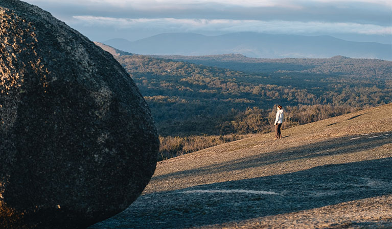
Minutes from the Northern Tablelands in New South Wales, granite gardens scatter across picturesque walks, leading to awe-inspiring lookouts over boundless countryside.
Read more about Bald Rock National Park
Whether you’re planning a day trip from Tenterfield, or a short vacation from Brisbane, it’s well worth visiting Bald Rock National Park.
From Bald Rock picnic area, follow the Border Link trail to the base of Bald Rock, where you’ll pass through eucalyptus, mountain gum and New England blackbutt. The trail leads to the NSW-Queensland border, and there are tremendous views of Girraween National Park, Queensland, along the way.
Bald Rock picnic area has gas barbecues and picnic tables where you can while away the hours. And as it’s the only established picnic area in Bald Rock National Park, with plenty of shaded spots to escape the heat, it’s a popular place to visit in summer.
Local alerts
For the latest updates on fires, closures and other alerts in this area, see https://www.nationalparks.nsw.gov.au/visit-a-park/parks/bald-rock-national-park/local-alerts
Contact
- in the Country NSW region
Bald Rock National Park is always open but may have to close at times due to poor weather or fire danger.
-
Park entry fees:
$8 per vehicle per day. The park uses a self-registration fee collection system. Please bring the correct change.
Buy annual pass. -
-
Glen Innes office
02 6739 0700
Contact hours: Monday to Friday, 8.30am to 4.30pm. - 68 Church Street, Glen Innes NSW 2370
-
Email: npws.ntab@environment.nsw.gov.au
-
Glen Innes office
Visitor info
All the practical information you need to know about Bald Rock National Park.
Map
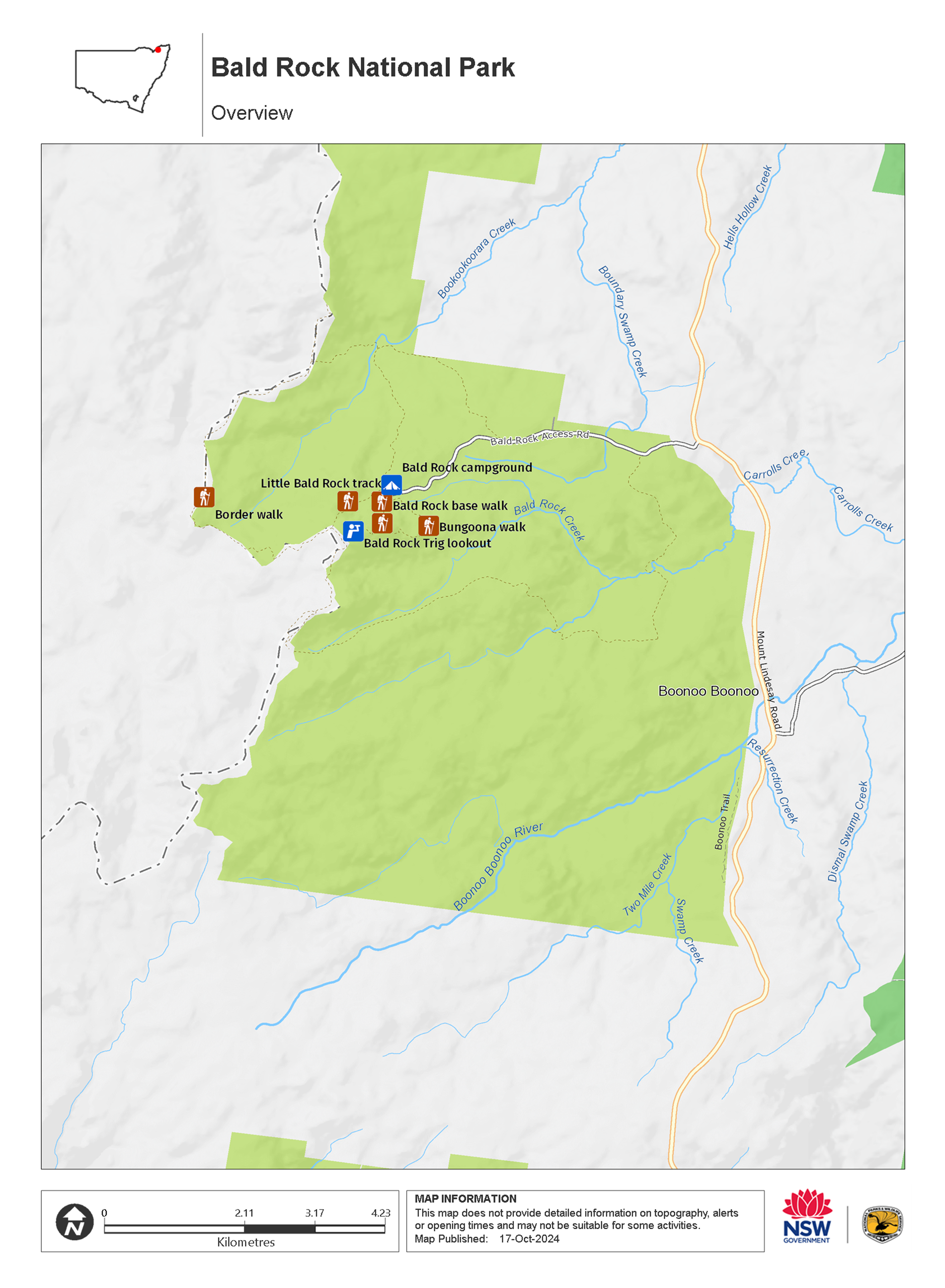
Map legend

Maps and downloads
Nearby towns
Tenterfield (28 km)
Sir Henry Parkes delivered his famous "birth of our nation" speech in the Tenterfield School of Arts in 1889. His rousing speech is credited with being the decisive moment that set the country on its path toward Federation in 1901.
Glen Innes (120 km)
Set in the most prolific sapphire region of Country NSW, Glen Innes hosts the annual Minerama Fossicking and Gem Show and the annual Australian Celtic Festival, and is home to the Australian Standing Stones.
Lismore (188 km)
Lismore is a major North Coast commercial, cultural and administrative centre. It's set in undulating country on the north arm of the Richmond River.
Learn more
Bald Rock National Park is a special place. Here are just some of the reasons why:
Nature lovers
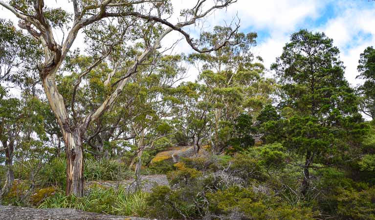
Following a good rain, the smells and colours of the bush really come alive; golden wattle trees bloom late in July as do wildflowers across spring, and the vibrant colours of the rock lilies, boronia and banksia are a sight to behold. Look out for the rare spotted tailed quoll, as well as possums, grey kangaroos and swamp wallabies on your tour through the park. There are several common species of snakes and lizards which you'll often see around the park's walking tracks in spring and summer.
- Border walk The Border walk takes you from the Bald Rock picnic area to the NSW/Queensland border. Heading north, you’ll be rewarded with views from the lookout over Bald Rock.
Conquer the granite titan
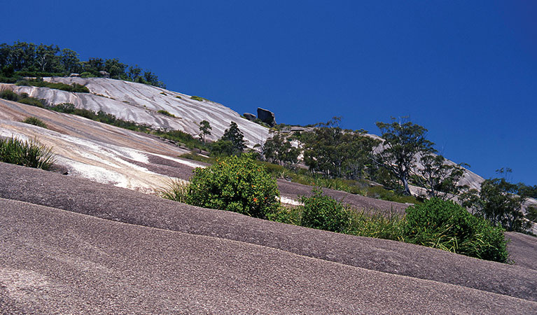
Bald Rock's dome is 500 metres wide and 750 metres in length, and at close to 1300 metres above sea level, it feels like a remote 'top of the world' experience from the summit. Collections of granite archways, scattered boulders, ravines roping their way through the terrain and a pile of enormous smooth granite stones balancing strangely across each other, all await your exploration. The boulders, looming in and out of view as you make your ascent towards the crown, bear the majestic title of 'Granite Titans', and it's easy to see why. Bald Rock's water-streaked dome is the largest granite formation of its kind anywhere in Australia.
- Bald Rock base walk Get an up-close view of Australia’s largest exposed granite dome on Bald Rock base walk. This short, accessible walking track is an easy way to explore Bald Rock National Park, near Tenterfield.
- Bald Rock Summit walk Bald Rock Summit walk is a challenging climb up the largest granite rock in Australia, with scenic views out across Bald Rock National Park, near Tenterfield.
- Border walk The Border walk takes you from the Bald Rock picnic area to the NSW/Queensland border. Heading north, you’ll be rewarded with views from the lookout over Bald Rock.
- Bungoona walk Bungoona walk is a moderately challenging hike to the top of Australia’s largest granite dome. From the summit, take in sweeping views of the mighty Bald Rock National Park, near Tenterfield.
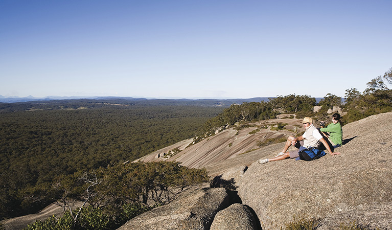
A picture to remember

From the summit, the best views are seen across winter and autumn, when the air is freshest and the light crisp. The colours are most dramatic at dusk, as the rock face hues change beneath your feet from orange to yellow. Be sure to take your camera, a flask of coffee, and wait till the sun sets to capture a photograph worthy of your living room wall.
- Bald Rock base walk Get an up-close view of Australia’s largest exposed granite dome on Bald Rock base walk. This short, accessible walking track is an easy way to explore Bald Rock National Park, near Tenterfield.
A peaceful trade
Bald Rock also served as neutral ground for three of the Aboriginal nations of the area: the Jukambal, Bundgalung and Kamilleroi. An important trade route for these three nations, meetings and trade occurred without each nation having to journey through the other territories, as Bald Rock was considered a boundary positioned fairly between each Country.
Education resources (1)
What we're doing
Bald Rock National Park has management strategies in place to protect and conserve the values of this park. View the detailed park and fire management documents.
General enquiries
- National Parks Contact Centre
- 7am to 7pm daily
- 1300 072 757 (13000 PARKS) for the cost of a local call within Australia excluding mobiles
- parks.info@environment.nsw.gov.au
Contact
- in the Country NSW region
Bald Rock National Park is always open but may have to close at times due to poor weather or fire danger.
-
Park entry fees:
$8 per vehicle per day. The park uses a self-registration fee collection system. Please bring the correct change.
Buy annual pass -
-
Glen Innes office
02 6739 0700
Contact hours: Monday to Friday, 8.30am to 4.30pm. - 68 Church Street, Glen Innes NSW 2370
-
Email: npws.ntab@environment.nsw.gov.au
-
Glen Innes office