Overview
The short, easy Warrego Floodplain walking track offers lookout views of the vast floodplain, birdwatching and seasonal wildflowers, in Toorale National Park, south of Bourke.
- Accessibility
- Easy
- Distance
- 1km return
- Time suggested
- 30min
- Grade
- Grade 2
- Opening times
Dry weather only.
- What to
bring - Hat, sunscreen, snacks, drinking water, suitable clothing, binoculars
- Please note
- Please respect the wishes of the Kurnu-Baakandji People by protecting the natural and cultural features of the park.
- This walk is in a remote location. Weather can be extreme and unpredictable, so please ensure you’re well-prepared for your visit.
- You can pick up maps and brochures from the Bourke NPWS office or Bourke Visitor Information Centre.
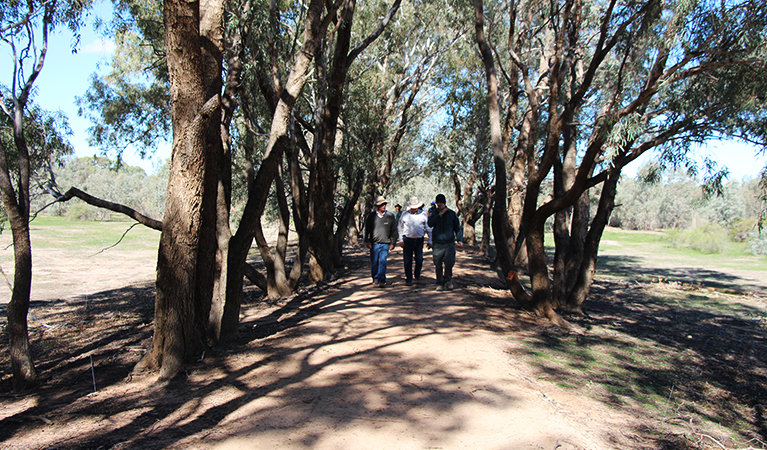
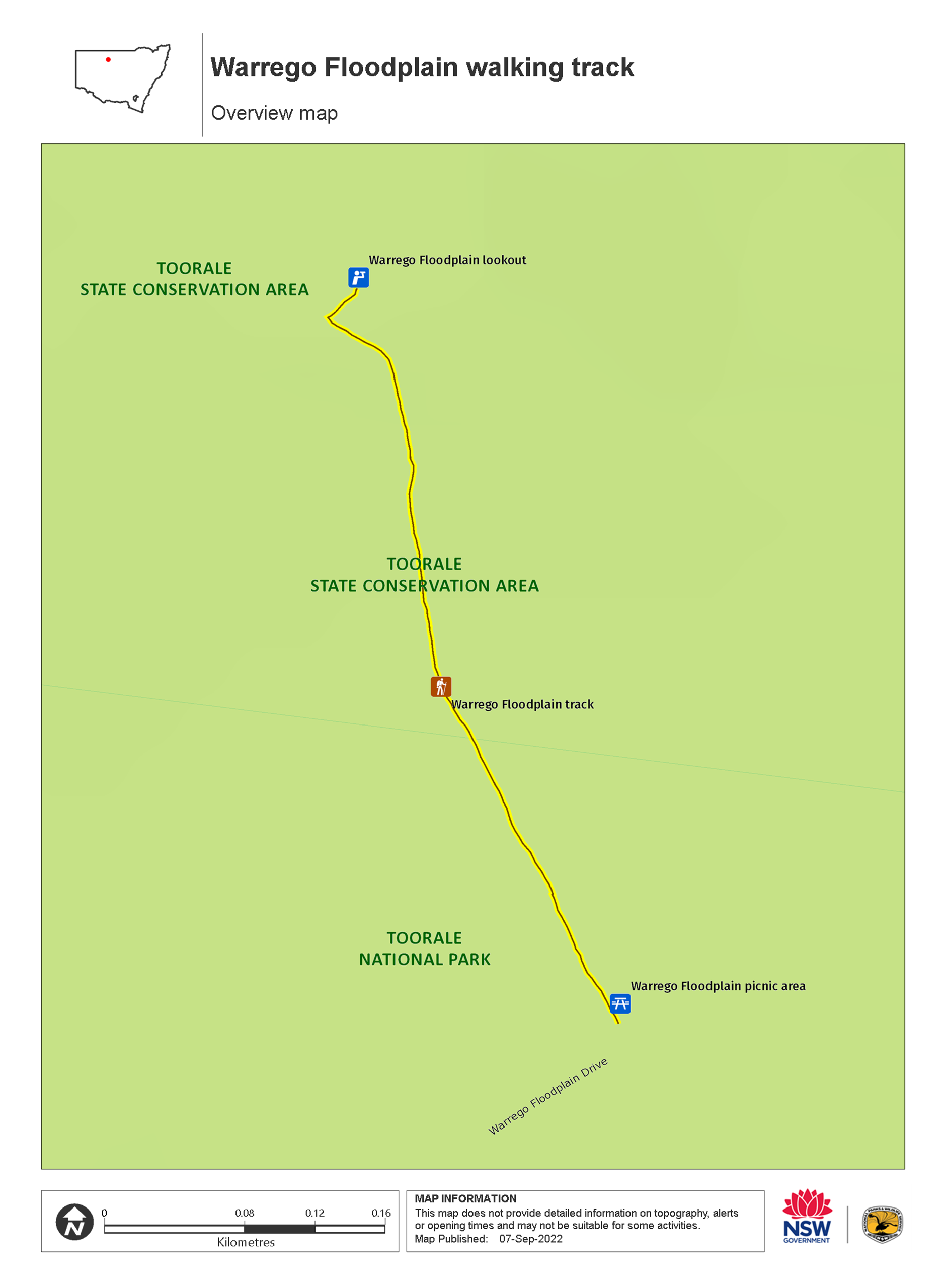
Take a stroll through the vast Warrego Floodplain of Outback NSW on this short, accessible walk. Starting from Warrego Floodplain picnic area (Wariku Pulka), the wide dirt track passes through an avenue of shady coolibah trees to the sheltered Warrego Floodplain lookout.
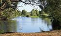
The lookout is a great spot to take in views across the expansive floodplain. It’s best to time your visit for March to October, when temperatures are cooler and summer rainfall has made the landscape come alive with wildflowers, and waterbirds flock to the floodplain.
Birdwatchers and keen photographers will enjoy spotting brolgas, bustards, cormorants, pelicans and spoonbills. As you wander along the track, keep an eye out for sand goannas, kangaroos, emus and shingleback lizards (known locally as bogeyes). Don’t be deceived by the flat landscape – sand ridges and clay depressions are home to an array of native plants and animals.
After your walk, enjoy lunch at the picnic area then head to Toorale Homestead precinct (Yarramarra), or explore the park further along Warrego Floodplain Drive (Wampa-wampa Wariku Pulka).
Also see
-
Warrego Floodplain picnic area (Wariku Pulka)
Warrego Floodplain picnic area (Wariku Pulka) is a tranquil spot for lunch, located at the start of Warrego Floodplain walking track in Toorale National Park, near Bourke.
-

Warrego Floodplain lookout
Warrego Floodplain lookout is on Warrego Floodplain walking track in Toorale National Park. Visit after rains to see this landscape come alive with wildflowers and waterbirds.
Map
Map legend

Local alerts
For the latest updates on fires, closures and other alerts in this area, see https://www.nationalparks.nsw.gov.au/things-to-do/walking-tracks/warrego-floodplain-walking-track/local-alerts
General enquiries
- National Parks Contact Centre
- 7am to 7pm daily
- 1300 072 757 (13000 PARKS) for the cost of a local call within Australia excluding mobiles
- parks.info@environment.nsw.gov.au
Park info
- in Toorale State Conservation Area in the Outback NSW region
- in Toorale National Park in the Outback NSW region
Toorale National Park and SCA is always open, but may have to close at times due to poor weather or fire danger.
Visitor info
All the practical information you need to know about Warrego Floodplain walking track.
Track grading
Features of this track
Distance
1km return
Time
30min
Quality of markings
Clearly sign posted
Experience required
No experience required
Gradient
Gentle hills
Steps
No steps
Quality of path
Formed track: The walk is a 2m-wide compacted dirt track with several gravel sections and a wood boardwalk.
Getting there and parking
Warrego Floodplain walking track is in Toorale National Park. To get there:
From Bourke:
- Drive around 10km north from Bourke along Hungerford Road, following the national park signs
- Turn left onto Bourke-Milparinka Road and continue 22km
- Turn left onto the unsealed Toorale Road and follow 38km until you enter Toorale National Park
- From the park entrance, continue 13km then turn right onto Warrego Floodplain Drive
- Drive 14km to Warrego Floodplain picnic area carpark.
From Louth:
- Cross the bridge and head west on Weeling Road for around 3km
- Turn right at the Tilpa sign onto the unsealed Toorale Road and follow 25km until you enter Toorale National Park
- From the park entrance, continue 17km then turn left onto Warrego Floodplain Drive
- Drive 14km to Warrego Floodplain picnic area carpark.
Road conditions and access
- Warrego Floodplain Drive is dry weather access only.
- Unsealed roads to, and within, Toorale National Park may close due to wet weather. It’s a good idea to check conditions and closures with the NPWS Bourke office or Bourke Shire Council before you set out. Fines apply for driving on closed roads.
- Unsealed roads
Vehicle access
- 2WD vehicles (no long vehicle access)
Weather restrictions
- Dry weather only
Parking
Parking is available in a hard-packed ground carpark at Warrego Floodplain picnic area, where this walk starts.
Facilities
- Toilets, picnic tables and car parking are available at Warrego Floodplain picnic area where this walk begins
- You’ll need to bring your own supply of drinking water.
- Rubbish bins are not provided, so please take your rubbish with you when you leave.
Seats and resting points
There's a bench with a backrest at the lookout.
Maps and downloads
Accessibility
Disability access level - easy
- Warrego Floodplain walking track is a 2m-wide compacted dirt track with several gravel sections and a wood boardwalk.
- The track is suitable for wheelchair users, prams and people with reduced mobility. Some assistance may be required on the gravel sections and gentle hills.
- There are picnic tables at the picnic area where the walk starts and ends, and bench seat at the lookout for resting.
- There are toilets at the picnic area, but they have steps leading to the entrance and the toilets themselves are not accessible or ambulant.
Prohibited
Camp fires and solid fuel burners
Camping
Please camp in designated campgrounds, at Darling River campground (Yapara Paaka Thuru).
Cycling
Not permitted on this walking track. You can cycle along Warrego Floodplain Drive.
Fishing
Gathering firewood
Generators
Pets
Pets and domestic animals (other than certified assistance animals) are not permitted. Find out which regional parks allow dog walking and see the pets in parks policy for more information.
Smoking
NSW national parks are no smoking areas.