Wollondilly lookout
Nattai National Park
Overview
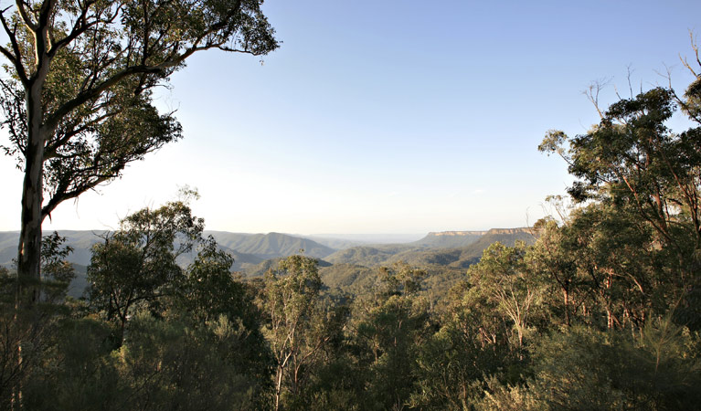
The scenic Wollondilly lookout gazes out across the eucalypt forests, sandstone cliffs and mountain ranges of Nattai National Park.
- Type
- Lookouts
- What to
bring - Hat, sunscreen, drinking water
Suburbia and city life couldn’t feel further away when you’re gazing out from this lookout at the magnificent mountain and lake views of Nattai National Park.
Take in the incredible sandstone cliff ridges and eucalypt forests of the park. It’s also a great spot for birdwatching and, if you’re lucky, you might even spot some of the eastern grey kangaroos, wallaroos, brush-tailed rock wallabies, koalas or owls that inhabit the park.
Check out the board at the lookout for a map of the area and more information about Nattai’s many amazing attractions.
Map
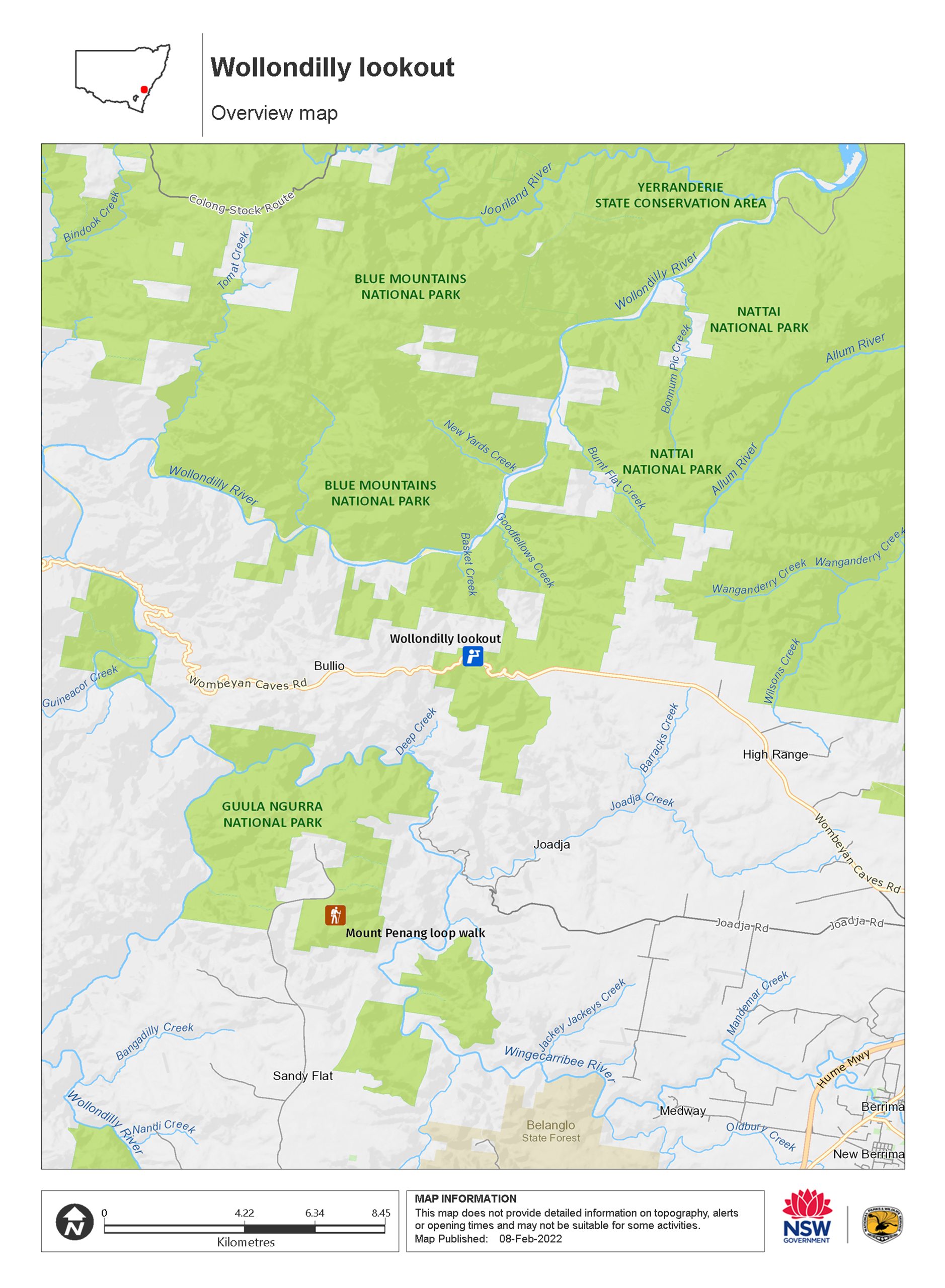
Map legend

Local alerts
For the latest updates on fires, closures and other alerts in this area, see https://www.nationalparks.nsw.gov.au/things-to-do/lookouts/wollondilly-lookout/local-alerts
General enquiries
- National Parks Contact Centre
- 7am to 7pm daily
- 1300 072 757 (13000 PARKS) for the cost of a local call within Australia excluding mobiles
- parks.info@environment.nsw.gov.au
Park info
- in Nattai National Park in the Sydney and surrounds and Country NSW regions
Nattai National Park is always open but may have to close at times due to poor weather or fire danger.
Visitor info
All the practical information you need to know about Wollondilly lookout.
Maps and downloads
Learn more
Wollondilly lookout is in Nattai National Park. Here are just some of the reasons why this park is special:
Dharawal and Gundungarra territory

The Nattai area is the traditional territory of the Dharawal and Gundungarra Aboriginal peoples. The Wollondilly and Burragorang valleys historically form a transition zone between the two. The land and waterways, and the plants and animals that live in them, feature in all facets of Aboriginal culture, including recreational, ceremonial, spiritual, and as a main source of food and medicine. They are closely associated with the dreaming stories and cultural learning that are still passed on to this day.
See the forest through the trees

Nattai is a wonderful place to revel in the beauty of Australian land, thanks to its incredible range of environments, from exposed sandstone plateau tops to wild rainforest and sheltered gorges. Stroll among eucalyptus trees, pockets of blue-leaved stringybark forest and, on the Nattai River, majestic stands of Nattai Sandstone River peppermint forest. In the northern part of the park, you'll find communities of red bloodwood, Sydney blackbutt, red ironbark, scribbly gum, Sydney peppermint, and smooth-barked apple trees. The incredible range of wildlife you can encounter in Nattai National Park will thrill animal-lovers. A huge variety of remote habitats support up to nine species of frogs, 160 species of birds, and 19 species of reptiles; not to mention, wallaroos, emus, swamp wallabies, grey kangaroos, dingoes, wombats, echidnas, forest microbats, gliders, and wallaroos. Among the threatened species you may see are brush-tailed rock wallabies, long-nosed potoroos, tiger quolls, powerful owls, and glossy black cockatoos.
- Couridjah Corridor walk Couridjah Corridor walk is a 14km return walk that takes in both Thirlmere Lakes National Park and Nattai National Park. Great for hiking, bushwalking and birdwatching.
- Wollondilly lookout The scenic Wollondilly lookout gazes out across the eucalypt forests, sandstone cliffs and mountain ranges of Nattai National Park.
Wilderness adventures

For the adventurous hiker, Nattai is a wilderness paradise offering rugged walking experiences rarely found so close to major cities and towns. There are several long hikes that will suit well-equipped nature lovers. Choose between a number of routes, all of them featuring incredible scenery among the sandstone cliffs, rainforest and woodlands, including Couridjah Corridor walk, Mount Jellore, Starlight's trail, or the Nattai River trail.