4WD Oberon Colong historic stock route
Sydney and surrounds, Country NSW
Affected by closures, check current alerts
Overview
Intrepid 4WD tourers will love the 4WD Oberon Colong historic route. Travel through the wild south of Blue Mountains National Park to a historic mining ghost town in Yerranderie Regional Park.
- Where
- Southern Blue Mountains area in Blue Mountains National Park, Yerranderie State Conservation Area, Kanangra-Boyd National Park, Yerranderie Regional Park in Sydney and surrounds, Country NSW
- Accessibility
- No wheelchair access
- Distance
- 63km
- Time suggested
- 2hrs
- What to
bring - Drinking water, snacks
- Please note
- No fuel, water or food is available along this route, so please be well-prepared.
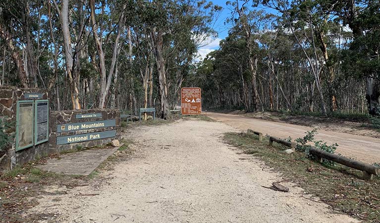
The 4WD Oberon Colong historic route (Mount Werong Road) is an adventurous drive through the remote Southern Blue Mountains area, near Oberon. The unsealed trail takes you deep into the wilderness of Blue Mountains National Park, to reach a forgotten ghost town in Yerranderie Regional Park.
The route follows slopes that plunge down to Wollondilly River to the south and Kowmung River to the north, offering tantalising glimpses of the rugged Kanangra-Boyd wilderness. Stop at Mount Werong campground along the way, and stretch your legs on a walk to historic Ruby Creek mine. Continue on your spectacular drive, dipping and weaving along the crest of the Murruin Range to Yerranderie Private Town, a carefully preserved silver mining town where you can stay overnight.
Keep your eyes peeled for kangaroos, wallabies, wombats and maybe even a shy echidna as you make your way along the route. If you’re a keen birdwatcher, be sure to look out for the gorgeous forest flocks of rainbow lorikeets and sulphur-crested cockatoos in spring and summer. At night, you might hear the cries of the powerful and sooty owls.
Take a virtual tour of 4WD Oberon Colong historic stock route captured with Google Street View Trekker.
Nearby
-
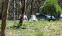
Mount Werong campground
Mount Werong campground is a great base to explore the mountain bike trails, bushwalks, and historic heritage in the remote south of Blue Mountains National Park, near Oberon.
-
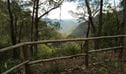
Ruby Creek walking track
Ruby Creek walking track is an easy return walk from Mount Werong campground. It offers mining heritage and waterfall views in the remote Southern Blue Mountains area, near Oberon.
Map
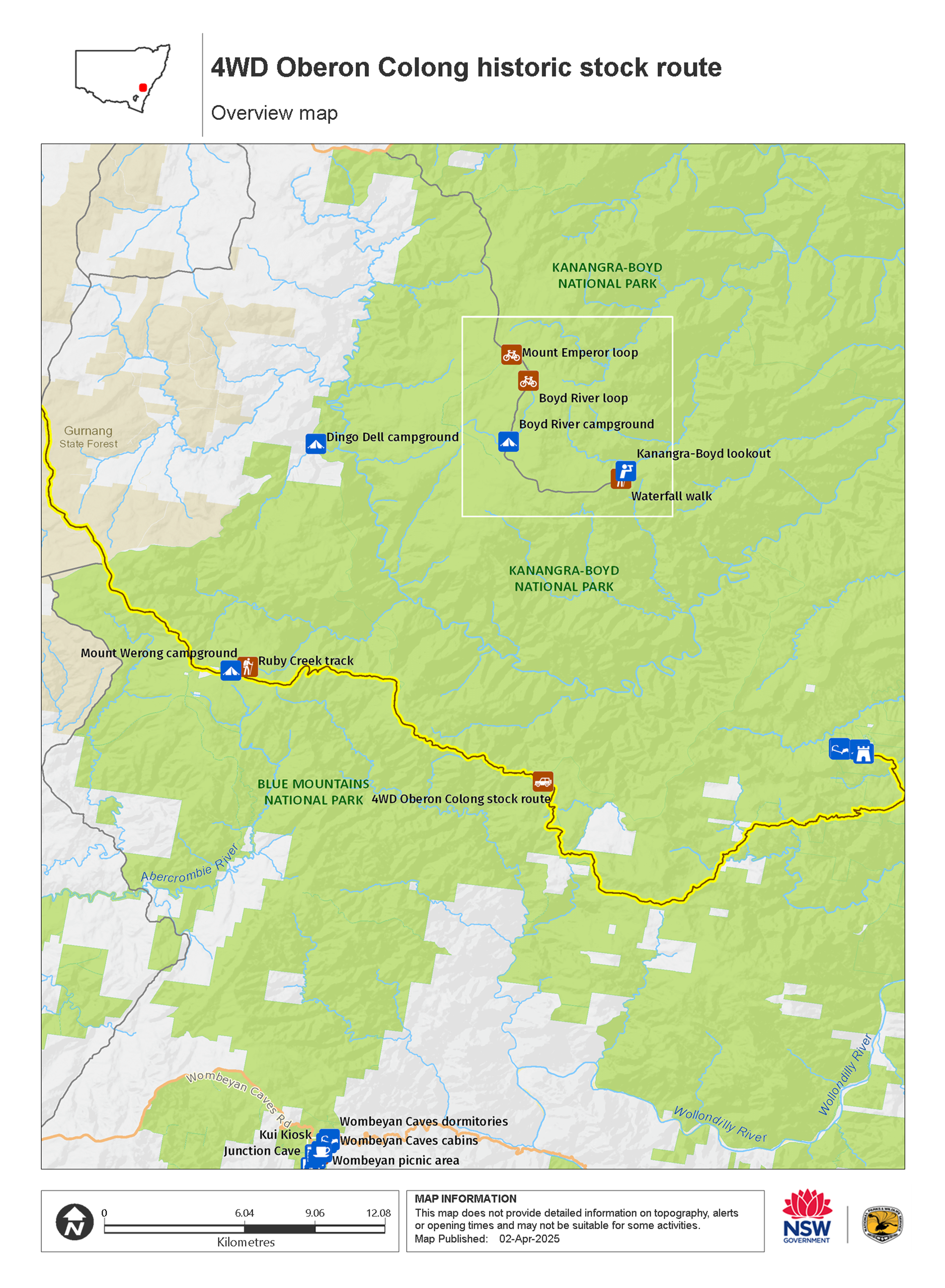
Map legend

Local alerts
For the latest updates on fires, closures and other alerts in this area, see https://www.nationalparks.nsw.gov.au/things-to-do/4wd-touring-routes/4wd-oberon-colong-historic-stock-route/local-alerts
Park info
- in Yerranderie Regional Park in the Sydney and surrounds region
Yerranderie Regional Park is always open but may have to close at times due to poor weather or fire danger.
- in Yerranderie State Conservation Area in the Sydney and surrounds region
- in Kanangra-Boyd National Park in the Sydney and surrounds and Country NSW regions
Kanangra-Boyd is always open, but may have to close at times due to poor weather or fire danger.
- in the Southern Blue Mountains area of Blue Mountains National Park in the Sydney and surrounds and Country NSW regions
Southern Blue Mountains area is always open but some locations may close at times due to poor weather or fire danger.
Visitor info
All the practical information you need to know about 4WD Oberon Colong historic stock route.
Getting there and parking
Get driving directions
4WD Oberon Colong historic stock route is in the Southern Blue Mountains area of Blue Mountains National Park, bordered by Kanangra-Boyd National Park. To get there:
- Start at Oberon on Edith Road, then turn right after 8km onto Butter Factory Lane, which leads onto Shooters Hill Road.
- Turn left onto Mount Werong Road (also known as Colong Oberon historic stock route) and follow this unsealed road past Mount Werong campground.
- Continue all the way along the crest of Murruin Range to Yerranderie Regional Park.
Road access, conditions and restrictions
- Restricted access: There’s no direct access to Southern Blue Mountains area or Yerranderie through the Burragorang Valley from East Picton or Oakdale. This is a Schedule 1 protected water catchment with access restrictions. If you’re using GPS or online mapping, please enter Oberon or Goulburn as your destination to avoid navigational issues.
- In wet weather, check alerts for conditions or closures.
- Watch for kangaroos, wombats and fallen trees on the Oberon Colong stock route. Keep speed down to avoid accidents and punctures.
- Unsealed Road. AWD/4WD recommended.
- Unsealed roads
Maps and downloads
Accessibility
Disability access level - no wheelchair access
Prohibited
Pets
Pets and domestic animals (other than certified assistance animals) are not permitted. Find out which regional parks allow dog walking and see the pets in parks policy for more information.
If you're travelling through a national park or reserve on a public road you can have pets inside your vehicle. However, you must keep them inside your vehicle while driving through national parks or reserves. You must also comply with any conditions in the park’s plan of management, and you cannot stop to visit the park or use park facilities (unless for safety reasons, or to use publicly accessible toilets).
Smoking
NSW national parks are no smoking areas.
Learn more
4WD Oberon Colong historic stock route is in Yerranderie Regional Park. Here are just some of the reasons why this park is special:
Mining heritage

Yerranderie township has retained much evidence of its history as a mining settlement of the early 20th century through its various remains, sites, mines, architecture and ruins. These, in combination with remnant exotic plantings, road systems and subdivision patterns, bring its early settlement to life for visitors. Yerranderie appears to be the only 20th century mining site to be preserved quasi-intact in all of eastern NSW and is an exceptionally well-preserved archaeological site. The township has been lovingly preserved to reflect its history, but the land itself has not seen much subsequent development due to its isolation. An unusually rich assemblage of mining equipment can still be viewed in the mines, and the township has a varied selection of sites, remains, ruins and buildings.
- 4WD Oberon Colong historic stock route Intrepid 4WD tourers will love the 4WD Oberon Colong historic route. Travel through the wild south of Blue Mountains National Park to a historic mining ghost town in Yerranderie Regional Park.
Dramatic natural environment

Yerranderie lies at the centre of a broad visual catchment surrounded by sandstone escarpments and indigenous bushland. The combination of this spectacular natural setting, strong sense of isolation, and the remnants of mining and settlement activity of the past all contribute to give the township a powerful identity and sense of place.