Yanununbeyan State Conservation Area
Overview
Yanununbeyan State Conservation Area, near Queanbeyan and Captains Flat, is a great place for horse riding, cycling, walking, picnicking and birdwatching.
Read more about Yanununbeyan State Conservation Area
If you’re after a bit of isolation and a lot of peace and solitude, Yanununbeyan State Conservation Area is just the place to visit. You can be as active or as passive as you wish.
Yanununbeyan is part of the traditional country of the Ngarigo people and was settled by European graziers as early as the 1820s. Today, remnants of Aboriginal heritage and colonial history can be seen as you explore the park’s various routes either by horse riding, cycling or walking.
Birdwatchers will have a field day in Yanununbeyan, where a huge number of different species make their home. Bring your binoculars and look out for wedge-tailed eagles, spotted quail thrush, superb lyrebirds, dusky wood swallows, speckled warblers and diamond firetails as you set out on your birdwatching expedition of the park. You’ll hear approaching gang gang cockatoos and yellow-tailed black cockatoos from miles away.
Local alerts
For the latest updates on fires, closures and other alerts in this area, see https://www.nationalparks.nsw.gov.au/visit-a-park/parks/yanununbeyan-state-conservation-area/local-alerts
Contact
- in the Country NSW region
Yanununbeyan State Conservation Area may have to close at times due to poor weather or fire danger.
-
-
Queanbeyan office
02 6229 7166
Contact hours: Monday to Friday, 8.30am to 4.30pm. - Level 3, 11 Farrer Street, Queanbeyan NSW 2620
-
Email: npws.alpinequeanbeyan@environment.nsw.gov.au
-
Queanbeyan office
Visitor info
All the practical information you need to know about Yanununbeyan State Conservation Area.
Map
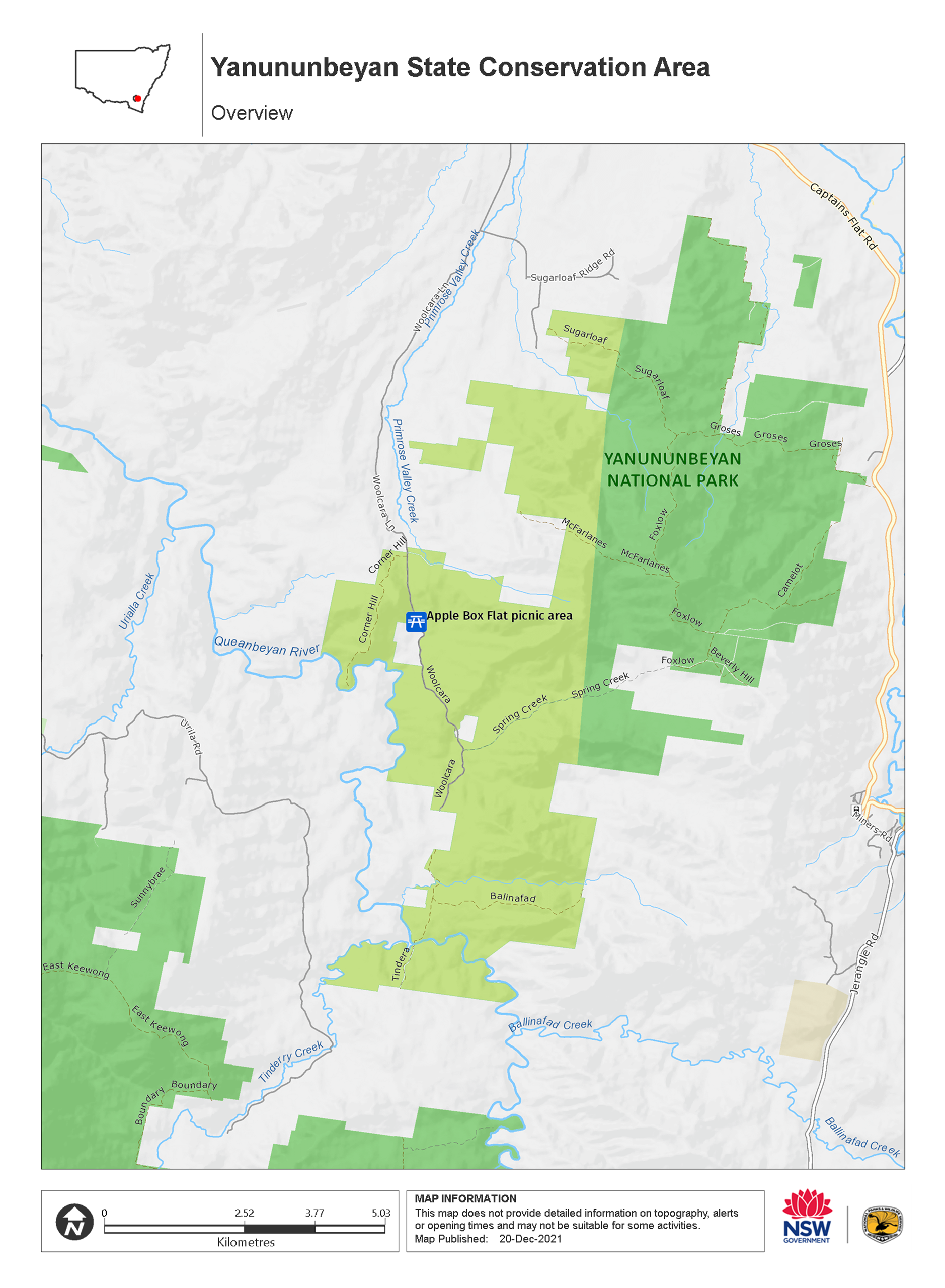
Map legend

Getting there and parking
Get driving directions
From Queanbeyan:
- Travel east on Kings Highway
- Turn right onto Captains Flat Road and follow for approximately 20km
- Turn right onto Woolcara Lane
- Follow Woolcara Lane into Yanununbeyan
Parking
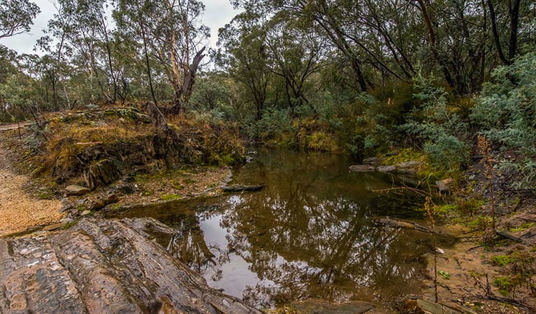
- Apple Box Flat picnic area See on map
By bike
Check out the Bicycle information for NSW website for more information.
By public transport
Yanununbeyan State Conservation Area is not accessible by public transport.
Best times to visit
There are lots of great things waiting for you in Yanununbeyan State Conservation Area. Here are some of the highlights.
Autumn
The milder conditions of this season are ideal for exploring the park whether you're on foot, bicycle or horseback.
Spring
Wildflower season is a superb time to visit the park, when the open grassy woodlands burst into colour and attract birds. Bring along your camera and binoculars for a birdwatching feast.
Weather, temperature and rainfall
Summer temperature
Average
12.3°C and 28.3°C
Highest recorded
41.1°C
Winter temperature
Average
5°C and 12.6°C
Lowest recorded
-9.2°C
Rainfall
Wettest month
January
Driest month
July
The area’s highest recorded rainfall in one day
200mm
Facilities
Picnic tables
Maps and downloads
Prohibited
Pets
Pets and domestic animals (other than certified assistance animals) are not permitted. Find out which regional parks allow dog walking and see the pets in parks policy for more information.
Smoking
NSW national parks are no smoking areas.
Nearby towns
Bungendore (35 km)
Proclaimed in 1837, the township of Bungendore quickly became an important crossroad linking Goulburn, Braidwood, Queanbeyan, Canberra and Cooma. Many of the most important buildings - the post office, an Anglican Church and the Bungendore Inn - were constructed in the 1840s.
Queanbeyan (35 km)
Explore the national parks and nature reserves around Queanbeyan to enjoy bushwalks and see native animals in the wild. At the Googong Foreshores, you can enjoy a walk and a picnic, or try one of the various water sports on offer.
Canberra (49 km)
Canberra is the home of Australia's Parliament House, National Gallery, National Museum and War Memorial, as well as many more significant cultural and architectural offerings. Kids of all ages love the interactive science and technology at Questacon.
Learn more
Yanununbeyan State Conservation Area is a special place. Here are just some of the reasons why:
Times of change
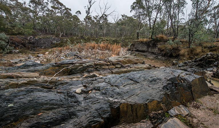
Explorers came to this area in the early 1820s with the purpose of opening up new grazing lands. By the decade's end, European settlers, along with their sheep and cattle, occupied Yanununbeyan. Up until the 1930s, a horse and buggy trail ran along the rough alignment of Woolcara trail and was used as a wool route between Tinderry Station and Bungendore. Physical remains of European settlement in Yanununbeyan include fences, bridle trails and shepherd's huts. On Woolcara trail near The Springs, look for hand-built road foundations.
On a wing and a pouch
Yanununbeyan is home to many animals and a diverse range of birds. Around dawn and dusk, you're likely to see kangaroos, wombats and wallabies. At night, eastern false pipistrelle, powerful owls and squirrel gliders come out to play or hunt or be hunted.
- Apple Box Flat picnic area Apple Box Flat picnic area is a grassy clearing near Queanbeyan River and is a great spot for picnicking and a spot of birdwatching in Yanununbeyan State Conservation Area.
Ngarigo territory
Welcome to Ngarigo territory. The level ground, natural clearings, spring water and forest food sources would have made Yanununbeyan an attractive area to the Ngarigo. There are recorded Aboriginal sites in Yanununbeyan, which include artefact scatters of grey and black chert and quartz. The Ngarigo spent much of their time on the tablelands, yet when temperatures dropped in winter, they would seek shelter at lower altitudes.
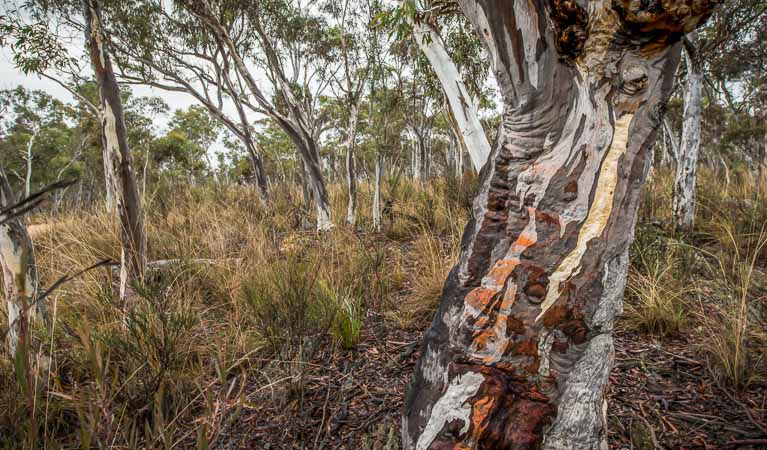
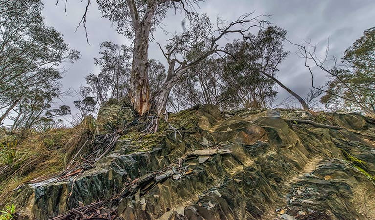
A home of many gum trees
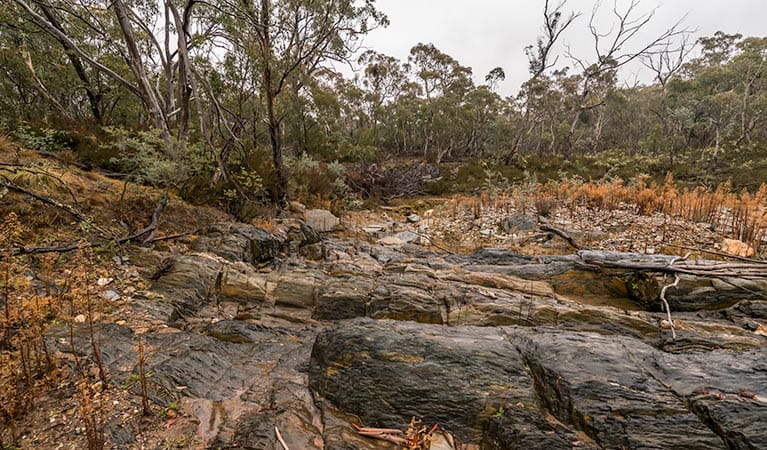
Yanunbeyan National Park is home to various environments within its landscape. The area is home to wet eucalypt forest, intermediate eucalypt forest, dry eucalypt forest and woodland, grassy woodland and riparian. Eucalyptus is the dominant plant in Yanununbeyan, and its varieties include stringybark, brittle gum, scribbly gum, peppermint gum, snow gum, ribbon gum, mountain gum, apple box, argyle apple and candlebark.
- Apple Box Flat picnic area Apple Box Flat picnic area is a grassy clearing near Queanbeyan River and is a great spot for picnicking and a spot of birdwatching in Yanununbeyan State Conservation Area.
Education resources (1)
What we're doing
Yanununbeyan State Conservation Area has management strategies in place to protect and conserve the values of this park. Visit the OEH website for detailed park and fire management documents.