Mount Hay summit walking track
Blackheath area in Blue Mountains National Park
Overview
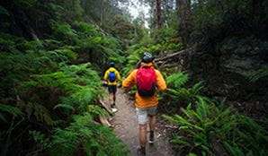
Short but steep Mount Hay summit walking track rewards experienced bushwalkers with dramatic Grose Valley views, and spring wildflowers in Blue Mountains National Park, near Leura.
- Accessibility
- No wheelchair access
- Distance
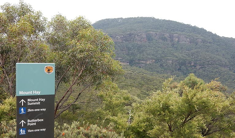
- 4.5km return
- Time suggested
- 2 - 3hrs
- Grade
- Grade 5
- What to
bring - Drinking water, hat, sunscreen, snacks, sturdy shoes, suitable clothing, personal locator beacon, topographic map, compass
- Please note
- This track has some false leads to view points. Bushwalking experience is recommended.
- Please take extreme care. Stay well back from cliff edges and be aware of your surroundings and footing at all times.
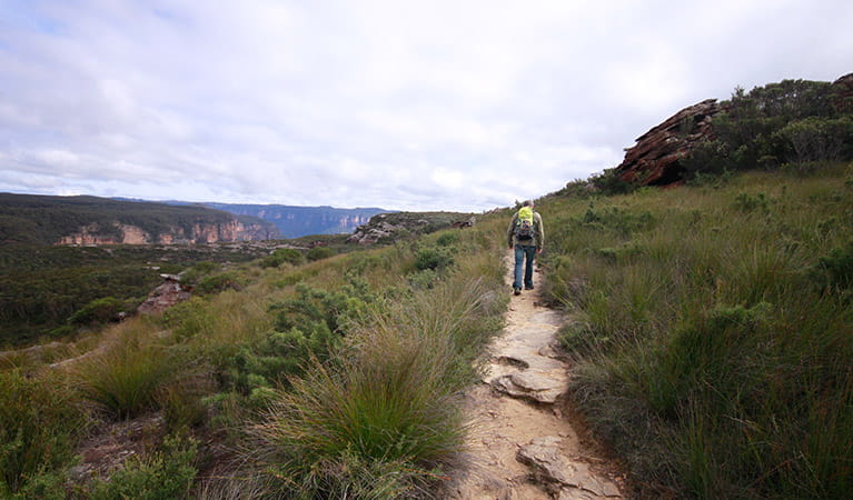
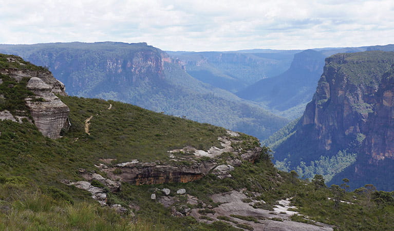
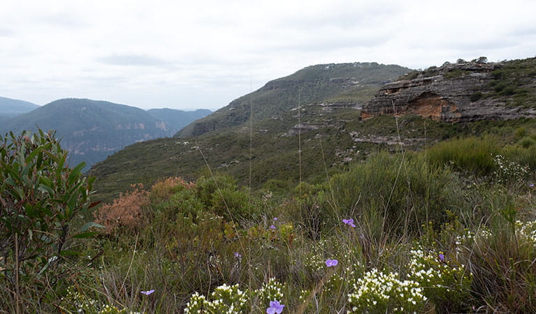
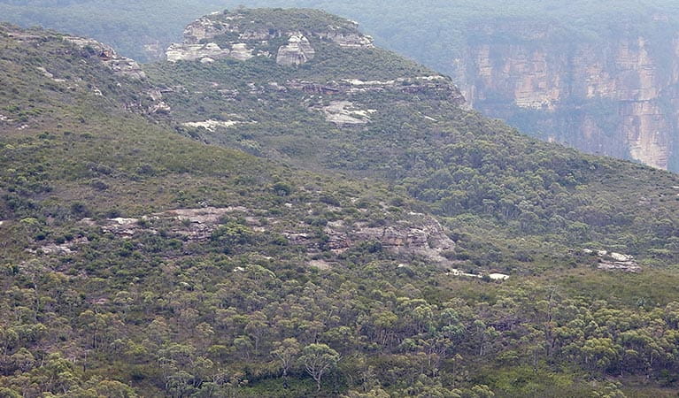
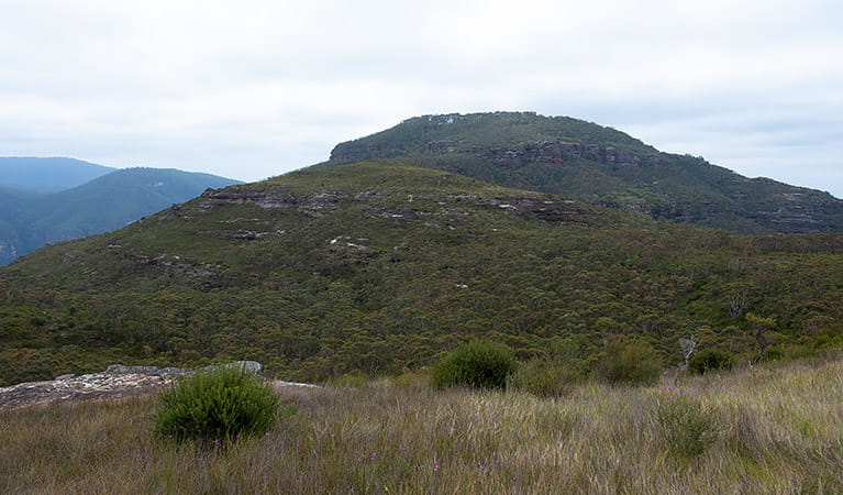
This short but challenging hike to the top of Mount Hay treats you to non-stop views across windswept heathland, rocky outcrops, swampy meadows, and sheer cliffs plunging into the Grose Wilderness.
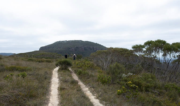
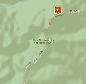
The track starts from the carpark at the end of Mount Hay Road, in north Leura. Stay right at the junction and look for the dome of Mount Hay’s summit to the northeast. The track meanders through heathland, passing rock formations and pristine swamplands.
The swamps provide important habitat for the giant dragonfly and endangered Blue Mountains water skink. In spring, the heath comes alive with wildflowers including pink boronia, blue iris, and flowering banksias, attracting plenty of birdlife.
As you climb the exposed ridgeline, enjoy majestic views of the sandstone cliff bands and verdant forests of the Grose Wilderness, with the imposing double hump of Mount Banks in the distance.
Closer to the summit, the landscape changes to grassy slopes dotted with soccer ball-sized rocks, then tall forest, thanks to the fertile basalt cap soil. Sheltered from sun and wind, it’s a good spot for a shady picnic lunch. A large rock cairn marks the summit, where the walk ends. Return the same way.
If you’re keen for a longer walk, explore this area further on Lockleys Pylon walking track.
Think Before You TREK
Are you planning a bushwalk, going somewhere remote or where the weather is extreme? Stay safe by planning your trip for all conditions and telling someone about it.
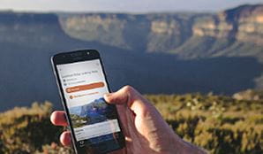
Download our app
The free NSW National Parks app lets you download maps and explore parks, things to do and places to stay—all without mobile reception.
General enquiries
- National Parks Contact Centre
- 7am to 7pm daily
- 1300 072 757 (13000 PARKS) for the cost of a local call within Australia excluding mobiles
- parks.info@environment.nsw.gov.au
Operated by
- Blue Mountains Heritage Centre and Blackheath office
- 9am to 4.30pm daily. Closed Christmas Day.
- 02 4787 8877
- bluemountains.heritagecentre@environment.nsw.gov.au
- 270 Govetts Leap Road, Blackheath NSW 2785
Park info
- in the Blackheath area of Blue Mountains National Park in the Sydney and surrounds region
Blackheath area is always open but may have to close at times due to poor weather or fire danger.
What's nearby:
Things to do (85)
- 4WD touring (1)
- Aboriginal culture (2)
- Adventure sports (12)
- Birdwatching and wildlife encounters (11)
- Cafes and kiosks (1)
- Cycling (6)
- Environmental appreciation/study (2)
- Historic heritage (6)
- Other experiences (9)
- Photography (3)
- Picnics and barbecues (8)
- Road trips and car/bus tours (3)
- Sightseeing (41)
- Swimming (2)
- Visitor centres (1)
- Walking (43)
- Waterfalls (22)
- Wildflowers (seasonal) (7)