Baldy Billy Peak walking track
Guula Ngurra National Park
Overview
Climb to the top of Billy Baldy Peak on this steep and challenging 5km return walk in Guula Ngurra National Park, near Moss Vale and Canyonleigh.
- Where
- Guula Ngurra National Park in Country NSW
- Accessibility
- No wheelchair access
- Distance
- 5km return
- Time suggested
- 3 - 4hrs
- Grade
- Grade 5
- Trip Intention Form
-
It's a good idea to let someone know where you're going. Fill in a trip intention form to send important details about your trip to your emergency contact.
- What to
bring - Drinking water, snacks, sturdy shoes, hat, raincoat, clothes for all weather conditions, sunscreen, first aid kit, personal locator beacon, topographic map, compass, gps
- Please note
- This challenging walk requires a good level of fitness and is only suitable for very experienced bushwalkers.
- Spring and autumn are the best seasons to walk this track. Summer is too hot.
- Drinking water is not available in the area so bring plenty with you.
- There is no mobile reception in this park.
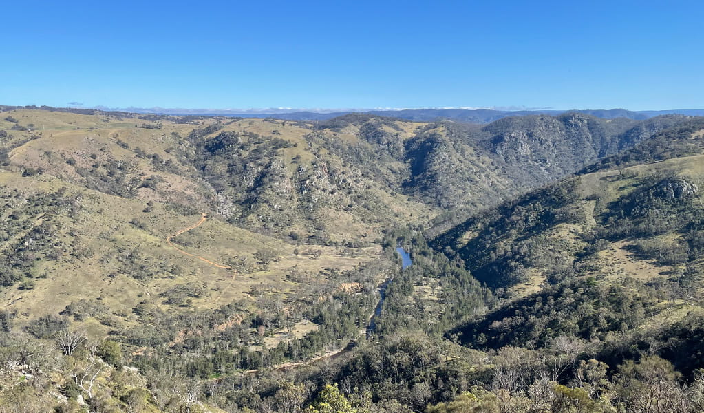
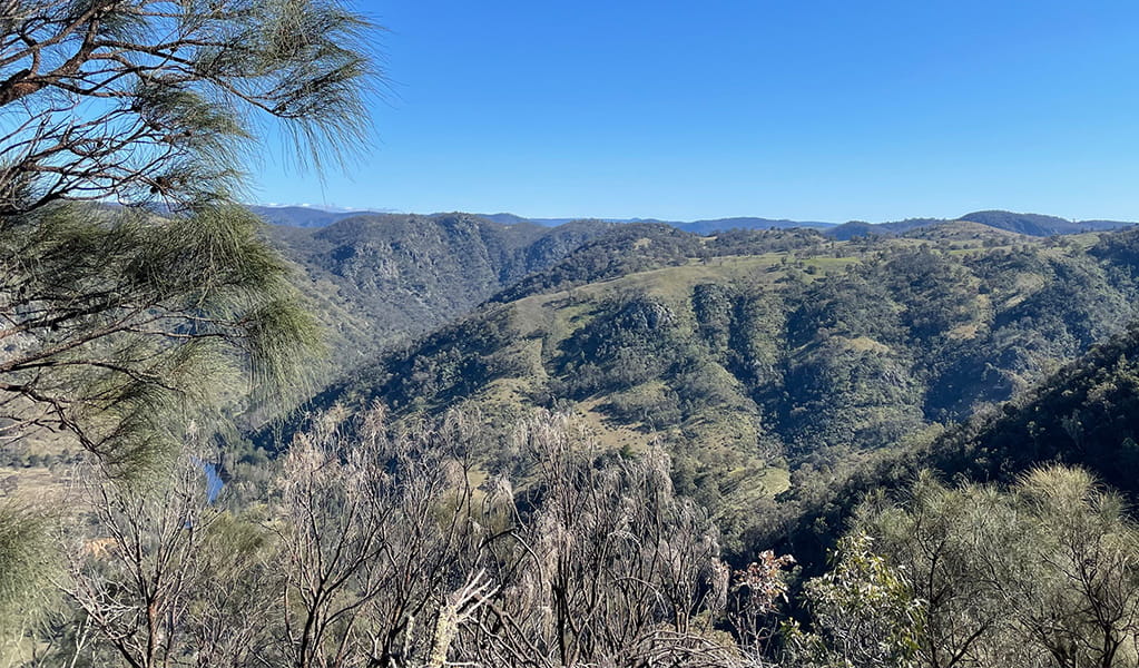
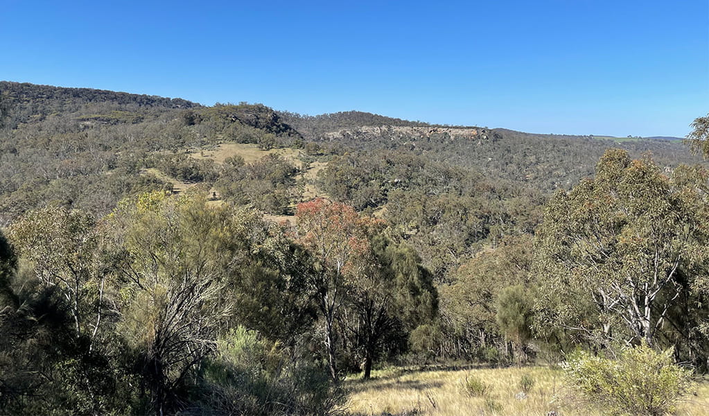
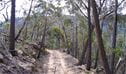
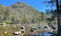
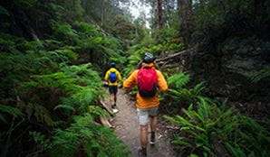
Making its way through remote forest, Baldy Billy Peak walking track is a peaceful day walk offering expansive views. With its rough track, limited signage and some steep sections, it's also a hard walk only suitable for very experienced bushwalkers.
You'll start from the informal parking area and follow Dirrang Management Trail for around 1km, descending into grey gum forest. Entering a clearing at the bottom of the Dirrang Management Trail, you'll then continue along a small trail heading west through a section of grass. The trail splits here with Wollondilly River walking track on your left heading south, and Baldy Billy Peak walking track on your right heading north.
Following Baldy Billy Peak walking track you'll enter forest red gum woodland and start your climb toward Baldy Billy Peak. Though the last few meters of the trail are steep, the reward for your efforts is well worth it as you'll enjoy incredible views from the top of Wollondilly River, Batteries Point, Limestone Creek and Little Baldy Peak.
Also see
-
Mount Penang loop walk
Mount Penang loop walk in Guula Ngurra National Park is a 3km unmarked hiking trail that is best-suited to experienced bushwalkers.
-
Wollondilly River walking track
Wollondilly River walking track is a challenging 8km return walk in Guula Ngurra National Park, near Moss Vale. It's best suited to very experienced bushwalkers.
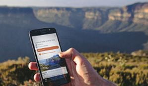
Download our app
The free NSW National Parks app lets you download maps and explore parks, things to do and places to stay—all without mobile reception.
Think Before You TREK
Are you planning a bushwalk, going somewhere remote or where the weather is extreme? Stay safe by planning your trip for all conditions and telling someone about it.
General enquiries
- National Parks Contact Centre
- 7am to 7pm daily
- 1300 072 757 (13000 PARKS) for the cost of a local call within Australia excluding mobiles
- parks.info@environment.nsw.gov.au
Operated by
- Mount Annan office
- 02 4632 4500
- npws.hawkesburynattai@environment.nsw.gov.au
Park info
- in Guula Ngurra National Park in the Country NSW region
The Mount Penang and Little Forest West areas of Guula Ngurra National Park are always open but may have to close at times due to poor weather or fire danger.
The Tugalong area of Guula Ngurra National Park is open to the public from 8.30am to 5pm on the 1st and 3rd Saturday of each month between 1 March and 31 October. Visitors must arrive onsite before 2pm. The area is closed to the public at other times to protect sensitive natural and cultural heritage values.
What's nearby:
Things to do (105)
- 4WD touring (1)
- Aboriginal culture (4)
- Adventure sports (2)
- Birdwatching and wildlife encounters (30)
- Cafes and kiosks (2)
- Canoeing/paddling (2)
- Cycling (5)
- Environmental appreciation/study (2)
- Historic heritage (9)
- Horse riding (1)
- Other experiences (4)
- Photography (1)
- Picnics and barbecues (17)
- Road trips and car/bus tours (9)
- Show cave tours (7)
- Sightseeing (58)
- Swimming (4)
- Visitor centres (1)
- Walking (55)
- Waterfalls (28)
- Waterhole (1)
- Wildflowers (seasonal) (15)