Overview
Get an up-close view of Australia’s largest exposed granite dome on Bald Rock base walk. This short, accessible walking track is an easy way to explore Bald Rock National Park, near Tenterfield.
- Where
- Bald Rock National Park in Country NSW
- Accessibility
- Easy
- Distance
- 0.7km return
- Time suggested
- 15min
- Grade
- Grade 1
- Entry fees
- Park entry fees apply
- What to
bring - Drinking water, sturdy shoes, hat, sunscreen
- Please note
- The Visitor Information Centre in Tenterfield is a great place to pick up maps and other information about the park.
- Spotted-tailed quolls live in this area of the park. They’re powerful animals, so please appreciate them from a distance and keep your food secured.
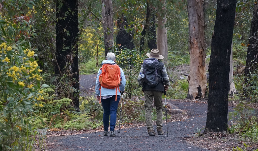
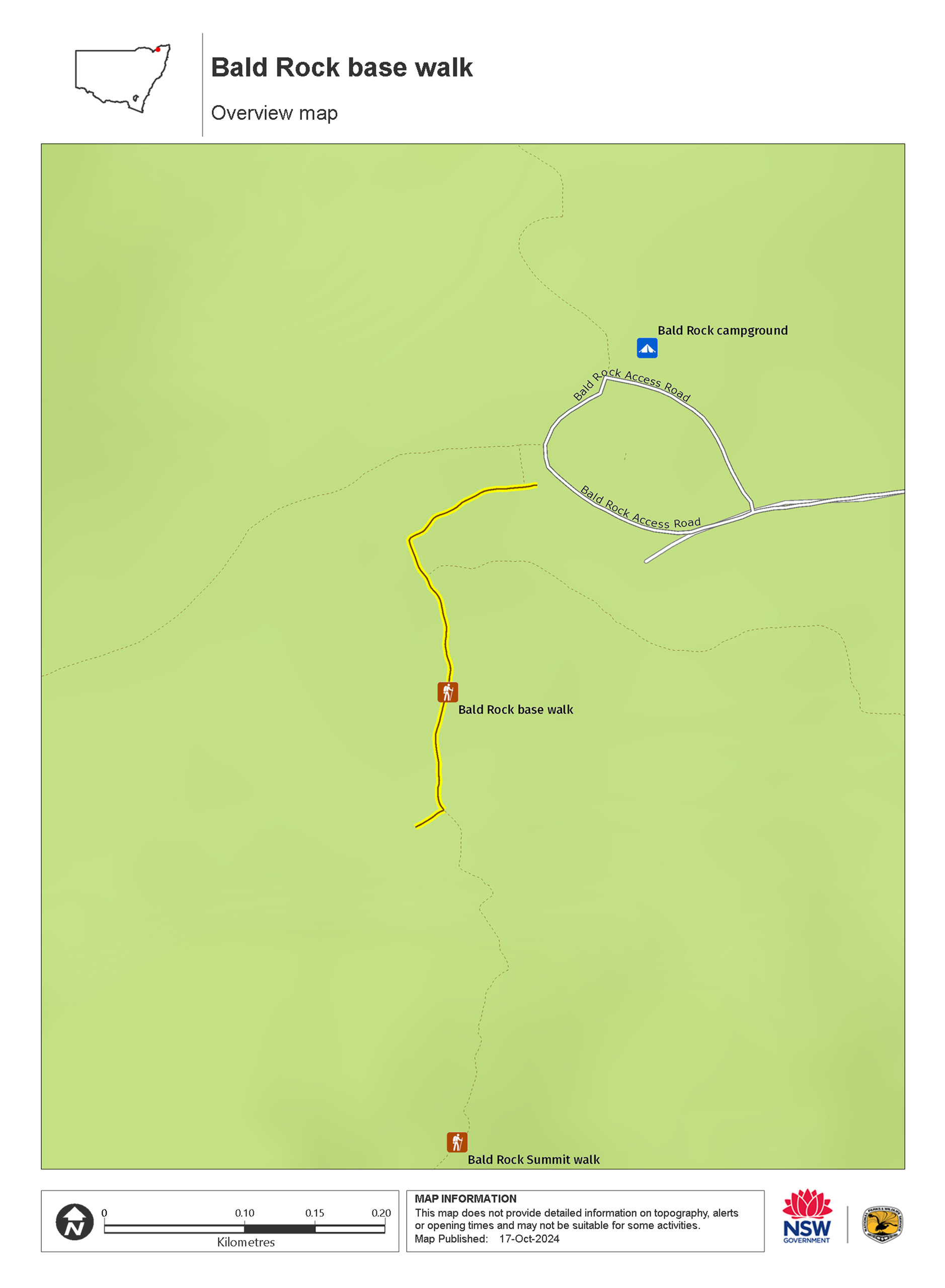
Discover the unique beauty of Bald Rock National Park on this accessible walk. The 450m track takes you to a picturesque lunch spot at the base of the mighty granite dome.
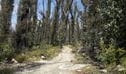
Setting out from Bald Rock campground and picnic area, you’ll pass through old-growth forest, with plenty of opportunities to spot local wildlife. Keep a look out for jacky lizards sunbathing on granite rock formations and listen out for the distinctive superb lyrebird song.
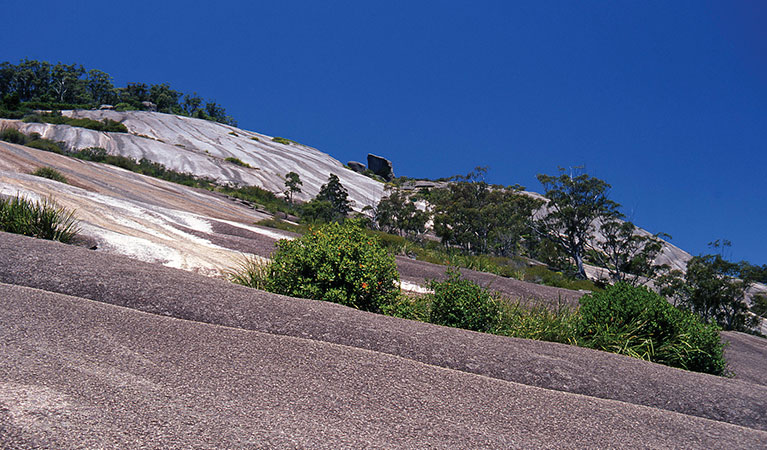
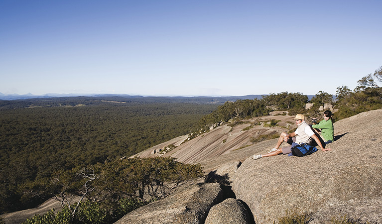
As you approach Bald Rock, you’ll see impressive colours and patterns on the water-streaked dome against the sky. Pack some snacks to enjoy at the picnic shelter that’s located at the rock base.
Granite country is known for its abundant wildflower displays. If you visit during spring, you’ll be rewarded with colourful everlasting daisies, native bluebells and flannel flowers. Ferns and rock orchids also adorn the boulders, nestling themselves into tiny cracks and crevices.
This sealed bitumen track is suitable for families with prams and visitors with limited mobility. It’s wide enough for 2 wheelchairs to comfortably pass one another, and there are several resting points along the way.
Also see
-
Bald Rock Summit walk
Bald Rock Summit walk is a challenging climb up the largest granite rock in Australia, with scenic views out across Bald Rock National Park, near Tenterfield.
-
Bungoona walk
Bungoona walk is a moderately challenging hike to the top of Australia’s largest granite dome. From the summit, take in sweeping views of the mighty Bald Rock National Park, near Tenterfield.
-
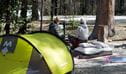
Bald Rock campground and picnic area
Relax over a picnic or barbecue at the base of the mighty summit, or bring a the family caravan or tent for a superb weekend’s bush camping at Bald Rock campground near Tenterfield.
Map
Map legend

Local alerts
For the latest updates on fires, closures and other alerts in this area, see https://www.nationalparks.nsw.gov.au/things-to-do/walking-tracks/bald-rock-base-walk/local-alerts
General enquiries
- National Parks Contact Centre
- 7am to 7pm daily
- 1300 072 757 (13000 PARKS) for the cost of a local call within Australia excluding mobiles
- parks.info@environment.nsw.gov.au
Park info
- in Bald Rock National Park in the Country NSW region
Bald Rock National Park is always open but may have to close at times due to poor weather or fire danger.
-
Park entry fees:
$8 per vehicle per day. The park uses a self-registration fee collection system. Please bring the correct change.
Buy annual pass.
Visitor info
All the practical information you need to know about Bald Rock base walk.
Track grading
Features of this track
Distance
0.7km return
Time
15min
Quality of markings
Clearly sign posted
Experience required
No experience required
Gradient
Flat
Steps
No steps
Quality of path
Well-formed track: The track is 1.5m wide and made from sealed bitumen.
Other barriers
Pinch points: There are 2 bridges on the track where the path slightly narrows.
Getting there and parking
Bald Rock Base walk leaves from Bald Rock campground and picnic area. To get there:
From Tenterfield:
- Turn right at the northern end of town onto the sealed Mount Lindesay Road. Continue for 29km, passing Boonoo Boonoo National Park and Boonoo Boonoo River.
- Follow the sealed Bald Rock Access Road for 5km to Bald Rock campground and picnic area.
From Stanthorpe:
- Take the road to Amosfield, then turn south towards Tenterfield along the sealed Mount Lindesay Road.
- Crossing Mursons and Jenner creeks, continue past Bald Rock Bush Retreat, then turn right and follow the sealed Bald Rock Access Road for 5km to Bald Rock campground and picnic area.
Road quality
- Sealed roads
Vehicle access
- 2WD vehicles
Weather restrictions
- All weather
Parking
Parking is available at Bald Rock campground and picnic area where this walk begins. There are 2 accessible parking spaces next to the start of the track.
Best times to visit
There are lots of great things waiting for you in Bald Rock National Park. Here are some of the highlights.
Autumn
Clear crisp atmosphere at this time of year offers outstanding views from the top of Bald Rock.
Spring
Wildflowers and the mild temperatures make spring a fantastic time of year for long walks and camping out.
Summer
Good camping weather as the temperature rarely exceeds 30 degrees.
Winter
Frosts and rare snow flakes overnight, followed by brilliant blue skies overhead and crisp, fresh sunny days.
Facilities
- Accessible non-flush toilets, picnic tables, barbeques and drinking water are available Bald Rock campground and picnic area.
- There are no bins, so you’ll need to take all rubbish away with you.
Picnic tables
There is an accessible picnic table set on a gravel surface at the base of Bald Rock.
Seats and resting points
There are several seats with backrests along the walk and benches at the base of Bald Rock.
Maps and downloads
Accessibility
Disability access level - easy
- This is a flat, step-free, sealed track.
- There are 2 bridges on the track where the path slightly narrows.
- There are 2 accessible parking spaces next to the start of the track.
- There are seats with backrests along the walk with and benches at the base of Bald Rock.
- There is an accessible non-flush toilet at the Bald Rock campground and picnic area.
Prohibited
Cycling
Pets
Pets and domestic animals (other than certified assistance animals) are not permitted. Find out which regional parks allow dog walking and see the pets in parks policy for more information.
Smoking
NSW national parks are no smoking areas.
Learn more
Bald Rock base walk is in Bald Rock National Park. Here are just some of the reasons why this park is special:
A peaceful trade
Bald Rock also served as neutral ground for three of the Aboriginal nations of the area: the Jukambal, Bundgalung and Kamilleroi. An important trade route for these three nations, meetings and trade occurred without each nation having to journey through the other territories, as Bald Rock was considered a boundary positioned fairly between each Country.
A picture to remember

From the summit, the best views are seen across winter and autumn, when the air is freshest and the light crisp. The colours are most dramatic at dusk, as the rock face hues change beneath your feet from orange to yellow. Be sure to take your camera, a flask of coffee, and wait till the sun sets to capture a photograph worthy of your living room wall.
- Bald Rock base walk Get an up-close view of Australia’s largest exposed granite dome on Bald Rock base walk. This short, accessible walking track is an easy way to explore Bald Rock National Park, near Tenterfield.
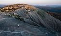
Conquer the granite titan
Bald Rock's dome is 500 metres wide and 750 metres in length, and at close to 1300 metres above sea level, it feels like a remote 'top of the world' experience from the summit. Collections of granite archways, scattered boulders, ravines roping their way through the terrain and a pile of enormous smooth granite stones balancing strangely across each other, all await your exploration. The boulders, looming in and out of view as you make your ascent towards the crown, bear the majestic title of 'Granite Titans', and it's easy to see why. Bald Rock's water-streaked dome is the largest granite formation of its kind anywhere in Australia.
- Bald Rock base walk Get an up-close view of Australia’s largest exposed granite dome on Bald Rock base walk. This short, accessible walking track is an easy way to explore Bald Rock National Park, near Tenterfield.
- Bald Rock Summit walk Bald Rock Summit walk is a challenging climb up the largest granite rock in Australia, with scenic views out across Bald Rock National Park, near Tenterfield.
- Border walk The Border walk takes you from the Bald Rock picnic area to the NSW/Queensland border. Heading north, you’ll be rewarded with views from the lookout over Bald Rock.
- Bungoona walk Bungoona walk is a moderately challenging hike to the top of Australia’s largest granite dome. From the summit, take in sweeping views of the mighty Bald Rock National Park, near Tenterfield.
Nature lovers
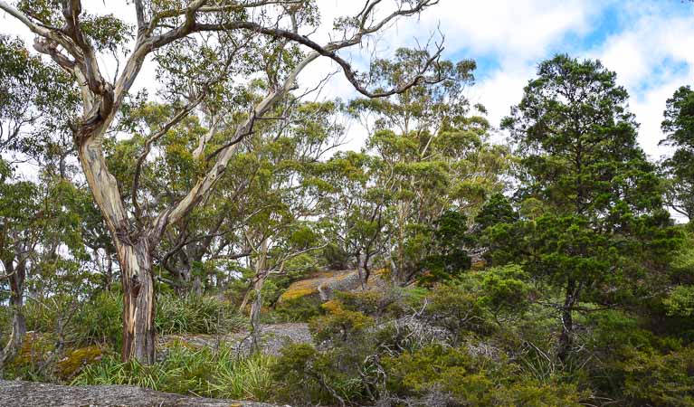
Following a good rain, the smells and colours of the bush really come alive; golden wattle trees bloom late in July as do wildflowers across spring, and the vibrant colours of the rock lilies, boronia and banksia are a sight to behold. Look out for the rare spotted tailed quoll, as well as possums, grey kangaroos and swamp wallabies on your tour through the park. There are several common species of snakes and lizards which you'll often see around the park's walking tracks in spring and summer.
- Border walk The Border walk takes you from the Bald Rock picnic area to the NSW/Queensland border. Heading north, you’ll be rewarded with views from the lookout over Bald Rock.