Warrumbungle National Park
Visitor info
All the practical information you need to know about Warrumbungle National Park.
Getting there and parking
Get driving directions
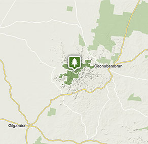
The turn-off to Warrumbungle National Park is clearly signposted.
From Coonabarabran:
- Take Dalgarno Street west from Newell Highway/John Street
- Turn right onto Namoi Street, then turn left onto Eden Street
- Following signs for Warrumbungle National Park, travel along Timor Road/John Renshaw Parkway for approx. 35km.
- Following the signs within the national park, turn right off John Renshaw Parkway and travel approx. 300m to the visitor centre.
From Gilgandra:
- Take Newell Highway north towards Coonabarabran
- At the brown Tourist Drive 1 sign, turn left off the highway into the village of Tooraweenah. Follow Tourist Drive 1 north through Tooraweenah
- Continue for 26km to the T-intersection at the old Gummin Gummin homestead
- Turn right onto John Renshaw Parkway and continue for 8km, when you will enter the national park.
- Continue along John Renshaw Parkway for approx. 6km more, then turn left off John Renshaw Parkway and travel approx. 300m to the visitor centre.
From Coonamble:
- Take Castlereagh Highway south, and turn left onto King Street.
- Continue along Coonamble-Tooraweenah Road for approx. 68km. Some of this road is unsealed.
- Once within Warrumbungle National Park, continue along John Renshaw Parkway for approx. 6km.
- Turn left off John Renshaw Parkway and travel approx. 300m to the visitor centre.
From Gulargambone:
- Take Gulargambone Road east for approx. 31km, as it becomes John Renshaw Parkway. Some of this road is unsealed.
- Veer right onto Coonamble-Tooraweenah Road. Some of this road is unsealed.
- Once within Warrumbungle National Park, continue along John Renshaw Parkway for approx. 6km.
- Turn left off John Renshaw Parkway and travel approx. 300m to the visitor centre.
Park entry points
- Gunneemooroo Entrance See on map
- Warrumbungle National Park Eastern access See on map
- Warrumbungle National Park Western access See on map
Parking Show more
- Bluff Mountain walking track See on map
- Burbie Camp See on map
- Camp Pincham See on map
- Camp Walaay group campground See on map
- Goulds Circuit walking track See on map
- Tara Cave walking track See on map
- Whitegum lookout walking track See on map
Road quality
- Unsealed roads
By bike
Check out the Bicycle information for NSW for more information.
By public transport
For information about public transport options, visit the NSW country transport info website.
Best times to visit
You may experience a great range of temperatures on any day in the park. In summer it's generally hot in the daytime and temperatures often exceed 30C. In contrast, winter can be very cold and the temperature drops below freezing at night. Rainfall is also highly variable, ranging from drought to prolonged wet periods. Less rain falls on the western side of the park than on the eastern side. It rains most from December to February and the annual average rainfall is 720mm. Thunderstorms are common in mid to late summer.
Spring
During early spring wildflowers are in bloom, including a huge variety of golden wattle flowers With a more moderate climate, spring is a great time to get out and camp under the stars .
Weather, temperature and rainfall
Summer temperature
Average
15°C and 30°C
Highest recorded
42.6°C
Winter temperature
Average
0°C and 15°C
Lowest recorded
-9°C
Rainfall
Wettest month
January
Driest month
September
The area’s highest recorded rainfall in one day
176.3mm
Facilities
Amenities
Toilets Show more
- Balor Hut campground
- Camp Blackman
- Camp Pincham
- Camp Walaay group campground
- Camp Wambelong
- Canyon picnic area
- Goulds Circuit walking track
- Gunneemooroo campground
- Tara Cave walking track
- Warrumbungle Environmental Education Centre
- Warrumbungle Visitor Centre
Picnic tables Show more
- Camp Blackman
- Camp Pincham
- Camp Walaay group campground
- Camp Wambelong
- Canyon picnic area
- Warrumbungle Environmental Education Centre
- Warrumbungle Visitor Centre
- Whitegum lookout
- Whitegum lookout walking track
Barbecue facilities Show more
Public phone
Showers
Maps and downloads
Fees and passes
Park entry fees:
$8 per vehicle per day.
-
All Parks Pass -
For all parks in NSW (including Kosciuszko NP)
$190 (1 year) / $335 (2 years)
Buy now | More info -
Multi Parks Pass -
For all parks in NSW (except Kosciuszko)
$65 (1 year) / $115 (2 years)
Buy now | More info -
Country Parks Pass -
For all parks in Country NSW (except Kosciuszko)
$45 (1 year) / $75 (2 years)
Buy now | More info -
Single Country Park Pass -
For entry to a single park in country NSW (except Kosciuszko).
$22 (1 year) / $40 (2 years)
Buy now | More info
Prohibited
Pets
Pets and domestic animals (other than certified assistance animals) are not permitted. Find out which regional parks allow dog walking and see the pets in parks policy for more information.
Smoking
NSW national parks are no smoking areas.
Contact
- in the Country NSW region
Warrumbungle National Park is always open but may have to close at times due to poor weather or fire danger.
-
Park entry fees:
$8 per vehicle per day.
Buy annual pass -
-
Warrumbungle NP Visitor Information Centre
02 6825 4364
Contact hours: 9am to 4pm daily. Closed Christmas Day. - 4261 John Renshaw Parkway, Warrumbungle NSW 2828
-
Email: warrumbungle.np@environment.nsw.gov.au
-
Warrumbungle NP Visitor Information Centre
Visitor centre
-
Warrumbungle Visitor Centre
4261 John Renshaw Parkway, Warrumbungle NSW 2828 - 9am to 4pm daily. Closed Christmas Day.
- 02 6825 4364
Nearby towns
Coonabarabran (24 km)
Coonabarabran is the closest town to the craggy peaks and spires of the Warrumbungle Ranges. Warrumbungle National Park is popular for bushwalking, camping and encountering wildlife amid breathtaking scenery.
Gilgandra (60 km)
Just a 50-minute drive north of Gilgandra are the majestic Warrumbungles - an area of forested ridges, barren spires, deep gorges and walking tracks. Warrumbungle National Park has some excellent day walks, such as the Breadknife and Grand High Tops walk.
Coonamble (95 km)
Coonamble is a delightful country town, the gateway to the wetlands of the Macquarie Marshes and the rugged scenery of Warrumbungle National Park. Nearby are opal fields to the north, and the Pilliga State Forest, with its stands of eucalypts.