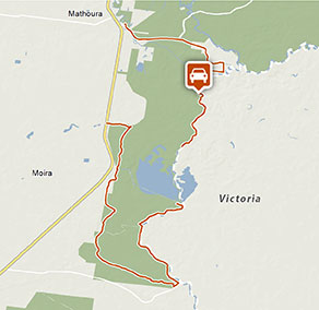
Moira Drive
Murray Riverina
Overview
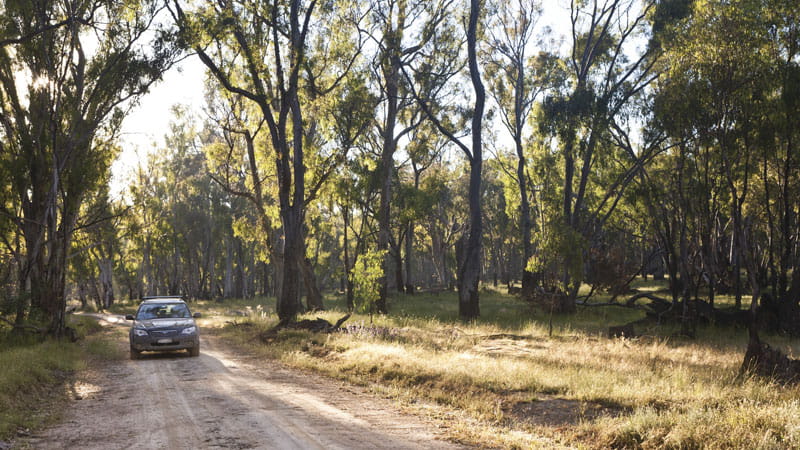
The scenic Moira drive takes you through the gorgeous river red gum forest around the mighty Murray River. Walk to the water bird observatory and stop for a picnic lunch.
- Accessibility
- Hard
- Distance
- 20km one-way
- Time suggested
- 1hr 30min
- Grade
- Easy
- Please note
- The northern section of this drive can be accessed from Picnic Point Road, and offers fantastic views of Murray River. The southern section of this drive, accessed from Cobb Highway, is a scenic drive which takes you to the south of Moira Lake.
- This park is in a remote location, please ensure you are thoroughly prepared, bring appropriate clothing and equipment and advise a family member or friend of your travel plans
- Remember to take your binoculars and camera to capture the wonderful birds of the wetlands – a bird identification book might also be handy
This leisurely and scenic drive through the river red gum forest takes in Cadell Tilt, Murray River , Poverty Point and King’s Log Landing.
Hop out of the car to stretch your legs at Poverty Point or is this Poverty Point Road; you can take an easy walk along the Moira walkway to the water bird observatory. Look out for eastern great egrets, common greenshanks and red necked stints, just some of the migratory birds you’ll see in the wetlands.
There’s a barbecue site here too so it’s a perfect spot for a picnic or barbecue lunch; you could ask for a more picturesque location.
Google Street View Trekker
Using Google Street View Trekker, we've captured imagery across a range of NSW national parks and attractions. Get a bird's eye view of these incredible landscapes before setting off on your own adventure.

General enquiries
- National Parks Contact Centre
- 7am to 7pm daily
- 1300 072 757 (13000 PARKS) for the cost of a local call within Australia excluding mobiles
- parks.info@environment.nsw.gov.au
Operated by
- Moama office
- Monday to Friday, 9am to 4pm. Closed 12pm to 1pm.
- 03 5483 9100
- npws.riverina@environment.nsw.gov.au
- Factory 5, Lot 8 Bowlan Road, Moama NSW 2731
Park info
- in Murray Valley National Park in the Murray-Riverina region
Murray Valley National Park is always open but may have to close at times due to poor weather or fire danger.
- in Murray Valley Regional Park in the Murray-Riverina region
What's nearby:
Things to do (9)
- Aboriginal culture (1)
- Birdwatching and wildlife encounters (6)
- Canoeing/paddling (5)
- Fishing (4)
- Historic heritage (1)
- Picnics and barbecues (4)
- Road trips and car/bus tours (2)
- Sailing, boating and cruises (1)
- Sightseeing (3)
- Swimming (3)
- Walking (6)