Norfolk Falls walk
Coolah Tops National Park
Overview
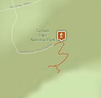
Norfolk Falls walk starts from Norfolk Falls picnic area, near Coolah. This short, steep walk ends at a lookout with stunning views of the largest waterfall in Coolah Tops National Park.
- Where
- Coolah Tops National Park in Country NSW
- Accessibility
- No wheelchair access
- Distance
- 1.1km return
- Time suggested
- 45min - 1hr
- Grade
- Grade 3
- What to
bring - Drinking water, suitable clothing, sturdy shoes, first aid kit, hat, sunscreen, raincoat, snacks
- Please note
- Please take extreme care as some areas at the top of Norfolk Falls are unfenced.
- Stay back from cliff edges at all times and ensure children are supervised.
- Temperatures in Coolah Tops are about 5 degrees cooler than valleys below, bring appropriate clothing.
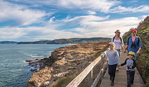
This 1.1km return walk is easily reached from Coolah, but will make you feel a million miles away.
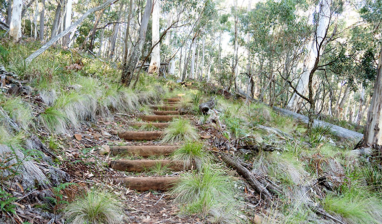
Starting from Norfolk Falls picnic area, you’ll soon be surrounded by the peaceful sounds of the open forest with its rich birdlife. There are lots of steps as the track descends through the tall ribbon gums and grassy understorey, but there are plenty of places to rest along the way.
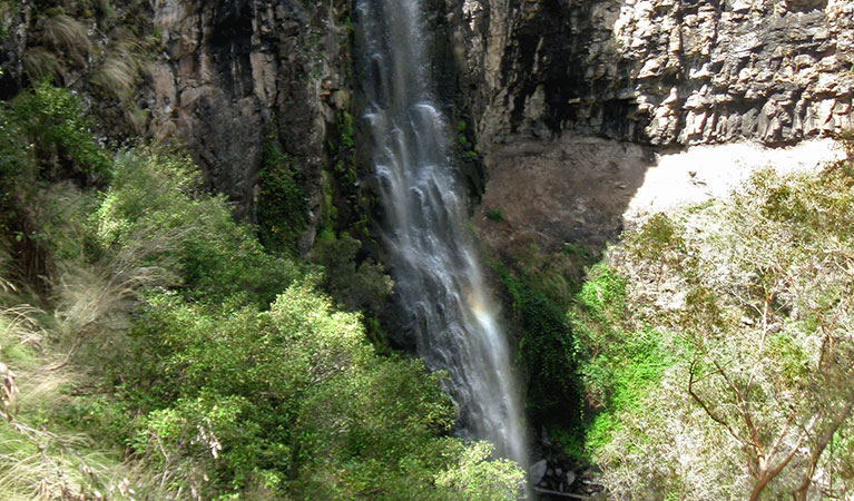
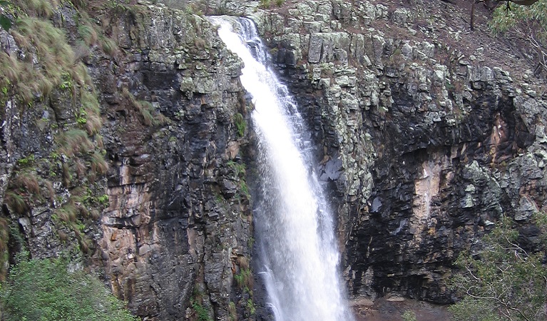
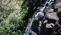
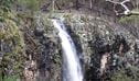
After around 20mins, you’ll reach Norfolk Falls lookout, perched atop the falls at the end of the track. The air fills with the sound of cascading water and you’ll be treated to stunning views of Norfolk Island Creek plunging 35m down black basalt cliffs into a natural pool.
The best spot to drink in the impressive views and take photos is the fenced lookout platform.
This area is brimming with wildlife. Look for bearded dragons sunning themselves on rocks, and crimson rosellas or red wattlebirds in the trees. You may even see a wedge tailed eagle. Keep an eye out for the wombat hole beside the track.
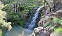
If you’re hungry for more, continue 1.4km along the track to Bald Hill Creek waterfall, then set up camp for the night at nearby Cox’s Creek or The Pines campground.
Also see
-
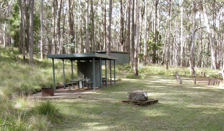
Norfolk Falls picnic area
Norfolk Falls picnic area is in Coolah Tops National Park near The Barracks and Coxs Creek campgrounds. It’s a lovely rest stop when exploring the park’s beautiful waterfalls, walks and lookouts.
-
Norfolk Falls lookout
Norfolk Falls lookout is located at the end of Norfolk Falls walk, in Coolah Tops National Park. It’s a great spot to view the cascading waterfall along Norfolk Island Creek, plunging 35m into a pool.
-
Bald Hill Creek Falls picnic area
Bald Hill Creek Falls picnic area is in Coolah Tops National Park, near The Pines campground. It’s a great stop on the walk to Bald Hill waterfall, which cascades over basalt rock formations.
Subscribe to Naturescapes
Subscribe to our Naturescapes e-newsletter which is packed with the latest information, experiences and events in NSW national parks. Your next park adventure starts here.
Saving Our Species program
Australia is home to more than 500,000 animal and plant species, many of which are found nowhere else in the world. Saving our Species is a statewide conservation program that addresses the growing number of Australian animals and Australian native plants facing extinction.

General enquiries
- National Parks Contact Centre
- 7am to 7pm daily
- 1300 072 757 (13000 PARKS) for the cost of a local call within Australia excluding mobiles
- parks.info@environment.nsw.gov.au
Operated by
- Warrumbungle NP Visitor Information Centre
- 9am to 4pm daily. Closed Christmas Day.
- 02 6825 4364
- warrumbungle.np@environment.nsw.gov.au
- 4261 John Renshaw Parkway, Warrumbungle NSW 2828
Park info
- in Coolah Tops National Park in the Country NSW region
Coolah Tops National Park is always open but may have to close at times due to poor weather, fire danger or management operations. The eastern end of the park is regularly closed during wet weather due to slippery road conditions.