Breadknife and Grand High Tops walk
Warrumbungle National Park
Overview
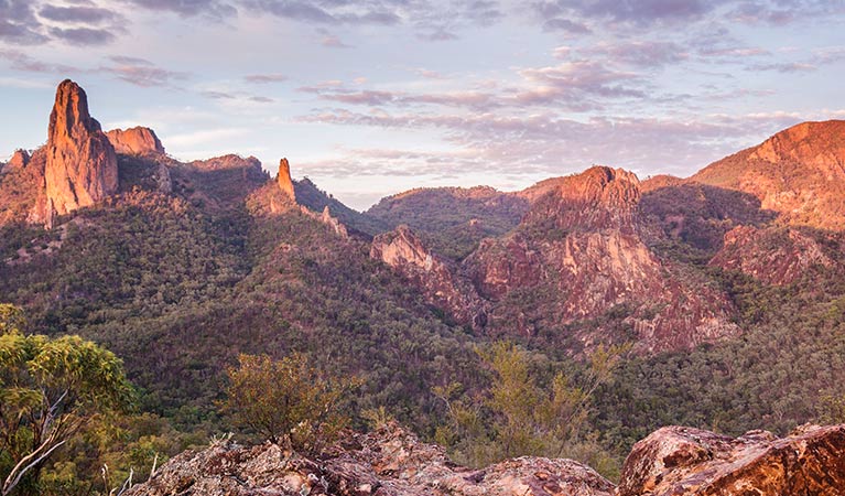
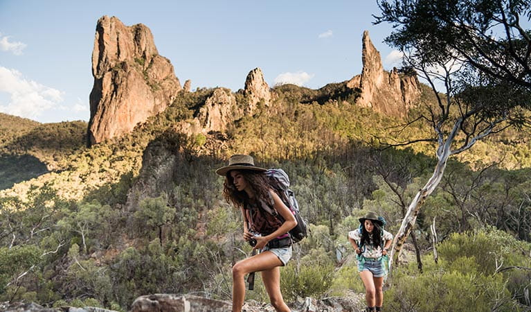
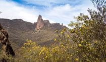
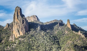
Breadknife and Grand High Tops walk in Warrumbungle National Park, regarded as one of the best walks in NSW, offers close up views of the park’s iconic rock formations.
- Where
- Warrumbungle National Park in Country NSW
- Distance
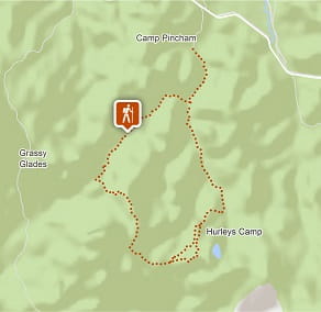
- 14.5km loop
- Time suggested
- 5 - 6hrs
- Grade
- Grade 4
- Trip Intention Form
-
It's a good idea to let someone know where you're going. Fill in a trip intention form to send important details about your trip to your emergency contact.
- Personal Locator Beacon
-
Hire a Personal Locator Beacon (PLB) for free at Warrumbungle Visitor Centre.
- Entry fees
- Park entry fees apply
- What to
bring - Drinking water, hat, sunscreen
- Please note
- The walk starts from Pincham carpark south of John Renshaw Parkway
- If you're after a shorter walk, Fans Horizon walking track starts from the carpark and climbs to a lookout with panoramic views of the Breadknife, Belougery Spire and Crater Bluff.
- If you plan to stay at one of the campgrounds along this walking track, you'll need to make a booking in advance.
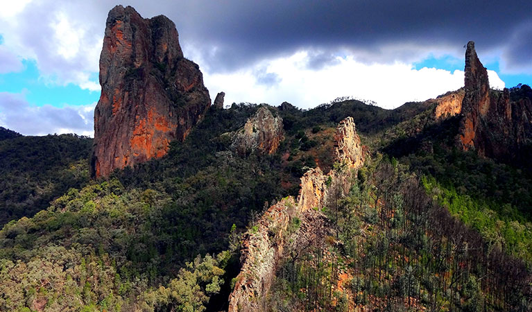
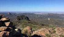
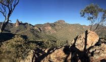
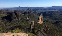
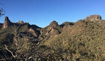
This iconic Warrumbungle National Park walk is famous for its wildlife and vistas of rugged volcanic landscape. Breadknife and Grand High Tops walk is the jewel in the glistening crown and is must do for bush walkers who love a challenge with their scenery. The track follows Spirey Creek before climbing steeply to give close encounters with iconic formations such as Belougery Spire, Bress Peak and Crater Bluff.
Passing Balor Hut campground on your way up, stop for a picnic and take in one of the best panoramas in NSW. After the breathtaking Grand High Tops summit, continue on towards Western High Tops and Ogma Gap campground, you’ll pass Dows Camp on the way for a look at the impressive Bluff Mountain. To complete the 14.5km loop, follow West Spirey track back to Pincham carpark.
Alternatively, you can take a shorter 12.5km return to Pincham carpark via Dagda Shortcut.
In spring, walkers will be treated to a wildflower display of purple hoveas, white daisy bushes, yellow wattles and orange pea flowers. A haven for birdwatchers, be sure to look for wedge-tailed eagles soaring high above the cliffs and listen out for the screech of peregrine falcons.
Take a virtual tour of Breadknife and Grand High Tops walk captured with Google Street View Trekker.
Also see
Google Street View Trekker
Using Google Street View Trekker, we've captured imagery across a range of NSW national parks and attractions. Get a bird's eye view of these incredible landscapes before setting off on your own adventure.

Download the NSW GeoTours app
Go on an interactive adventure in Warrumbungle National Park with the free NSW GeoTours app on your smartphone or tablet. Explore geotrails, investigate the eroded remnants of a volcano and learn the park’s explosive history.
General enquiries
- National Parks Contact Centre
- 7am to 7pm daily
- 1300 072 757 (13000 PARKS) for the cost of a local call within Australia excluding mobiles
- parks.info@environment.nsw.gov.au
Operated by
- Warrumbungle NP Visitor Information Centre
- 9am to 4pm daily. Closed Christmas Day.
- 02 6825 4364
- warrumbungle.np@environment.nsw.gov.au
- 4261 John Renshaw Parkway, Warrumbungle NSW 2828
Park info
- in Warrumbungle National Park in the Country NSW region
Warrumbungle National Park is always open but may have to close at times due to poor weather or fire danger.
-
Park entry fees:
$8 per vehicle per day.
Buy annual pass
What's nearby:
Things to do (27)
- Aboriginal culture (1)
- Adventure sports (1)
- Birdwatching and wildlife encounters (9)
- Cultural heritage (1)
- Educational activities (1)
- Historic heritage (1)
- Other experiences (1)
- Picnics and barbecues (3)
- Road trips and car/bus tours (2)
- Sightseeing (17)
- Swimming (1)
- Visitor centres (1)
- Walking (19)
- Wildflowers (seasonal) (10)