Wentworth Falls to Woodford via Ingar campground
Blue Mountains National Park
Overview
Wentworth Falls to Woodford is a long mountain bike ride or overnight hike through heath and woodland in Blue Mountains National Park. Enjoy a picnic or stay overnight by the natural waterhole at Ingar campground.
- Where
- Katoomba area, Glenbrook area in Blue Mountains National Park in Sydney and surrounds, Country NSW
- Distance
- 19km one-way
- Time suggested
- 3-4 hr
- Grade
- Medium
- What to
bring - Drinking water, hat, sunscreen, snacks, suitable clothing, bike repair kit, helmet, personal locator beacon, tent
- Please note
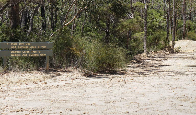
- Access to Ingar campground is only via Andersons (20km) and Bedford Creek (10km) trails by foot. These trails may become inaccessible in wet weather.
- Parking is available 1km from Murphys Glen campground along Bedford Rd.
- Bedfords Creek trail is recommended for experienced, well-prepared riders who are extremely fit.
- You'll need to carry in all your equipment if you plan to camp at Ingar or Murphys Glen campground.
- If starting from Wentworth Falls Station, it's a 4km ride via Great Western Highway and Tableland Rd to Queen Elizabeth Drive, where this route starts.
- It's a good idea to fill in the free trip intention form and hire a Personal Locator Beacon (PLB). Some navigation may be required.
- Riders, please give way to walkers.
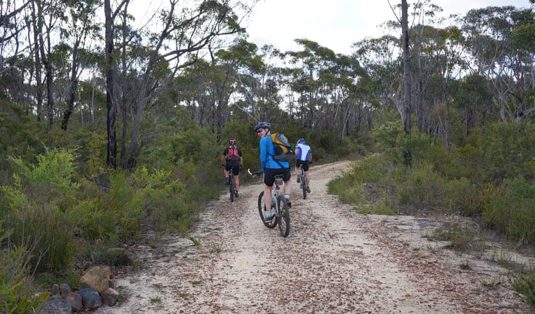
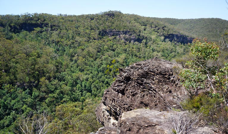
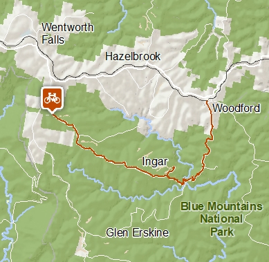
Looking for an overnight hike, bike-packing adventure or day ride in Blue Mountains National Park? This walking and mountain bike trail heads into remote bushland atop the Kings Tableland plateau between Wentworth Falls and Woodford.
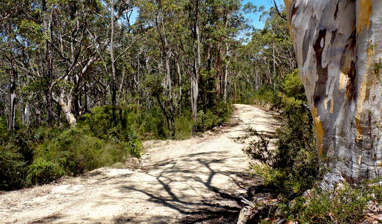
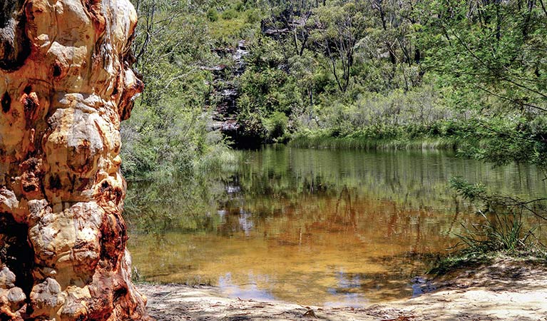
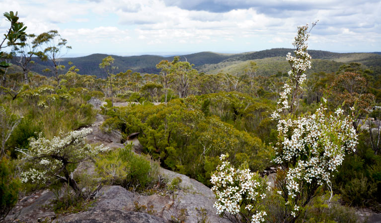
Set out along the undulating Ingar trail, which winds through heath and open forest. At the junction with Bedford Creek trail turn left to continue along the trail for around 700m to Ingar campground and picnic area. This scenic spot is set beside a natural waterhole, surrounded by rock. It’s a good spot to enjoy lunch and a refreshing swim, or pitch your tent and camp overnight.
From Ingar campground you can return the way you came, or continue to Woodford along Bedford Creek trail. There’s a steep descent to Bedford Creek, where the forest gives way to rainforest and an inviting creek. It’s then a hard climb out to join Murphys trail.
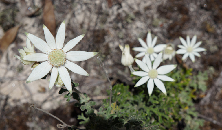
At the junction with Murphys trail, turn left and follow Murphys trail and Bedford Road north to Woodford Station. In spring, the open heath is bursting with wildflowers. Or you can turn right at Murphys trail for an optional detour downhill to the tall forests at Murphys Glen campground.
Take a virtual tour of Wentworth Falls to Woodford via Ingar campground captured with Google Street View Trekker.
Google Street View Trekker
Using Google Street View Trekker, we've captured imagery across a range of NSW national parks and attractions. Get a bird's eye view of these incredible landscapes before setting off on your own adventure.

Conservation program:
Bush Trackers
Bush Trackers was created to encourage children to engage with the environment in and around the Greater Blue Mountains World Heritage area. This program highlights the natural and cultural splendour of the greater Blue Mountains through education initiatives and bushwalks.
General enquiries
- National Parks Contact Centre
- 7am to 7pm daily
- 1300 072 757 (13000 PARKS) for the cost of a local call within Australia excluding mobiles
- parks.info@environment.nsw.gov.au
Operated by
- Blue Mountains Heritage Centre and Blackheath office
- 9am to 4.30pm daily. Closed Christmas Day.
- 02 4787 8877
- bluemountains.heritagecentre@environment.nsw.gov.au
- 270 Govetts Leap Road, Blackheath NSW 2785
Park info
- in the Katoomba area of Blue Mountains National Park in the Sydney and surrounds region
Katoomba area is always open but some locations may close at times due to maintenance, poor weather or fire danger.
- in the Glenbrook area of Blue Mountains National Park in the Sydney and surrounds region
- From the first Sunday in October to the first Sunday in April: park gates are open 8.30am to 7pm.
- Rest of the year: park gates are open 8.30am to 6pm.
-
$8 per vehicle per day applies at the Bruce Road entrance to the Glenbrook area. You can also pay for your visit via the Park’nPay app.
Buy annual pass
What's nearby:
Things to do (126)
- 4WD touring (3)
- Aboriginal culture (9)
- Adventure sports (12)
- Birdwatching and wildlife encounters (11)
- Cafes and kiosks (2)
- Cultural heritage (1)
- Cycling (10)
- Environmental appreciation/study (5)
- Historic heritage (9)
- Other experiences (8)
- Photography (3)
- Picnics and barbecues (9)
- Road trips and car/bus tours (3)
- Sightseeing (63)
- Swimming (3)
- Visitor centres (1)
- Walking (70)
- Waterfalls (42)
- Wildflowers (seasonal) (4)