Andersons trail
Blue Mountains National Park
Overview
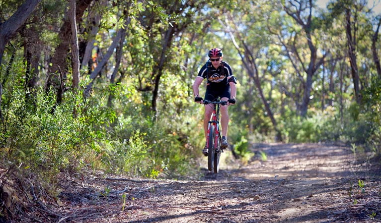
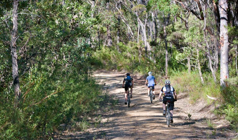
Andersons trail is a challenging cycling route for experienced mountain bike riders. It heads deep into the central wilderness of Blue Mountains National Park, between Wentworth Falls and Woodford.
- Where
- Katoomba area, Glenbrook area in Blue Mountains National Park in Sydney and surrounds, Country NSW
- Accessibility
- No wheelchair access
- Distance
- 28km one-way
- Time suggested
- 3-5 hr
- Grade
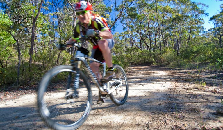
- Hard. This trail is suited to experienced, well-prepared riders who are extremely fit.
- What to
bring - Drinking water, snacks, first aid kit, helmet, bike repair kit, hat, sunscreen, personal locator beacon, suitable clothing
- Please note
- If starting from Wentworth Falls Station, it's a 7.5km ride via Great Western Highway and Kings Tableland Road to Old Victoria Hospital, where this route starts.
- After wind and rain there may be branches, sticks, puddles, potholes and obstacles across the track.
- It's a good idea to fill in the free trip intention form and hire a Personal Locator Beacon (PLB). Some navigation may be required.
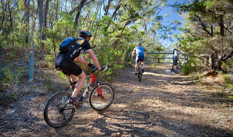
- Riders please give way to walkers.
This adrenaline-filled mountain bike adventure in Blue Mountains National Park has ultra-steep sections, loose gravel, and obstacles bound to challenge even the most experienced rider.
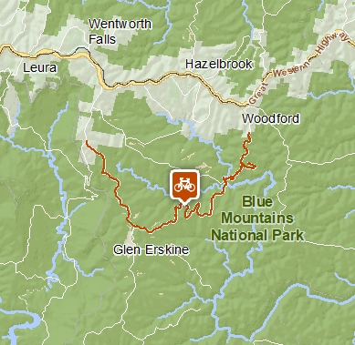
Best tackled west to east, this route starts from the Old Queen Victoria Hospital on Kings Tableland Road. Follow the unsealed road towards McMahons Point for 7km and turn left onto Andersons fire trail at the gate. Stay right at the fork after 650m.
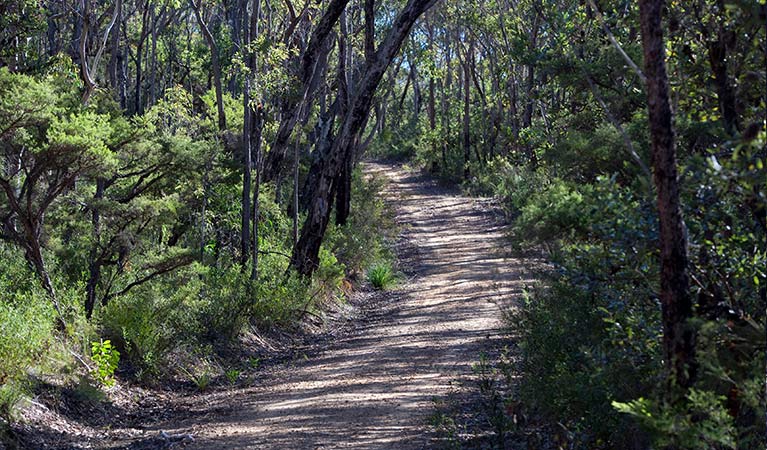
This 12km section along Andersons fire trail winds through steep gullies and open eucalypt forest atop the escarpment. Breathe in the fabulous aroma of the peppermint gums as you cycle, and keep an eye out for echidnas or swamp wallabies on the track.
At the end of Andersons fire trail turn right onto Bedford Creek trail and cross the creek. This is a great stop to refuel or cool your feet before the major uphill slog out to Woodford Station, around 9km away. Alternatively, turn left onto Bedford Creek trail before the creek crossing and return uphill to the hospital via Ingar Road for a 32km loop.
Well-prepared riders can also combine this ride with an overnight stay at Murphys Glen campground. Or, if you’ve got the legs for an extended ride, link up with the Woodford-Oaks trail. This adds 25km and a thigh-numbing final climb to Glenbrook Station.
Take a virtual tour of Andersons trail captured with Google Street View Trekker.
Google Street View Trekker
Using Google Street View Trekker, we've captured imagery across a range of NSW national parks and attractions. Get a bird's eye view of these incredible landscapes before setting off on your own adventure.

Conservation program:
Bush Trackers
Bush Trackers was created to encourage children to engage with the environment in and around the Greater Blue Mountains World Heritage area. This program highlights the natural and cultural splendour of the greater Blue Mountains through education initiatives and bushwalks.
General enquiries
- National Parks Contact Centre
- 7am to 7pm daily
- 1300 072 757 (13000 PARKS) for the cost of a local call within Australia excluding mobiles
- parks.info@environment.nsw.gov.au
Operated by
- Blue Mountains Heritage Centre and Blackheath office
- 9am to 4.30pm daily. Closed Christmas Day.
- 02 4787 8877
- bluemountains.heritagecentre@environment.nsw.gov.au
- 270 Govetts Leap Road, Blackheath NSW 2785
Park info
- in the Katoomba area of Blue Mountains National Park in the Sydney and surrounds region
Katoomba area is always open but some locations may close at times due to maintenance, poor weather or fire danger.
- in the Glenbrook area of Blue Mountains National Park in the Sydney and surrounds region
- From the first Sunday in October to the first Sunday in April: park gates are open 8.30am to 7pm.
- Rest of the year: park gates are open 8.30am to 6pm.
-
$8 per vehicle per day applies at the Bruce Road entrance to the Glenbrook area. You can also pay for your visit via the Park’nPay app.
Buy annual pass
What's nearby:
Things to do (112)
- 4WD touring (3)
- Aboriginal culture (9)
- Adventure sports (9)
- Birdwatching and wildlife encounters (11)
- Cafes and kiosks (2)
- Cultural heritage (1)
- Cycling (9)
- Environmental appreciation/study (2)
- Historic heritage (8)
- Other experiences (7)
- Photography (3)
- Picnics and barbecues (8)
- Road trips and car/bus tours (3)
- Sightseeing (59)
- Swimming (3)
- Walking (62)
- Waterfalls (38)
- Wildflowers (seasonal) (2)