Yarriabini National Park
Visitor info
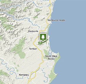
All the practical information you need to know about Yarriabini National Park.
Getting there and parking
Get driving directions
From Macksville:
- Travel south on the Pacific Highway for approximately 7km
- Turn left into Albert Drive and follow the signs for ‘Yarrahapinni Mountain’ or ‘Yarriabini National Park’
- Turn left onto the continuation of Albert Drive and follow for 400m
- Turn right into Rosewood Road and follow all the way into the park
From Kempsey:
- Travel north on the Pacific Highway for approximately 45km
- Turn right into Albert Drive and follow the signs for ‘Yarrahapinni Mountain’ or ‘Yarriabini National Park’
- Turn left onto the continuation of Albert Drive and follow for 400m
- Turn right into Rosewood Road and follow all the way into the park
Park entry points
- Rosewood access See on map
Parking
- The Pines picnic area See on map
- Yarriabini lookout See on map
By bike
Check out the Bicycle information for NSW website for more information.
By public transport
Yarriabini National Park is not directly accessible by public transport. For information about public transport options to nearby towns, visit the NSW country transport info website.
Best times to visit
There are lots of great things waiting for you in Yarriabini National Park. Here are some of the highlights.
Autumn
Take your mountain bike along Way Way Creek Road and feel the refreshing air in the forest.
Spring
Enjoy a scenic drive along Way Way Creek Road, with its bubbling creek crossings and vibrant green forest.
Summer
Enjoy a picnic under the shade and wander through the cool rainforest at The Pines picnic area.
Winter
Admire the colourful banksias in flower along Tower Road as you head up to Yarriabini lookout to see spectacular views of Macleay Valley.
Weather, temperature and rainfall
Summer temperature
Average
18°C and 27°C
Highest recorded
41.7°C
Winter temperature
Average
11°C and 19°C
Lowest recorded
4°C
Rainfall
Wettest month
March
Driest month
September
The area’s highest recorded rainfall in one day
702.6mm
Facilities
Amenities
Picnic tables
Barbecue facilities
Maps and downloads
Prohibited
Pets
Pets and domestic animals (other than certified assistance animals) are not permitted. Find out which regional parks allow dog walking and see the pets in parks policy for more information.
Smoking
NSW national parks are no smoking areas.
Contact
- in the North Coast region
Yarriabini National Park is always open but may have to close at times due to poor weather or fire danger.
-
-
Coffs Harbour office
02 6652 0900
Contact hours: Monday to Friday, 8.30am to 4.30pm. - 4/32 Edgar St, Coffs Harbour NSW 2450
-
Email: npws.coffscoast@environment.nsw.gov.au
-
Coffs Harbour office
Nearby towns
Macksville (12 km)
Macksville is a relaxed fishing and oyster-farming town centre of a rich rural district. It's on low-lying land around the Nambucca River.
Kempsey (51 km)
Kempsey is a historic river town close to national parks and majestic beaches. Kempsey is a convenient place for an overnight stop for anyone driving between Sydney and the North Coast.
Port Macquarie (98 km)
Vibrant Port Macquarie is surrounded by beautiful waterways - the Hastings River, canals, creeks, bays and the Pacific Ocean. The city also has a five-star collection of golden-sand beaches stretching from Port Macquarie Beach to Town Beach and north along the 16-km swathe of North Beach.