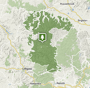
Wollemi National Park
Visitor info
All the practical information you need to know about Wollemi National Park.
Getting there and parking
Get driving directions
To get to the Colo area from Windsor:
- Take Wilberforce Road and Putty Road
- Or, head through Richmond and follow Bells Line of Road to Kurrajong, then turn right onto Comleroy Road.
To get to the Newnes area from Sydney:
- Take the Great Western Highway to Lithgow, then Castlereagh Highway towards Mudgee
- Turn right at Lisdale on to Wolgan Road and follow around 35km to Newnes
- Or, take Bells Line of Road towards Lithgow
- Turn right at the Zig Zag Railway onto the gravel Old Bells Line of Road and Glow Worm Tunnel Road
- Follow around 23km through Newnes State Forest to Glow Worm Tunnel.
To get to the Ganguddy-Dunns Swamp area from Rylstone:
- Turn off Ilford Road on to Fitzgerald Street and continue on to Glen Alice Road for 2.4km
- Slight left on to Narango Road and drive around 15.4km
- Continue straight on to Coricudgy Road and then Mount Coricudgy Road for 7km.
To get to Deep Pass:
- Turn off Bells Line of Road at the Zig Zag railway and follow the gravel road for 7km
- Turn right at Newnes Forest Road and continue driving through the pine forest to its end - around 11.5km
- Turn right here on to Eastern Boundary Road, and then take the second road on the left to head towards Deep Pass North.
Park entry points Show more
- Coricudgy Road access to Gunguddy See on map
- Newnes Plateau Cliffs access See on map
- Putty Road (Colo) See on map
- Putty Road (Millbrodale) See on map
- Wolgan Road access to Newnes See on map
Parking
- Ganguddy-Dunns Swamp campground See on map
- Glow Worm Tunnel walking track See on map
- Sheepskin Hut campground See on map
- Twister and Rocky Creek canyons See on map
Best times to visit
There are lots of great things waiting for you in Wollemi National Park. Here are some of the highlights.
Autumn
With its softer light, autumn is the perfect time of year to head out to photograph or paint Wollemi's extraordinary landscapes.
Spring
With the temperature warming up, dig out the canoe and head to picturesque Ganguddy (Dunns swamp) for a cruise along the waterways.
Summer
Escape the heat and join an illuminating tour of the Glow Worm tunnel.
Facilities
Toilets Show more
- Colo Meroo campground
- Coorongooba campground
- Ganguddy-Dunns Swamp campground
- Glow Worm Tunnel walking track
- Newnes campground
- Sheepskin Hut campground
- Wheeny Creek campground
Picnic tables
Barbecue facilities Show more
Maps and downloads
Prohibited
Pets
Pets and domestic animals (other than certified assistance animals) are not permitted. Find out which regional parks allow dog walking and see the pets in parks policy for more information.
Smoking
NSW national parks are no smoking areas.
Contact
- in the Sydney and surrounds, North Coast and Country NSW regions
Wollemi National Park is always open but may have to close at times due to poor weather or fire danger.
-
-
Blue Mountains Heritage Centre and Blackheath office
02 4787 8877
Contact hours: 9am to 4.30pm daily. Closed Christmas Day. - 270 Govetts Leap Road, Blackheath NSW 2785
-
Email: bluemountains.heritagecentre@environment.nsw.gov.au
-
Blue Mountains Heritage Centre and Blackheath office
-
-
Mudgee office
02 6370 9000
Contact hours: Monday to Friday, 9am to 4:30pm. - 27 Inglis Street, Mudgee NSW 2850
-
Email: npws.mudgee@environment.nsw.gov.au
-
Mudgee office
-
-
Bulga office
02 6574 5555
Contact hours: Monday to Friday, 9.30am to 4pm. - 2156 Putty Road, Bulga NSW 2330
-
Email: npws.wollemiyengo@environment.nsw.gov.au
-
Bulga office
Nearby towns
Kandos (30 km)
Kandos is a gateway to the wonderland of Wollemi National Park, the rugged home of one of the rarest plants in the world - the Wollemi Pine - and other endangered and threatened species of plants, marsupials and birds. It's a great base for bushwalking, water sports and enjoying the great outdoors.
Windsor (30 km)
Explore Windsor's historic buildings, including St Matthew's Anglican Church (1817), Windsor Court House (1822), and the Macquarie Arms Hotel (1815). Bring a picnic or your boat and enjoy the beautiful riverside parks in Windsor including Howe Park and Governor Phillip Park.
Lithgow (35 km)
Hassans Walls Lookout, near Lithgow, is the highest in the Blue Mountains. Admire Mt Wilson, Mt York, Mt Tarana and Mt Blaxland as well as the pretty Hartley Valley below. To the south are the Kanimbla and Megalong valley and Mt Bindo. While there, go for a walk or ride around the lookout.
Denman (50 km)
Take a step back in time on a heritage walk through the charming town of Denman, which is near World Heritage-listed Wollemi National Park. Wander past colonial and early federation buildings, including St Matthias Church, and discover the Upper Hunter's fine wine and good food.