Woko National Park
Visitor info
All the practical information you need to know about Woko National Park.
Getting there and parking
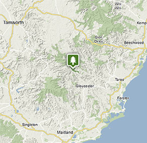
From Gloucester:
- Drive 14km north along Thunderbolts Way
- Turn onto Curricabark Road, then drive another 14km.
- Take Flood Detour Road into Woko National Park (about 1km), then turn left into Woko campground.
Road quality
- Unsealed roads
Vehicle access
- 2WD vehicles
Weather restrictions
- All weather
By bike
Check out the Bicycle information for NSW website for more information.
Best times to visit
There are lots of great things waiting for you in Woko National Park. Here are some of the highlights.
Spring
Walk along Brush Turkey track, keeping an eye out for brush turkeys and lyrebirds scratching in the undergrowth.
Summer
Escape from the summer heat by taking advantage of Manning River for a refreshing dip, or float along the current on an air mattress.
Weather, temperature and rainfall
Summer temperature
Average
16.8°C and 25.9°C
Highest recorded
43°C
Winter temperature
Average
20.1°C and 14.4°C
Lowest recorded
-6.2°C
Rainfall
Wettest month
February
Driest month
July
The area’s highest recorded rainfall in one day
666.2mm
Facilities
Maps and downloads
Prohibited
Pets
Pets and domestic animals (other than certified assistance animals) are not permitted. Find out which regional parks allow dog walking and see the pets in parks policy for more information.
Smoking
NSW national parks are no smoking areas.
Contact
- in the North Coast region
Woko National Park is always open but may have to close at times due to poor weather or fire danger.
-
-
Gloucester office
02 6538 5300
Contact hours: Monday to Friday, 8.30am to 4.30pm. - 59 Church Street, Gloucester NSW 2422
-
Email: npws.barringtontops@environment.nsw.gov.au
-
Gloucester office
Nearby towns
Gloucester (33 km)
Famous for gold deposits and the bushranger Captain Thunderbolt, Gloucester is located in the north Hunter region, east of Barrington Tops. The nearby state forests and national parks are ideal for walking, camping and outdoor adventure sports.
Forster (105 km)
Dominated by water sports Forster is the centre of the Great Lakes area.
Taree (110 km)
Taree is a major mid North Coast city, ringed by superb beaches. It's situated on the Manning River and set against rolling hills.