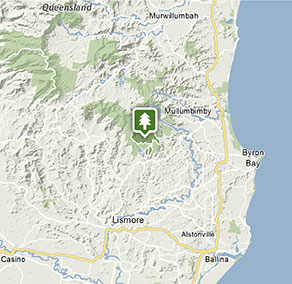
Whian Whian State Conservation Area
Visitor info
All the practical information you need to know about Whian Whian State Conservation Area.
Getting there and parking
Get driving directions
From the north (Brisbane):
- Travelling on the Pacific Highway exit south of Byron Bay, at the top of the hill, turn right into Coolamon Scenic Drive. Follow this winding road through the village of Coorabell.
- Continue, then turn right to the village of Federal. From Federal, continue north along Federal Road, then turn left into Repentance Creek Road.
- Head west along this road and across the Byangerry Creek crossing and continue. Just over the Coopers Creek crossing, turn right into Upper Coopers Creek Road, then left into Minyon Falls Road and follow through to the park entrance.
From Lismore:
- Take Dunoon Road out of north Lismore and go through the villages of Modanville, then Dunoon, then Doroughby. Just past Dorroughby Hall, turn left into Nightcap Range Road and follow right through to the SCA entrance.
- Continue until you reach the Peates Mountain Road intersection (turn left if you want to go to Rummery Park campground) or continue straight through to Minyon Falls within the Nightcap National Park (Minyon Drive).
From Bangalow:
- Travel towards Lismore on the Bangalow-Lismore Road until you reach the village of Clunes.
- Turn right into James Gibson Road, then right into Mackie Road, then right onto Rosebank Road.
- Through Rosebank village, follow Repentance Creek Road, then turn left into Upper Coopers Creek Road, then left again into Minyon Falls Road. Continue along this road then into the Nightcap National Park entrance on Minyon Drive. Follow park signs from there.
Park entry points
- Minyon Falls Road access See on map
Parking
- Rummery Park campground See on map
- Whian Whian mountain biking trails See on map
By bike
Check out the Bicycle information for NSW website for more information
By public transport
There is no public transport to Whian Whian State Conservation Area.
Best times to visit
There are lots of great things waiting for you in Whian Whian State Conservation Area. Here are some of the highlights.
Autumn
The cooler months are great for enjoying some of the longer bushwalks available in both Whian Whian and the adjoining Nightcap National Park - Autumn/winter .
Spring
Bushwalking when many plant species are in bloom, such as bottlebrush, wattle and tea tree species along the creeks. Swimming in the Boggy Creek along the Boggy Creek walk The Freedom Marathon is an annual event held in spring .
Summer
When the weather heats up, swimming in Boggy Creek is a popular way to cool off.
Weather, temperature and rainfall
Summer temperature
Average
28°C and 28°C
Highest recorded
40°C
Winter temperature
Average
8°C and 18°C
Lowest recorded
-0.6°C
Rainfall
Wettest month
February
Driest month
September
The area’s highest recorded rainfall in one day
430.5mm
Facilities
Toilets
Picnic tables
Barbecue facilities
Drinking water
Maps and downloads
Prohibited
Pets
Pets and domestic animals (other than certified assistance animals) are not permitted. Find out which regional parks allow dog walking and see the pets in parks policy for more information.
Smoking
NSW national parks are no smoking areas.
Contact
- in the North Coast region
Whian Whian State Conservation Area is always open but may have to close at times due to poor weather.
-
-
Alstonville office
02 6627 0200
Contact hours: Monday to Friday, 8:30am to 4:30pm - Russelton Industrial Estate, 7 Northcott Crescent, Alstonville NSW 2477
-
Email: npws.richmondriver@environment.nsw.gov.au
-
Alstonville office
Nearby towns
Mullumbimby (23 km)
Mullumbimby sits on the Brunswick River and is overshadowed by subtropical hills.
Bangalow (26 km)
Bangalow is a relaxed but stylish village close to Byron Bay. It's set in lush green hills near the coast.
Lismore (35 km)
Lismore is a major North Coast commercial, cultural and administrative centre. It's set in undulating country on the north arm of the Richmond River.