Wallingat National Park
Overview
On the mid-North Coast of NSW, Wallingat National Park, with its varied forest and swamp landscapes, offers hiking, touring, birdwatching and camping in a coastal locale.
Read more about Wallingat National Park
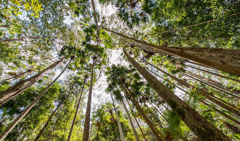
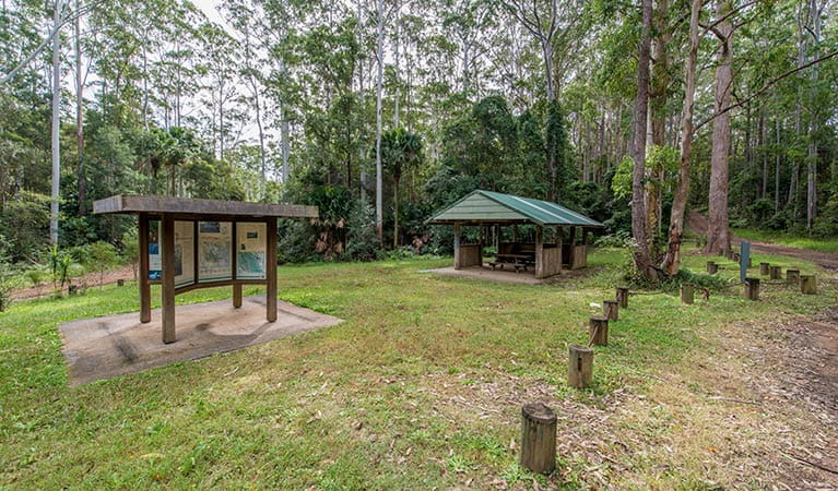
Here, on the Mid North Coast of NSW, the Pacific Ocean meets forest. At Whoota Whoota lookout, one of Wallingat National Park’s most visited attractions, you’ll be overwhelmed by the beauty. Explore the park further and you’ll see stands of straight, tall flooded gums. At Sugar Creek, there are also stands of cabbage palms, filled with the sounds of Wallingat’s native birdlife. Pack the car and explore what this great park has to offer for a few hours. There’s camping at Wallingat River, and a picnic area at Sugar Creek.
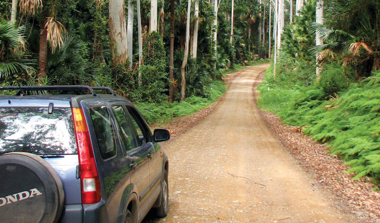
A network of unsealed roads throughout the park allows you to discover its best features. Accessible by 2WD in dry weather, you can also explore them by mountain bike or horseback. There’s great fishing in the river and lake, and you can swim when the weather is warm. Keep your eyes peeled for kangaroos and wallabies, as well as some of the 200 species of birds that make Wallingat their home.
Local alerts
For the latest updates on fires, closures and other alerts in this area, see https://www.nationalparks.nsw.gov.au/visit-a-park/parks/wallingat-national-park/local-alerts
Contact
- in the North Coast region
Wallingat National Park is always open but may have to close at times due to extreme weather or fire danger.
-
-
Booti Booti Office
02 6591 0300
Contact hours: Monday to Friday, 8.30am to 4.30pm. Closed public holidays. - The Ruins campground, Booti Booti National Park, 4374 The Lakes Way, Booti Booti 2428
-
Email: npws.manninggreatlakes@environment.nsw.gov.au
-
Booti Booti Office
Visitor info
All the practical information you need to know about Wallingat National Park.
Map
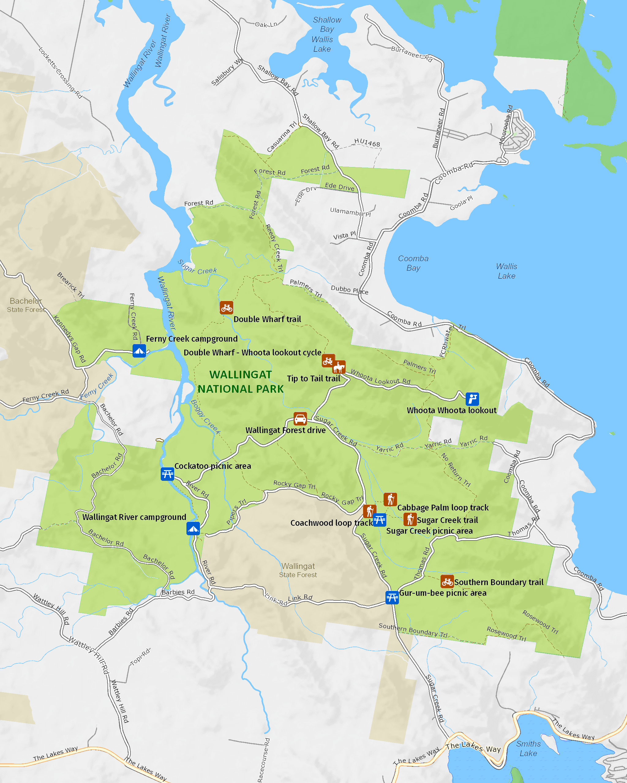
Map legend

Getting there and parking
Get driving directions
From Forster:
- Travel 30km south along Lakes Way to Sugar Creek Road
From Bulahdelah:
- Head north on Pacific Highway
- Turn right at Lakes Way – it is signposted Forster
- Follow Lakes Way for approximately 40km to Sugar Creek Road (2.5kms past Bungwahl)
Parking
- Cockatoo picnic area See on map
- Gur-um-bee picnic area See on map
By bike
Check out the Bicycle information for NSW website for more information.
By public transport
For information about public transport options, visit the NSW country transport info website.
Best times to visit
There are lots of great things waiting for you in Wallingat National Park. Here are some of the highlights.
Autumn
With temperatures slightly cooler, explore the network of gravel roads by foot or on a mountain bike.
Spring
With the wildflowers - including the purple blooms of the velvet mint-bush - coming out, this is a great time for birdwatching.
Summer
The weather is warm and sunny, so now's the time to pitch a tent and stay for a few days. Make the most of the boat ramp at Cockatoo picnic area Head to Sugar Creek picnic area and, after lunch, take a walk through the cool forest. .
Winter
Visitor numbers are down, so take the car along the park's unsealed roads and discover the forest, rivers and lake.
Weather, temperature and rainfall
Summer temperature
Average
20°C and 29°C
Highest recorded
45.2°C
Winter temperature
Average
7°C and 21°C
Lowest recorded
-5°C
Rainfall
Wettest month
March
Driest month
Sept
The area’s highest recorded rainfall in one day
280.2mm
Facilities
Amenities
Toilets
Picnic tables
Barbecue facilities
Boat ramp
Maps and downloads
Prohibited
Generators
Generators are prohibited in this park.
Pets
Pets and domestic animals (other than certified assistance animals) are not permitted. Find out which regional parks allow dog walking and see the pets in parks policy for more information.
Smoking
NSW national parks are no smoking areas.
Nearby towns
Forster (30 km)
Dominated by water sports Forster is the centre of the Great Lakes area.
Bulahdelah (32 km)
Buladelah is the gateway to Myall Lakes National Park. It's situated on the Myall River, with a backdrop of soaring, forested hills.
Taree (64 km)
Taree is a major mid North Coast city, ringed by superb beaches. It's situated on the Manning River and set against rolling hills.
Learn more
Wallingat National Park is a special place. Here are just some of the reasons why:
Life among the trees
More than 200 species of birds make Wallingat National Park a home. Walking through forest as well as stands of straight flooded gums, and cabbage palms, you'll hear birds singing. Noisy friarbirds, for instance, have a distinctive 'ya-kob' call, while a 'woop, woop, woop' sound signals the presence of the wonga pigeon. You might see blue wrens flitting through the trees, as well as king parrots and glossy black cockatoos. Wallingat is also a popular spot for the satin bowerbird – the males are black and shiny, the females are a plainer brown. They both, however, have startling lilac eyes.
- Double Wharf trail Experience the scenic waterways and mountainous forests of Wallingat National Park along Double Wharf trail – perfect for walking or mountain bike riding.
- Sugar Creek picnic area Sugar Creek picnic area is a family-friendly relaxation spot with easy walking trails through forested landscape, a leisurely drive from Forster and Pacific Palms.
Fun times
Whether you're after a relaxing time or something more adventurous, Wallingat is just the spot. Take to the gravel roads either on foot, in a car or on a bike – to explore the forests. You can swim, fish and paddle on Wallingat River. Pitch a tent in the campground and get away from it all for a few days in this naturally beautiful setting. Surrounding some of the picnic areas and campsites, you’ll find magnificent stands of trees. In the southeast corner of Wallingat, there are tall, straight flooded gums, as well as stands of cabbage palms. Find both during a walk from Sugar Creek picnic area. Some rare plants such as the liana woody climber, a climbing species that bears white flowers from August to May, can also be found here.
- Double Wharf trail Experience the scenic waterways and mountainous forests of Wallingat National Park along Double Wharf trail – perfect for walking or mountain bike riding.
- Wallingat Forest drive The 25km loop of Wallingat Forest drive, near Forster, is on unsealed roads that meander through forests, and excellent for cars, 4WDs, bicycles, walking and horse riding.
- Whoota Whoota lookout From Whoota Whoota lookout, easily accessible by car, you can see for miles. Take in scenic views of Wallingat’s eucalypt forests, Wallis Lake and 100km of coastline.
Ancient footprints
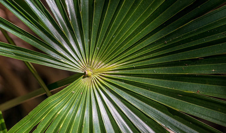
The 6,557ha of Wallingat National Park is part of the identity and spirituality, as well as a resource, for people of the Worimi nation. The Worimi People lived a traditional hunter-gatherer lifestyle and used the leaves of the cabbage palm for weaving baskets and its fibrous bark for making fishing line. They used many of the area's natural resources, including the freshwater lakes, stone outcrops, and the ocean. A central campsite was known to exist in the area now known as Coomba Park, although there are few other Aboriginal sites recorded within the park include the Bungwahl area.
Education resources (1)
What we're doing
Wallingat National Park has management strategies in place to protect and conserve the values of this park. Visit the OEH website for detailed park and fire management documents.