Wallingat National Park
Visitor info
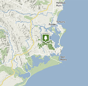
All the practical information you need to know about Wallingat National Park.
Getting there and parking
Get driving directions
From Forster:
- Travel 30km south along Lakes Way to Sugar Creek Road
From Bulahdelah:
- Head north on Pacific Highway
- Turn right at Lakes Way – it is signposted Forster
- Follow Lakes Way for approximately 40km to Sugar Creek Road (2.5kms past Bungwahl)
Park entry points
- Shallow Bay Road access See on map
- Sugar Creek Road See on map
- Thomas Road See on map
Parking
- Cockatoo picnic area See on map
- Gur-um-bee picnic area See on map
By bike
Check out the Bicycle information for NSW website for more information.
By public transport
For information about public transport options, visit the NSW country transport info website.
Best times to visit
There are lots of great things waiting for you in Wallingat National Park. Here are some of the highlights.
Autumn
With temperatures slightly cooler, explore the network of gravel roads by foot or on a mountain bike.
Spring
With the wildflowers - including the purple blooms of the velvet mint-bush - coming out, this is a great time for birdwatching.
Summer
The weather is warm and sunny, so now's the time to pitch a tent and stay for a few days. Make the most of the boat ramp at Cockatoo picnic area Head to Sugar Creek picnic area and, after lunch, take a walk through the cool forest. .
Winter
Visitor numbers are down, so take the car along the park's unsealed roads and discover the forest, rivers and lake.
Weather, temperature and rainfall
Summer temperature
Average
20°C and 29°C
Highest recorded
45.2°C
Winter temperature
Average
7°C and 21°C
Lowest recorded
-5°C
Rainfall
Wettest month
March
Driest month
Sept
The area’s highest recorded rainfall in one day
280.2mm
Facilities
Amenities
Toilets
Picnic tables
Barbecue facilities
Boat ramp
Maps and downloads
Prohibited
Generators
Generators are prohibited in this park.
Pets
Pets and domestic animals (other than certified assistance animals) are not permitted. Find out which regional parks allow dog walking and see the pets in parks policy for more information.
Smoking
NSW national parks are no smoking areas.
Contact
- in the North Coast region
Wallingat National Park is always open but may have to close at times due to extreme weather or fire danger.
-
-
Booti Booti Office
02 6591 0300
Contact hours: Monday to Friday, 8.30am to 4.30pm. Closed public holidays. - The Ruins campground, Booti Booti National Park, 4374 The Lakes Way, Booti Booti 2428
-
Email: npws.manninggreatlakes@environment.nsw.gov.au
-
Booti Booti Office
Nearby towns
Forster (30 km)
Dominated by water sports Forster is the centre of the Great Lakes area.
Bulahdelah (32 km)
Buladelah is the gateway to Myall Lakes National Park. It's situated on the Myall River, with a backdrop of soaring, forested hills.
Taree (64 km)
Taree is a major mid North Coast city, ringed by superb beaches. It's situated on the Manning River and set against rolling hills.