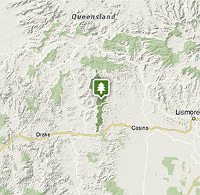
Richmond Range National Park
Visitor info
All the practical information you need to know about Richmond Range National Park.
Getting there and parking
Get driving directions
From Kyogle:
- Leave Summerland Way south of Kyogle at McDonalds Bridge Road
- Travel along Edenville Road, which becomes Sextonville Road.
- Turn right onto Cambridge Plateau scenic drive and travel north to Richmond Range National Park
From Casino:
- Drive west along the Bruxner Highway along Route 44
- Turn north at Cambridge Plateau scenic drive near Mallanganee
Park entry points
- Sextonville Road See on map
By bike
Check out the Bicycle information for NSW website for more information
By public transport
There is no public transport available to Richmond Range National Park.
Best times to visit
There are lots of great things waiting for you in Richmond Range National Park. Here are some of the highlights.
Autumn
Peacock Creek campground is a great place to camp in autumn. This clean, open, sunny campground is perfect for camping with wood fires, while watching an array of birdlife by your tent.
Spring
This is a lovely time to drive along Cambridge Plateau scenic drive. See new red tips on the rainforest trees, creamy clusters of flowers on wonga vines, and white flowering clematis vines in full bloom.
Summer
Enjoy the cool of the rainforests during these hot months. The Culmaran Creek walking track is a perfect place to cool off.
Winter
Watch mists rising in the valley below from Cambridge Plateau picnic. On a clear winter's day, you can see all the way east to Wollumbin and Nightcap national parks.
Weather, temperature and rainfall
Summer temperature
Average
25°C and 27°C
Highest recorded
27°C
Winter temperature
Average
15°C and 21°C
Lowest recorded
15°C
Rainfall
Wettest month
February
Driest month
August
The area’s highest recorded rainfall in one day
214.6mm
Facilities
Toilets
Picnic tables
Barbecue facilities
Maps and downloads
Prohibited
Pets
Pets and domestic animals (other than certified assistance animals) are not permitted. Find out which regional parks allow dog walking and see the pets in parks policy for more information.
Smoking
NSW national parks are no smoking areas.
Contact
- in the North Coast region
Richmond Range National Park is always open but may have to close at times due to poor weather or fire danger.
-
-
Kyogle office
02 6632 0000
Contact hours: Monday to Friday, 8.30am to 4.30pm. - 136 Summerland Way, Kyogle NSW 2474
-
Email: npws.richmondriver@environment.nsw.gov.au
-
Kyogle office
Nearby towns
Kyogle (55 km)
Kyogle is an attractive timber-milling town surrounded by rainforest. It's set on the Richmond River at the base of Fairy Mountain.
Casino (82 km)
Casino is a thriving rural centre in the heart of rich agricultural country. It's set in lush pastures on the banks of the Richmond River.
Lismore (115 km)
Lismore is a major North Coast commercial, cultural and administrative centre. It's set in undulating country on the north arm of the Richmond River.