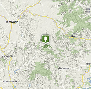
Nowendoc National Park
Visitor info
All the practical information you need to know about Nowendoc National Park.
Getting there and parking
Get driving directions
From Nowendoc:
- Drive 6.5km south of Nowendoc on Thunderbolts Way, turn right into Wrights Road, and then access the park through Nowendoc State Forest.
- Alternatively, drive 18.5km north-west of Nowendoc on Thunderbolts Way, turn left into Wild Cattle Creek Road, and access the park through Nowendoc State Forest.
- Please note: there is no public access on Wild Cattle Creek Road through the Wild Cattle Creek property.
Park entry points
- Wrights Road See on map
Parking
- Jacky Barkers campground See on map
Road quality
- Unsealed roads
Vehicle access
- All roads require 4WD vehicle
By bike
Check out the Bicycle information for NSW website for more information.
By public transport
For information about public transport options, visit the NSW country transport info website
Best times to visit
There are lots of great things waiting for you in Nowendoc National Park. Here are some of the highlights.
Autumn
With its sunny days and cool nights, autumn is a real treat. Go bushwalking along the leafy tracks and follow the meandering Myall Creek, which flows all year round.
Spring
Come to the park in spring to feast your eyes on wildflowers. The banksias turn the brightest yellow, while the flame trees live up to their name, transforming into red blooms.
Summer
Beat the summer heat with a swim in the creek and crystal-clear streams. Nothing beats nature when it comes to refreshment.
Winter
Visit in winter to recharge your batteries with crisp, clean air and even the chance of snow. Many say the valley looks even more beautiful cloaked in early-morning winter fog. See if you agree.
Weather, temperature and rainfall
Summer temperature
Average
11°C and 28°C
Highest recorded
36.5°C
Winter temperature
Average
-2°C and 11°C
Lowest recorded
-14.5°C
Rainfall
Wettest month
January
Driest month
April
The area’s highest recorded rainfall in one day
110.4mm
Facilities
Maps and downloads
Prohibited
Pets
Pets and domestic animals (other than certified assistance animals) are not permitted. Find out which regional parks allow dog walking and see the pets in parks policy for more information.
Smoking
NSW national parks are no smoking areas.
Contact
- in the North Coast and Country NSW regions
Nowendoc National Park is always open but may have to close at times due to poor weather or fire danger.
-
-
Walcha office
02 6777 4700
Contact hours: Monday to Friday, 8.30am to 4.30pm. - 188W North Street, Walcha NSW 2354
-
Email: npws.nea@environment.nsw.gov.au
-
Walcha office
Nearby towns
Gloucester (72 km)
Famous for gold deposits and the bushranger Captain Thunderbolt, Gloucester is located in the north Hunter region, east of Barrington Tops. The nearby state forests and national parks are ideal for walking, camping and outdoor adventure sports.
Walcha (79 km)
Walcha is the gateway to some of the best adventure experiences in Australia. Expect gorges, rainforests, waterfalls and wilderness. Enjoy helicopter flights, 4WD tours and fishing, as well as guided bushwalks in some of Australia's most rugged terrain.
Armidale (143 km)
During autumn the parks and gardens around Armidale show their beautiful colours. Enjoy a drive along the Waterfall Way, stopping at waterfalls and craggy gorges in the rugged countryside.