Deriah Aboriginal Area
Overview
Ideal for school groups and families, Deriah Aboriginal Area, near Narrabri, offers opportunities to picnic, enjoy scenic views and learn about the area’s Aboriginal heritage.
Read more about Deriah Aboriginal Area
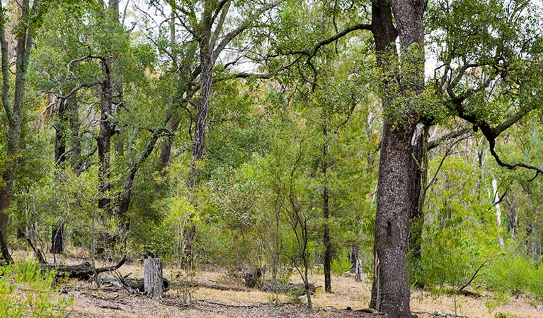
Deriah Aboriginal Area offers a unique insight into the traditions and culture of the Gamilaraay Nation. The area is nestled on the western slopes of Nandewar Ranges between Narrabri and Mount Kaputar National Park, is co-managed by NPWS and the local Aboriginal community. This fascinating region offers breathtaking scenic views, as well as great picnicking, walking and birdwatching opportunities to locals and visitors alike .
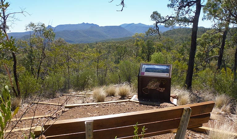
It’s a great place to spend a day and relish the spectacular scenic views across the sweeping Liverpool Plains to the south-west and Mount Kaputar to the north-east. There’s opportunity to learn about the natural history of this ancient landscape from an Aboriginal perspective. The rare ooline dry rainforest is a fascinating reminder of a time when megafauna roamed the planet.
An innovative educational program provides teachers and students with school excursion options and a rare opportunity to learn about the language, history and culture of Gamilaraay People.
Local alerts
For the latest updates on fires, closures and other alerts in this area, see https://www.nationalparks.nsw.gov.au/visit-a-park/parks/deriah-aboriginal-area/local-alerts
Contact
- in the Country NSW region
Deriah Aboriginal Area is always open but may have to close at times due to severe weather or extreme fire danger.
-
-
Narrabri office
02 6792 7300
Contact hours: Monday to Friday, 8.30am to 4.30pm. - Level 1, 100 Maitland Street, Narrabri NSW 2390. Accessible via Dewhurst Street.
-
Email: npws.barwon@environment.nsw.gov.au
-
Narrabri office
Visitor info
All the practical information you need to know about Deriah Aboriginal Area.
Map

Map legend

Getting there and parking
Deriah Aboriginal Area lies in the foothills of Nandewar Range, adjacent to Mount Kaputar National Park.
From Narrabri:
- Drive south-east along Old Gunnedah Road for 3km, then turn left onto Kaputar Road.
- After 9km, turn right onto Eulah Creek Road and continue for 5km until you reach the unsealed section.
- Follow the unsealed section of Eulah Creek Road for 6km, past the olive farm, before turning right onto Carinya Road.
- Follow this route up the hill to enter Deriah Aboriginal Area
- After 1km you'll see the information bay on the left
Parking
- Winangabaa – Information Bay See on map
- Wirrila picnic area See on map
Road quality
- Mixture of sealed and unsealed roads
Vehicle access
- All roads require 4WD vehicle
Weather restrictions
- Dry weather only
By bike
All roads and trails within Deriah Aboriginal Area are suitable for mountain bikes. Check out the Bicycle information for NSW website for more information.
By public transport
For information about public transport options, visit the NSW country transport info website.
Best times to visit
There are lots of great things waiting for you in Deriah Aboriginal Area. Here are some of the highlights.
Autumn
Enjoy bushwalking or mountain biking along the area's roads and trails.
Spring
A spectacular time to enjoy the activities of the area's abundant birdlife and wildlife.
Summer
Escape the heat of the plains in the dry rainforest, where you can enjoy bushwalking and picnicking as well as a range of cultural activities.
Winter
Soak up the sun while enjoying a picnic and take advantage of the scenic views available on a clear winter day.
Weather, temperature and rainfall
Summer temperature
Average
19.4°C and 35.3°C
Highest recorded
43.3°C
Winter temperature
Average
3.4°C and 17°C
Lowest recorded
-5.6°C
Rainfall
Wettest month
January
Driest month
August
The area’s highest recorded rainfall in one day
188mm
Facilities
Maps and downloads
Prohibited
Pets
Pets and domestic animals (other than certified assistance animals) are not permitted. Find out which regional parks allow dog walking and see the pets in parks policy for more information.
Smoking
NSW national parks are no smoking areas.
Nearby towns
Narrabri (24 km)
Explore Pilliga Forest to see salt caves, native flora and fauna, and bore baths, or enjoy camping and bushwalking in Mt Kaputar National Park. Mt Kaputar's summit offers magnificent panoramic views, and there's excellent cabin accommodation within the park.
Gunnedah (119 km)
This bustling town is the self-proclaimed koala capital of the world. Go koala spotting around the town - just ask at the Visitor Information Centre for some pointers.
Moree (124 km)
Join a Heritage and Art Deco Guided Walk to uncover Moree's outstanding collection of period architecture. Wander along the main street of Moree which showcases heritage-listed buildings influenced by American, Egyptian, Greek and Spanish design practices.
Learn more
Deriah Aboriginal Area is a special place. Here are just some of the reasons why:
Gamilaraay country – Gamilaraay culture
Deriah Aboriginal Area is of high cultural value to the local Aboriginal community and contains important evidence of their lives in the area, with a large number of significant sites recorded including scarred trees and grinding grooves. The exact origin of the name ‘Deriah’ is unknown, although it may have come from the Gamilaraay word ‘dhiriya’, meaning ‘old’. Deriah Aboriginal Area Co-management Committee was formed in 2008 to work in partnership with NPWS to help guide management of the reserve and encourage connection with country. This committee consists of Aboriginal community members from Narrabri who represent Gamilaraay families with a historical connection to the area.
Ancient volcanic landscape
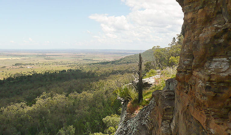
The region offers spectacular scenery of steep volcanic rock cliff lines and soft sandstone that has eroded over time into unique formations. The volcanic rocks were created by eruptions that formed the Nandewar Range shield volcano, around 19-21 million years ago. Lava flows were pushed out from beneath the earth’s surface and spread across the land. The lava cooled when it was exposed to the air and hardened to make new rocks.
Bird watching paradise
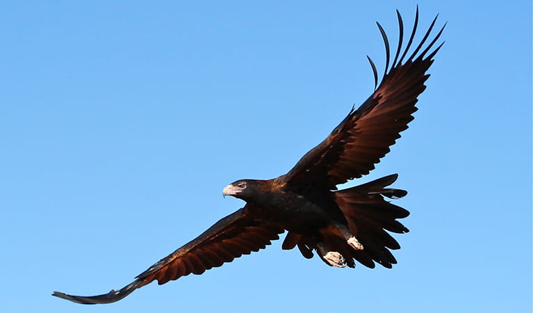
The Deriah forest region protects a huge and diverse range of bird species, including numerous threatened and significant bird populations. Take your binoculars for a chance to see spotted harrier, little eagle, little lorikeet, black-chinned honeyeater, rainbow bee-eater and hooded robin. A number of species, including the superb parrot, turquoise parrot and speckled warbler, are listed as vulnerable.
Education in the forest
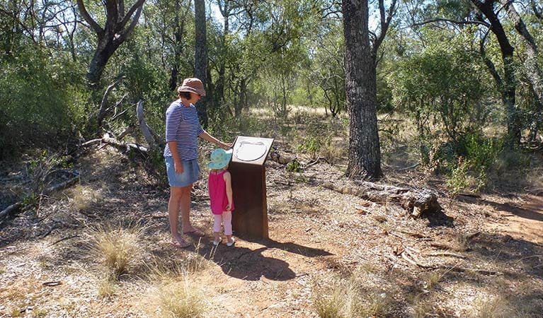
An innovative education package is available for Deriah Aboriginal Area. It aims to incorporate Aboriginal cultural heritage into all aspects of the curriculum. The package provides teachers with excursion options and activities within Deriah forest for stage 1-3 of the NSW Syllabus.
Education resources (1)
What we're doing
Deriah Aboriginal Area has management strategies in place to protect and conserve the values of this park. Visit the OEH website for detailed park and fire management documents.