Deriah Aboriginal Area
Visitor info
All the practical information you need to know about Deriah Aboriginal Area.
Getting there and parking
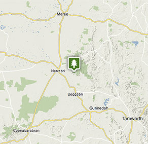
Deriah Aboriginal Area lies in the foothills of Nandewar Range, adjacent to Mount Kaputar National Park.
From Narrabri:
- Drive south-east along Old Gunnedah Road for 3km, then turn left onto Kaputar Road.
- After 9km, turn right onto Eulah Creek Road and continue for 5km until you reach the unsealed section.
- Follow the unsealed section of Eulah Creek Road for 6km, past the olive farm, before turning right onto Carinya Road.
- Follow this route up the hill to enter Deriah Aboriginal Area
- After 1km you'll see the information bay on the left
Parking
- Winangabaa – Information Bay See on map
- Wirrila picnic area See on map
Road quality
- Mixture of sealed and unsealed roads
Vehicle access
- All roads require 4WD vehicle
Weather restrictions
- Dry weather only
By bike
All roads and trails within Deriah Aboriginal Area are suitable for mountain bikes. Check out the Bicycle information for NSW website for more information.
By public transport
For information about public transport options, visit the NSW country transport info website.
Best times to visit
There are lots of great things waiting for you in Deriah Aboriginal Area. Here are some of the highlights.
Autumn
Enjoy bushwalking or mountain biking along the area's roads and trails.
Spring
A spectacular time to enjoy the activities of the area's abundant birdlife and wildlife.
Summer
Escape the heat of the plains in the dry rainforest, where you can enjoy bushwalking and picnicking as well as a range of cultural activities.
Winter
Soak up the sun while enjoying a picnic and take advantage of the scenic views available on a clear winter day.
Weather, temperature and rainfall
Summer temperature
Average
19.4°C and 35.3°C
Highest recorded
43.3°C
Winter temperature
Average
3.4°C and 17°C
Lowest recorded
-5.6°C
Rainfall
Wettest month
January
Driest month
August
The area’s highest recorded rainfall in one day
188mm
Facilities
Maps and downloads
Prohibited
Pets
Pets and domestic animals (other than certified assistance animals) are not permitted. Find out which regional parks allow dog walking and see the pets in parks policy for more information.
Smoking
NSW national parks are no smoking areas.
Contact
- in the Country NSW region
Deriah Aboriginal Area is always open but may have to close at times due to severe weather or extreme fire danger.
-
-
Narrabri office
02 6792 7300
Contact hours: Monday to Friday, 8.30am to 4.30pm. - Level 1, 100 Maitland Street, Narrabri NSW 2390. Accessible via Dewhurst Street.
-
Email: npws.barwon@environment.nsw.gov.au
-
Narrabri office
Nearby towns
Narrabri (24 km)
Explore Pilliga Forest to see salt caves, native flora and fauna, and bore baths, or enjoy camping and bushwalking in Mt Kaputar National Park. Mt Kaputar's summit offers magnificent panoramic views, and there's excellent cabin accommodation within the park.
Gunnedah (119 km)
This bustling town is the self-proclaimed koala capital of the world. Go koala spotting around the town - just ask at the Visitor Information Centre for some pointers.
Moree (124 km)
Join a Heritage and Art Deco Guided Walk to uncover Moree's outstanding collection of period architecture. Wander along the main street of Moree which showcases heritage-listed buildings influenced by American, Egyptian, Greek and Spanish design practices.