Cullendulla Creek Nature Reserve
Overview
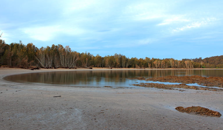
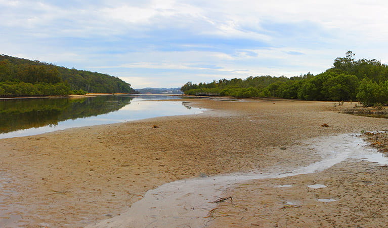
Next to Batemans Bay , Cullendulla Creek Nature Reserve offers scenic views of the surrounding area and islands, as well as picnic spots, birdwatching, and easy walks.
Read more about Cullendulla Creek Nature Reserve
Batemans Bay is beautiful, but it also has a hidden trump card up its sleeve; Cullendulla Creek Nature Reserve. Sugar gliders slip between the trees, echidnas forage in the undergrowth, oystercatchers and soldier crabs stalk across the sand, and black swans frolic in the bay.
Visitors will find the activities just as rich as the wildlife, with plenty to keep you returning. Pack a picnic, grab a towel, and head to the secluded beach, or pull on your walking shoes for a short hike to a scenic lookout, with Snapper Island and the Tollgates in clear sight. There’s canoeing and kayaking too, and even fishing in certain areas.
Pack some binoculars for some stellar birdwatching: the southern emu wren is here all year round, but it’s joined by local and migratory birds from everywhere. And budding geologists will be fascinated by the two ‘chenier’ dune formations – the only examples south of North Queensland.
Local alerts
For the latest updates on fires, closures and other alerts in this area, see https://www.nationalparks.nsw.gov.au/visit-a-park/parks/cullendulla-creek-nature-reserve/local-alerts
Contact
- in the South Coast region
Cullendulla Creek Nature Reserve is always open but may have to close at times due to poor weather or fire danger.
-
-
Ulladulla office
02 4454 9500
Contact hours: Monday to Friday, 9am to 4pm. - Lot 9 Blackburn Industrial Estate, 6 Coller Road Ulladulla NSW 2539
-
Email: npws.shoalhaven@environment.nsw.gov.au
-
Ulladulla office
-
-
Nowra office
02 4428 6300
Contact hours: Monday to Friday, 9am to 4pm. - 104 Flatrock Road, Mundamia NSW 2540
-
Email: npws.shoalhaven@environment.nsw.gov.au
-
Nowra office
Visitor info
All the practical information you need to know about Cullendulla Creek Nature Reserve.
Map
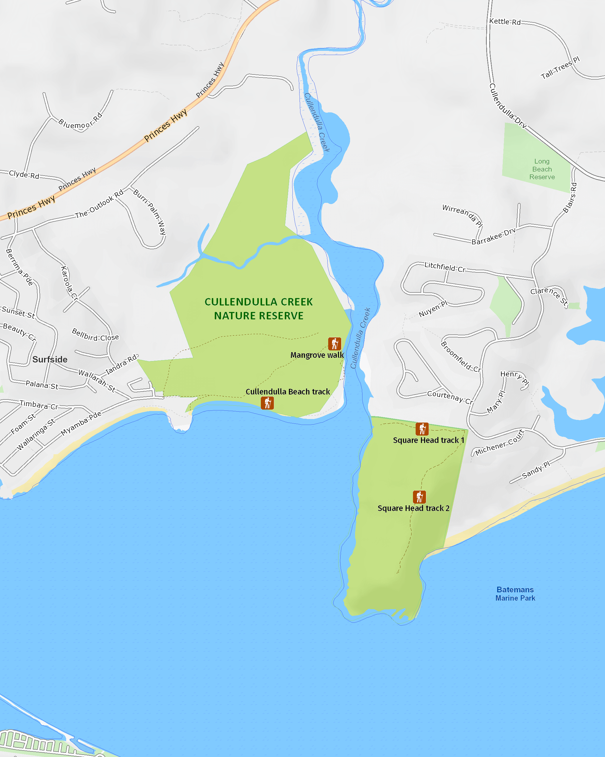
Map legend

Getting there and parking
Get driving directions
From Batemans Bay to:
- Square Head: Turn from the Princes Highway into Cullendulla Drive, then into Blairs Road, Long Beach.
- Cullendulla Beach: Turn from Princes Highway into Peninsula Drive (north Batemans Bay), then into McLeod Street, Timbara Crescrent, and Myamba Parade, Surfside.
Road quality
- Sealed roads
Vehicle access
- 2WD vehicles
By bike
Check out the Bicycle information for NSW website for more information.
By public transport
Both parts of Cullendulla Creek Nature Reserve are accessible by bus, however a short walk is required from the nearest stop. For information about public transport options, visit the Priors transport info website.
Best times to visit
Spring
Migratory birds arrive from Russia, Asia, northeast China, and Europe for the warmer months, foraging on the sand flats where you can see them from Cullendulla Beach.
Summer
Break out the canoe or kayak and beat the summer heat with a refreshing paddle up Cullendulla Creek.
Winter
Make the short hike to Square Head to do the Mangrove walk, watching how the landscape changes in high and low tide.
Weather, temperature and rainfall
Summer temperature
Average
15.5°C and 23.5°C
Highest recorded
43.3°C
Winter temperature
Average
6.5°C and 17.2°C
Lowest recorded
0°C
Rainfall
Wettest month
March
Driest month
August
The area’s highest recorded rainfall in one day
275.3mm
Maps and downloads
Prohibited
Pets
Pets and domestic animals (other than certified assistance animals) are not permitted. Find out which regional parks allow dog walking and see the pets in parks policy for more information.
Smoking
NSW national parks are no smoking areas.
Nearby towns
Batemans Bay (3 km)
Batemans Bay is a bustling coastal town with majestic seascapes. It's located on the estuary of the Clyde River.
Mogo (12 km)
In 1857, the discovery of a single nugget sparked a goldrush in the Batemans Bay area that saw the town grow to a population of 10,000 virtually overnight. When the boom was over, Mogo stalled but has been rescued by tourism in recent times thanks to its collection of historic buildings and new attractions.
Moruya (30 km)
Moruya is a historic dairy town on the Moruya River surrounded by dairy pastures and rugged national parks.
Learn more
Cullendulla Creek Nature Reserve is a special place. Here are just some of the reasons why:
Remarkable dune formations
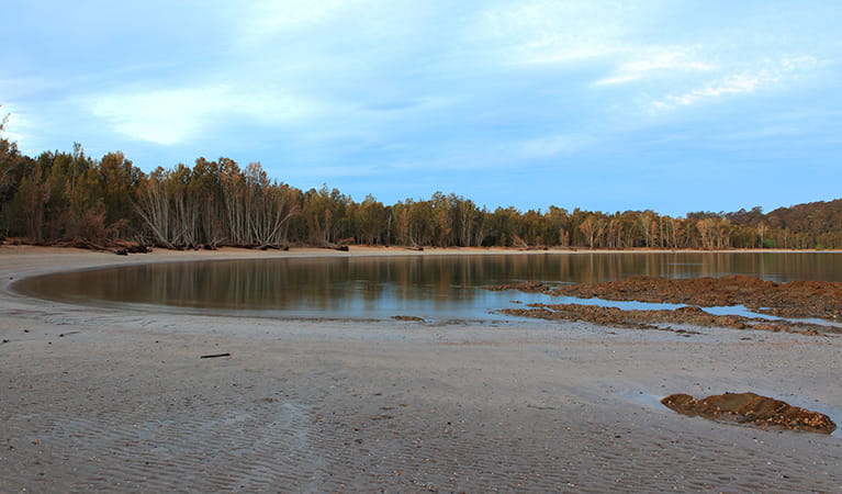
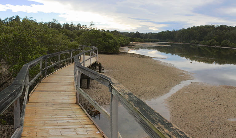
The nature reserve contains important and unusual dune formations called cheniers. Roughly parallel to the shoreline, these long, low (3-6m) and narrow ridges overlay estuarine mud and are of great scientific interest for the information they provide about the evolving landscape - some 7000 years worth of changes. There are nine beach ridges at Cullendulla; the most northerly two are cheniers. Though they're not directly visible to visitors, a fascinating boardwalk tracks through the mangrove estuary, accompanied by signs which offer a keen insight into the local ecosystem. For the best overview, visit in both high and low tide and compare the differences.
- Mangrove walk An easy walk offering great birdwatching opportunities, Mangrove walk is partly along an elevated boardwalk, giving an insight into the unusual dune formations.
Birdwatchers' haven
Cullendulla Creek Nature Reserve is home to mangrove estuary (and two mangrove species, the grey and river mangroves), forest red gums, littoral rainforest, and sea grass beds. The reserve is also a fish nursery for the Clyde River. Unsurprisingly then, a substantial mix of forest and shorebirds visit the area annually, including white ibises, curlews, two species of spoonbill and several of duck. Migratory birds come from as far away as Russia, taking refuge in the warm weather.
- Cullendulla Beach track A secluded stretch of sand in the protected waters of Batemans Bay, Cullendulla Beach offers terrific swimming, birding and a great place to launch a canoe up the creek.
- Square Head track 1 This short walk offers rich rewards, leading to the entrance of Cullendulla Creek, perfect for an afternoon picnic and swim near the shorebirds.
Aboriginal culture
Cullendulla Creek holds several ancient Aboriginal midden sites, including rarely recorded mounded midden sites. The Mangrove walk is a great way to engage with the past lives of people here, weaving through areas where mud oysters, mussels and shellfish were once collected.
Education resources (1)
What we're doing
Cullendulla Creek Nature Reserve has management strategies in place to protect and conserve the values of this park. Visit the OEH website for detailed park and fire management documents.